Fitxer:Canada labelled map.svg

Mida d'aquesta previsualització PNG del fitxer SVG: 619 × 600 píxels. Altres resolucions: 248 × 240 píxels | 496 × 480 píxels | 793 × 768 píxels | 1.057 × 1.024 píxels | 2.114 × 2.048 píxels | 1.304 × 1.263 píxels.
Fitxer original (fitxer SVG, nominalment 1.304 × 1.263 píxels, mida del fitxer: 123 Ko)
| Aquest fitxer i la informació mostrada a continuació provenen del dipòsit multimèdia lliure Wikimedia Commons. |
| Descripció |
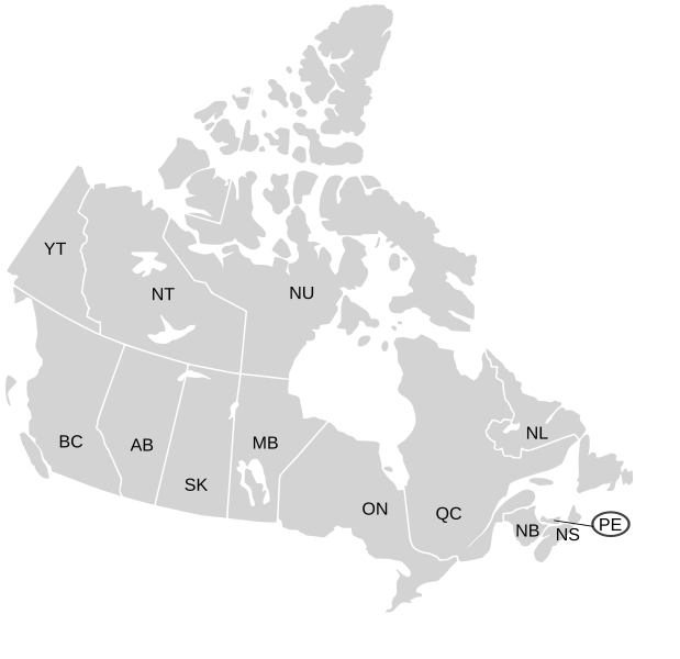
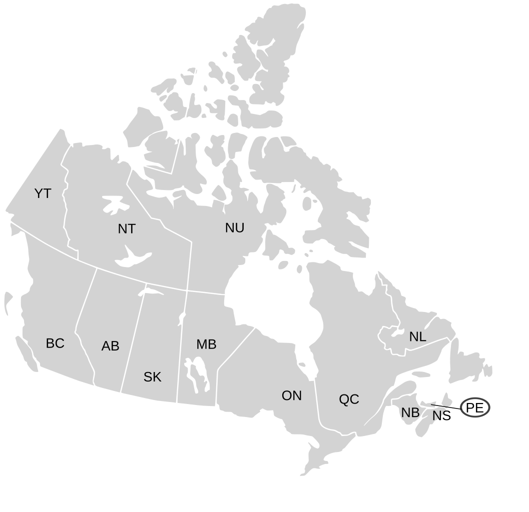
English: SVG map of Canada labelled with province names
Non-contiguous parts of a states/provinces are "grouped" together with the main area of the state/provinces, so any state/provinces can be coloured in completion with one click anywhere on the state/provinces's area. Also, all states/provinces have a "id" attached to them, making them easy to find. Select "find" and then enter in the state/provinces's ISO 3166-2 code in the "id" field to find it. The codes can be found here (Canada) and here (USA). |
| Data | 03-07-2007 edited 8-Aug-2007 |
| Font |
|
| Autor | Lokal_Profil image cut to remove Canada and move Alaska closer by Paul Robinson |
| Permís (Com reutilitzar aquest fitxer) |
Aquest fitxer està publicat sota la llicència de Creative Commons Reconeixement i Compartir Igual 2.5 Genèrica.
|
| Altres versions |
Labelled US map.svg same map with state labels, Blank US Map.svg similar map with inset versions of Alaska and Hawaii (as opposed to actual size, which is what appears here) Original blank map of USA and Canada, That image with labels, Original USA/Canada map with labels, Canada blank map.svg blank map of Canada |
Historial del fitxer
Cliqueu una data/hora per veure el fitxer tal com era aleshores.
| Data/hora | Miniatura | Dimensions | Usuari/a | Comentari | |
|---|---|---|---|---|---|
| actual | 21:07, 7 gen 2009 | | 1.304 × 1.263 (123 Ko) | Lokal Profil | Fixed NS (Nova Scotia) / NB (New Brunswick) issue |
| 23:20, 9 ago 2007 |  | 1.304 × 1.263 (123 Ko) | Rfc1394 | {{Information |Description={{en|SVG map of Canada labelled with province names}} Non-contiguous parts of a states/provinces are "grouped" together with the main area of the state/provinces, so any state/provinces can be coloured in completion with one cli |
Ús del fitxer
La pàgina següent utilitza aquest fitxer:
Ús global del fitxer
Utilització d'aquest fitxer en altres wikis:
- Utilització a en.wikipedia.org
- Utilització a eo.wikipedia.org
- Utilització a es.wikipedia.org
- Utilització a ja.wikipedia.org
- Utilització a lt.wikipedia.org
- Utilització a mk.wikipedia.org
- Utilització a no.wikipedia.org
- Utilització a sv.wikipedia.org
- Utilització a tr.wikipedia.org
- Utilització a zh-min-nan.wikipedia.org
- Utilització a zh.wikipedia.org