Fitxer:IndianTerritory1885.jpg

Mida d'aquesta previsualització: 792 × 600 píxels. Altres resolucions: 317 × 240 píxels | 634 × 480 píxels | 1.015 × 768 píxels | 1.321 × 1.000 píxels.
Fitxer original (1.321 × 1.000 píxels, mida del fitxer: 413 Ko, tipus MIME: image/jpeg)
| Aquest fitxer i la informació mostrada a continuació provenen del dipòsit multimèdia lliure Wikimedia Commons. |
Resum
| Descripció |
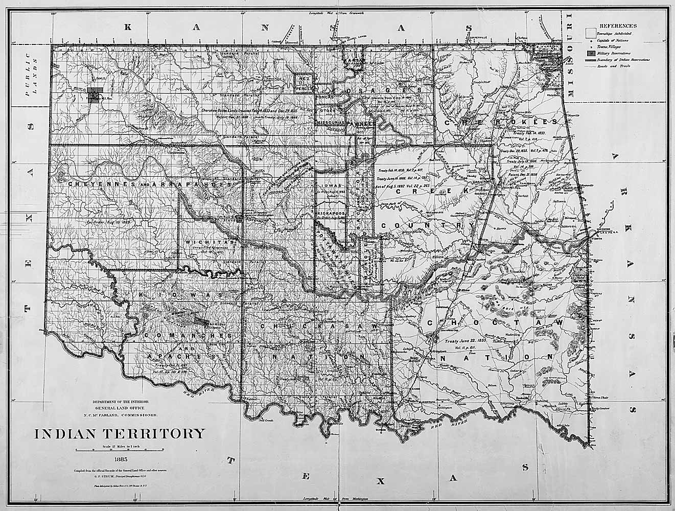
English: Map of Indian territory in Oklahoma in 1885. |
| Data | |
| Font |
National Archives Federal Indian Policy, direct image here. Source claims the image is available in ARC with identifier NWDC-49-STP-IT1885, but cannot find it. |
| Autor | General Land Office, U.S. Department of the Interior |
Llicència
| This image or media file contains material based on a work of a United States Department of the Interior employee, created as part of that person's official duties. As a work of the U.S. federal government, such work is in the public domain in the United States. See the Department of the Interior copyright policy for more information. |  |
Historial del fitxer
Cliqueu una data/hora per veure el fitxer tal com era aleshores.
| Data/hora | Miniatura | Dimensions | Usuari/a | Comentari | |
|---|---|---|---|---|---|
| actual | 19:48, 5 juny 2011 | | 1.321 × 1.000 (413 Ko) | Clindberg | {{Information |Description={{en|Map of Indian territory in Oklahoma in 1885.}} |Source=National Archives [http://www.archives.gov/education/lessons/fed-indian-policy/activities.html Federal Indian Policy], direct image [http://www.archives.gov/education/l |
Ús del fitxer
La pàgina següent utilitza aquest fitxer:
Ús global del fitxer
Utilització d'aquest fitxer en altres wikis:
- Utilització a es.wikipedia.org
- Utilització a kk.wikipedia.org