Fitxer:Keyesport Illinois with Carlyle Lake filling.jpg
Mida d'aquesta previsualització: 800 × 533 píxels. Altres resolucions: 320 × 213 píxels | 640 × 427 píxels | 1.024 × 683 píxels | 1.500 × 1.000 píxels.
Fitxer original (1.500 × 1.000 píxels, mida del fitxer: 287 Ko, tipus MIME: image/jpeg)
| Aquest fitxer i la informació mostrada a continuació provenen del dipòsit multimèdia lliure Wikimedia Commons. |
| Descripció |
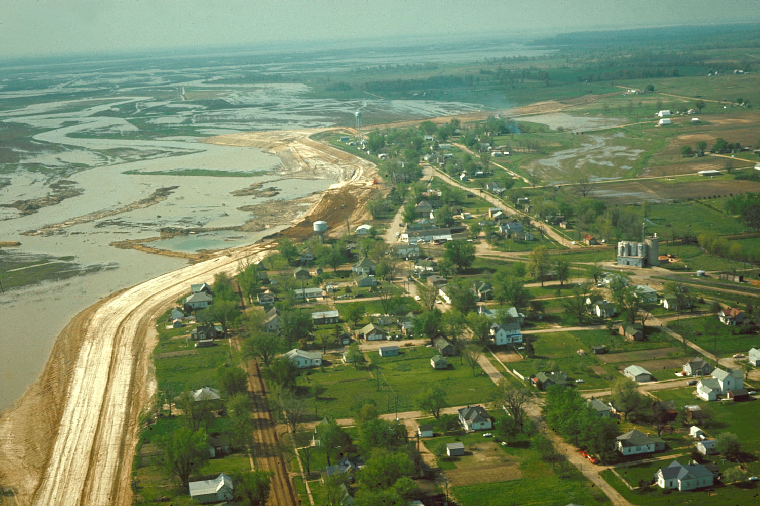
English: Aerial view of Keyesport, Illinois, USA. The photograph was taken in 1967 or 1968 after the Carlyle Lake Dam had been completed and Carlyle Lake was filling. The town now lies directly on the lakeshore. |
|||
| Data | cap a 1968 | |||
| Font |
U.S. Army Corps of Engineers Digital Visual Library Image page Image description page Digital Visual Library home page |
|||
| Autor | U.S. Army Corps of Engineers, photographer not specified or unknown | |||
| Permís (Com reutilitzar aquest fitxer) |
|
|||
| Localització | Keyesport, Illinois, USA |
| Posició de la càmera | | Aquesta i altres imatges properes a: OpenStreetMap |
|---|
Historial del fitxer
Cliqueu una data/hora per veure el fitxer tal com era aleshores.
| Data/hora | Miniatura | Dimensions | Usuari/a | Comentari | |
|---|---|---|---|---|---|
| actual | 23:01, 7 abr 2007 | | 1.500 × 1.000 (287 Ko) | DanMS | {{Information | Description = {{en|Aerial view of Keyesport, Illinois, USA. The photograph was taken in 1967 or 1968 after the Carlyle Lake Dam had been completed and Carlyle Lake was filling. The town now lies directly on the lakeshore.}} | So |
Ús del fitxer
La pàgina següent utilitza aquest fitxer:
Ús global del fitxer
Utilització d'aquest fitxer en altres wikis:
- Utilització a ar.wikipedia.org
- Utilització a ceb.wikipedia.org
- Utilització a cy.wikipedia.org
- Utilització a en.wikipedia.org
- Utilització a es.wikipedia.org
- Utilització a eu.wikipedia.org
- Utilització a fr.wikipedia.org
- Utilització a ht.wikipedia.org
- Utilització a it.wikipedia.org
- Utilització a lld.wikipedia.org
- Utilització a pl.wikipedia.org
- Utilització a pt.wikipedia.org
- Utilització a sr.wikipedia.org
- Utilització a uk.wikipedia.org
- Utilització a vi.wikipedia.org
- Utilització a www.wikidata.org
- Utilització a zh-min-nan.wikipedia.org
- Utilització a zh.wikipedia.org