Fitxer:Morocco relief location map.jpg

Mida d'aquesta previsualització: 737 × 600 píxels. Altres resolucions: 295 × 240 píxels | 590 × 480 píxels | 944 × 768 píxels | 1.223 × 995 píxels.
Fitxer original (1.223 × 995 píxels, mida del fitxer: 265 Ko, tipus MIME: image/jpeg)
| Aquest fitxer i la informació mostrada a continuació provenen del dipòsit multimèdia lliure Wikimedia Commons. |
Resum
| Descripció |
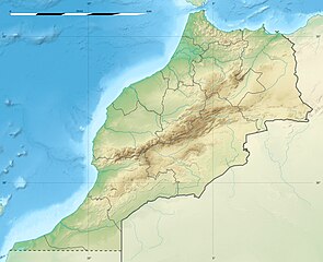
English: Blank physical map of Morocco, for geo-location purposes.
Français : Carte physique vierge du Maroc, destinée à la géolocalisation. Scale: 1:4,000,000 (precision: 1,000 m)
Geographic limits of the map:
|
||
| Data | 2009-11, updated 2017-02 | ||
| Font |
Treball propi
|
||
| Autor | Eric Gaba (Sting - fr:Sting) | ||
| Permís (Com reutilitzar aquest fitxer) |
|
||
| Altres versions |
|

| Posició de la càmera | | Aquesta i altres imatges properes a: OpenStreetMap |
|---|
Llicència
Jo, el titular dels drets d'autor d'aquest treball, el public sota les següents llicències:
Aquest fitxer està subjecte a la llicència de Creative Commons Reconeixement i Compartir Igual 3.0 No adaptada.
- Sou lliure de:
- compartir – copiar, distribuir i comunicar públicament l'obra
- adaptar – fer-ne obres derivades
- Amb les condicions següents:
- reconeixement – Heu de donar la informació adequada sobre l'autor, proporcionar un enllaç a la llicència i indicar si s'han realitzat canvis. Podeu fer-ho amb qualsevol mitjà raonable, però de cap manera no suggereixi que l'autor us dóna suport o aprova l'ús que en feu.
- compartir igual – Si modifiqueu, transformeu, o generareu amb el material, haureu de distribuir les vostres contribucions sota una llicència similar o una de compatible com l'original

|
S'autoritza la còpia, la distribució i la modificació d'aquest document sota els termes de la llicència de documentació lliure GNU versió 1.2 o qualsevol altra versió posterior que publiqui la Free Software Foundation; sense seccions invariants, ni textos de portada, ni textos de contraportada. S'inclou una còpia d'aquesta llicència en la secció titulada GNU Free Documentation License. |
Podeu seleccionar la llicència que vulgueu.
Historial del fitxer
Cliqueu una data/hora per veure el fitxer tal com era aleshores.
| Data/hora | Miniatura | Dimensions | Usuari/a | Comentari | |
|---|---|---|---|---|---|
| actual | 22:55, 10 feb 2017 | | 1.223 × 995 (265 Ko) | Sting | Updated regions borders as since 2015 |
| 15:11, 19 jul 2010 |  | 1.223 × 995 (234 Ko) | Sting | Color profile | |
| 22:31, 21 nov 2009 |  | 1.223 × 995 (240 Ko) | Sting | Putting back the southern dotted boundary (regarding Western Sahara's location map) | |
| 03:23, 21 nov 2009 |  | 1.223 × 995 (239 Ko) | Sting | Drawback for one "correction" | |
| 03:10, 21 nov 2009 |  | 1.223 × 995 (240 Ko) | Sting | Several little corrections | |
| 02:09, 21 nov 2009 |  | 1.223 × 995 (241 Ko) | Sting | == {{int:filedesc}} == {{Location|31|46|30|N|7|04|30|W|scale:5000000}} <br/> {{Information |Description={{en|Blank physical map of Morocco, for geo-location purposes.}} {{fr|Carte physique vierge du Maroc, destinée à la gé |
Ús del fitxer
Les 3 pàgines següents utilitzen aquest fitxer:
Ús global del fitxer
Utilització d'aquest fitxer en altres wikis:
- Utilització a af.wikipedia.org
- Utilització a ar.wikipedia.org
- Utilització a ast.wikipedia.org
- Utilització a azb.wikipedia.org
- Utilització a az.wikipedia.org
- Utilització a ba.wikipedia.org
- Utilització a be.wikipedia.org
- Utilització a bg.wikipedia.org
Vegeu més usos globals d'aquest fitxer.