Fitxer:Muscovy1715.jpg

Mida d'aquesta previsualització: 800 × 576 píxels. Altres resolucions: 320 × 230 píxels | 640 × 461 píxels | 1.024 × 737 píxels | 1.143 × 823 píxels.
Fitxer original (1.143 × 823 píxels, mida del fitxer: 841 Ko, tipus MIME: image/jpeg)
| Aquest fitxer i la informació mostrada a continuació provenen del dipòsit multimèdia lliure Wikimedia Commons. |
| Descripció |
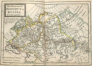
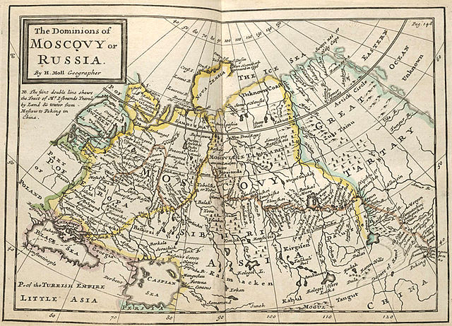
Русский: «Владения Московии или России». Карта из сборника Германа Молла "Twenty four new and accurate maps of the several parts of Europe". Лондон, 1715?
English: Map of dominions of Moscovy or Russia. From: Moll, Herman, Twenty four new and accurate maps of the several parts of Europe ... : all (except the last) new done, according to the latest observations / by Herman Moll, London, 1715? |
||||
| Data | |||||
| Font | Beinecke Rare Book and Manuscript Library, Yale University, USA | ||||
| Autor | Moll, Herman. Uploaded by Nickpo. | ||||
| Permís (Com reutilitzar aquest fitxer) |
|
||||
| Altres versions | Compare with: File:Growth of Russia 1613-1914.png | ||||
Historial del fitxer
Cliqueu una data/hora per veure el fitxer tal com era aleshores.
| Data/hora | Miniatura | Dimensions | Usuari/a | Comentari | |
|---|---|---|---|---|---|
| actual | 14:57, 16 jul 2009 | | 1.143 × 823 (841 Ko) | Nickpo | {{Information |Description={{ru|«Владения Московии или России». Карта из сборника Германа Молла "Twenty four new and accurate maps of the several parts of Europe". Лондон, 1715?}} {{en|Map of dom |
| 14:57, 16 jul 2009 |  | 1.143 × 823 (841 Ko) | Nickpo | {{Information |Description={{ru|«Владения Московии или России». Карта из сборника Германа Молла "Twenty four new and accurate maps of the several parts of Europe". Лондон, 1715?}} {{en|Map of dom |
Ús del fitxer
La pàgina següent utilitza aquest fitxer:
Ús global del fitxer
Utilització d'aquest fitxer en altres wikis:
- Utilització a be-tarask.wikipedia.org
- Utilització a be.wikipedia.org
- Utilització a en.wikipedia.org
- Utilització a es.wikipedia.org
- Utilització a ka.wikipedia.org
- Utilització a pt.wikipedia.org
- Utilització a uk.wikipedia.org
- Utilització a xmf.wikipedia.org