Fitxer:NImap-CIA.jpg

Mida d'aquesta previsualització: 727 × 599 píxels. Altres resolucions: 291 × 240 píxels | 582 × 480 píxels | 932 × 768 píxels | 1.252 × 1.032 píxels.
Fitxer original (1.252 × 1.032 píxels, mida del fitxer: 274 Ko, tipus MIME: image/jpeg)
| Aquest fitxer i la informació mostrada a continuació provenen del dipòsit multimèdia lliure Wikimedia Commons. |
Resum
| Descripció |
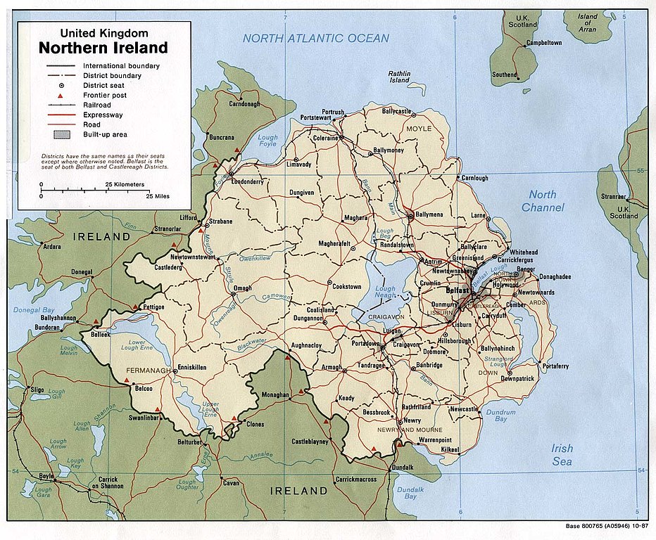
English: Map of Northern Ireland. |
| Data | |
| Font | Northern Ireland (U.K) (Political) 1987 from Perry-Castañeda Library Map Collection: Europe Maps |
| Autor | U.S. Central Intelligence Agency |
| Permís (Com reutilitzar aquest fitxer) |
Public domain |
Llicència
| This image is a work of a Central Intelligence Agency employee, taken or made as part of that person's official duties. As a Work of the United States Government, this image or media is in the public domain in the United States.
|

|
Historial del fitxer
Cliqueu una data/hora per veure el fitxer tal com era aleshores.
| Data/hora | Miniatura | Dimensions | Usuari/a | Comentari | |
|---|---|---|---|---|---|
| actual | 11:06, 11 gen 2005 | | 1.252 × 1.032 (274 Ko) | Hoshie | CIA map of Northern Ireland, from [http://www.lib.utexas.edu/maps/europe/northern_ireland_pol87.jpg]. |
Ús del fitxer
Les 2 pàgines següents utilitzen aquest fitxer:
Ús global del fitxer
Utilització d'aquest fitxer en altres wikis:
- Utilització a als.wikipedia.org
- Utilització a bn.wikipedia.org
- Utilització a cs.wikipedia.org
- Utilització a cv.wikipedia.org
- Utilització a de.wikipedia.org
- Utilització a dsb.wikipedia.org
- Utilització a el.wikipedia.org
- Utilització a en.wikipedia.org
- Utilització a es.wikipedia.org
- Utilització a fa.wikipedia.org
- Utilització a fi.wikipedia.org
- Utilització a frr.wikipedia.org
- Utilització a fr.wikipedia.org
- Utilització a gu.wikipedia.org
- Utilització a he.wikipedia.org
- Utilització a id.wikipedia.org
- Utilització a is.wikipedia.org
- Utilització a it.wikipedia.org
- Utilització a it.wikinews.org
- Utilització a ja.wikipedia.org
- Utilització a kn.wikipedia.org
- Utilització a lfn.wikipedia.org
- Utilització a mr.wikipedia.org
- Utilització a nl.wikipedia.org
- Utilització a os.wikipedia.org
- Utilització a pt.wikipedia.org
- Utilització a qu.wikipedia.org
- Utilització a rmy.wikipedia.org
- Utilització a sco.wikipedia.org
- Utilització a sh.wikipedia.org
- Utilització a simple.wikipedia.org
- Utilització a si.wikipedia.org
- Utilització a sk.wikipedia.org
Vegeu més usos globals d'aquest fitxer.