Fitxer:Neerpelt Limburg Belgium Map.png
No hi ha cap versió amb una resolució més gran.
Neerpelt_Limburg_Belgium_Map.png (270 × 203 píxels, mida del fitxer: 5 Ko, tipus MIME: image/png)
| Aquest fitxer i la informació mostrada a continuació provenen del dipòsit multimèdia lliure Wikimedia Commons. |

|
File:Neerpelt Limburg Belgium Map.svg és una versió vectorial (SVG) d'aquest fitxer. En cas de ser millor, hauria de ser emprada en lloc d'aquesta imatge tramada.
File:Neerpelt Limburg Belgium Map.png → File:Neerpelt Limburg Belgium Map.svg
Per a més informació pel que fa als gràfics vectorials, llegiu la transició a SVG en Commons. També hi ha informació quant a la compatibilitat del MediaWiki amb les imatges SVG. |
 |
Resum
| Descripció |
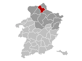
Brezhoneg: Lec'hiañ Neerpelt, Belgia.
English: Map, municipality belgium Neerpelt.
Français : Carte indiquant la localisation de la commune de Neerpelt dans la Province de Limbourg. |
| Font | Treball propi, originally from w:nl:Gebruiker:LennartBolks/kaartenhoekje. |
| Autor | LennartBolks |
Llicència
| S'ha alliberat aquesta obra al domini públic pel seu autor LennartBolks. Això s'aplica a tot el món. En alguns països això pot no ser legalment possible, en tal cas: |
Historial del fitxer
Cliqueu una data/hora per veure el fitxer tal com era aleshores.
| Data/hora | Miniatura | Dimensions | Usuari/a | Comentari | |
|---|---|---|---|---|---|
| actual | 02:49, 12 abr 2006 | | 270 × 203 (5 Ko) | Profoss | |
| 12:44, 9 abr 2005 |  | 270 × 203 (4 Ko) | Nicnac25~commonswiki | Map, municipality belgium Neerpelt {{PD}} FR; Carte indiquant la localisation de la commune de Neerpelt dans la Province de Limbourg. EN; Map from w:nl:Gebruiker:LennartBolks/kaartenhoekje in Public Domain by the Author choice. [[Category:Maps of pro |
Ús del fitxer
La pàgina següent utilitza aquest fitxer:
Ús global del fitxer
Utilització d'aquest fitxer en altres wikis:
- Utilització a af.wikipedia.org
- Utilització a ar.wikipedia.org
- Utilització a el.wikipedia.org
- Utilització a eo.wikipedia.org
- Utilització a es.wikipedia.org
- Utilització a eu.wikipedia.org
- Utilització a it.wikipedia.org
- Utilització a li.wikipedia.org
- Utilització a nl.wikipedia.org
- Utilització a pt.wikipedia.org
- Utilització a ro.wikipedia.org
- Utilització a th.wikipedia.org
- Utilització a vi.wikipedia.org
- Utilització a www.wikidata.org