Fitxer:Northbound entering Gorongosa District.JPG

Mida d'aquesta previsualització: 800 × 462 píxels. Altres resolucions: 320 × 185 píxels | 640 × 369 píxels | 1.031 × 595 píxels.
Fitxer original (1.031 × 595 píxels, mida del fitxer: 123 Ko, tipus MIME: image/jpeg)
| Aquest fitxer i la informació mostrada a continuació provenen del dipòsit multimèdia lliure Wikimedia Commons. |
Resum
| Descripció |
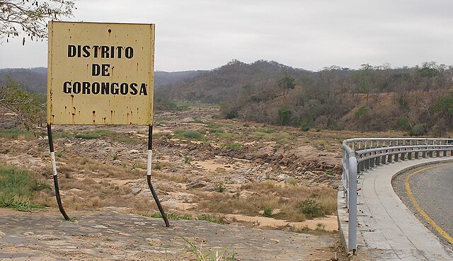
English: Travelling north on the main north-south highway of Mozambique (the EN1), entering the Gorongosa District. The bridge over the Rio Púnguè continues to the right of the photo. Note that river's low water level is typical of the late dry season. |
||
| Data | |||
| Font | Treball propi | ||
| Autor | Brian Dell | ||
| Permís (Com reutilitzar aquest fitxer) |
|
| Posició de la càmera | | Aquesta i altres imatges properes a: OpenStreetMap |
|---|
Historial del fitxer
Cliqueu una data/hora per veure el fitxer tal com era aleshores.
| Data/hora | Miniatura | Dimensions | Usuari/a | Comentari | |
|---|---|---|---|---|---|
| actual | 10:07, 11 nov 2008 | | 1.031 × 595 (123 Ko) | Bdell555 | {{Information |Description={{en|1=Travelling north on the main north-south highway of Mozambique, entering the Gorongosa District. The bridge continues to the right of the photo. Note that the river's low water level is typical of the late dry season.}} |
Ús del fitxer
Les 2 pàgines següents utilitzen aquest fitxer:
Ús global del fitxer
Utilització d'aquest fitxer en altres wikis:
- Utilització a ceb.wikipedia.org
- Utilització a en.wikipedia.org
- Utilització a fi.wikipedia.org
- Utilització a ha.wikipedia.org
- Utilització a ig.wikipedia.org
- Utilització a no.wikipedia.org
- Utilització a pt.wikipedia.org
- Utilització a ts.wikipedia.org
- Utilització a www.wikidata.org
- Utilització a yo.wikipedia.org
- Utilització a zh-min-nan.wikipedia.org
- Utilització a zh.wikipedia.org
- Utilització a zu.wikipedia.org