Fitxer:Serrasalmus distribution map.svg

Fitxer original (fitxer SVG, nominalment 1.022 × 1.428 píxels, mida del fitxer: 1,06 Mo)
| Aquest fitxer i la informació mostrada a continuació provenen del dipòsit multimèdia lliure Wikimedia Commons. |
| Descripció |
Deutsch: Verbreitungskarte Piranhas
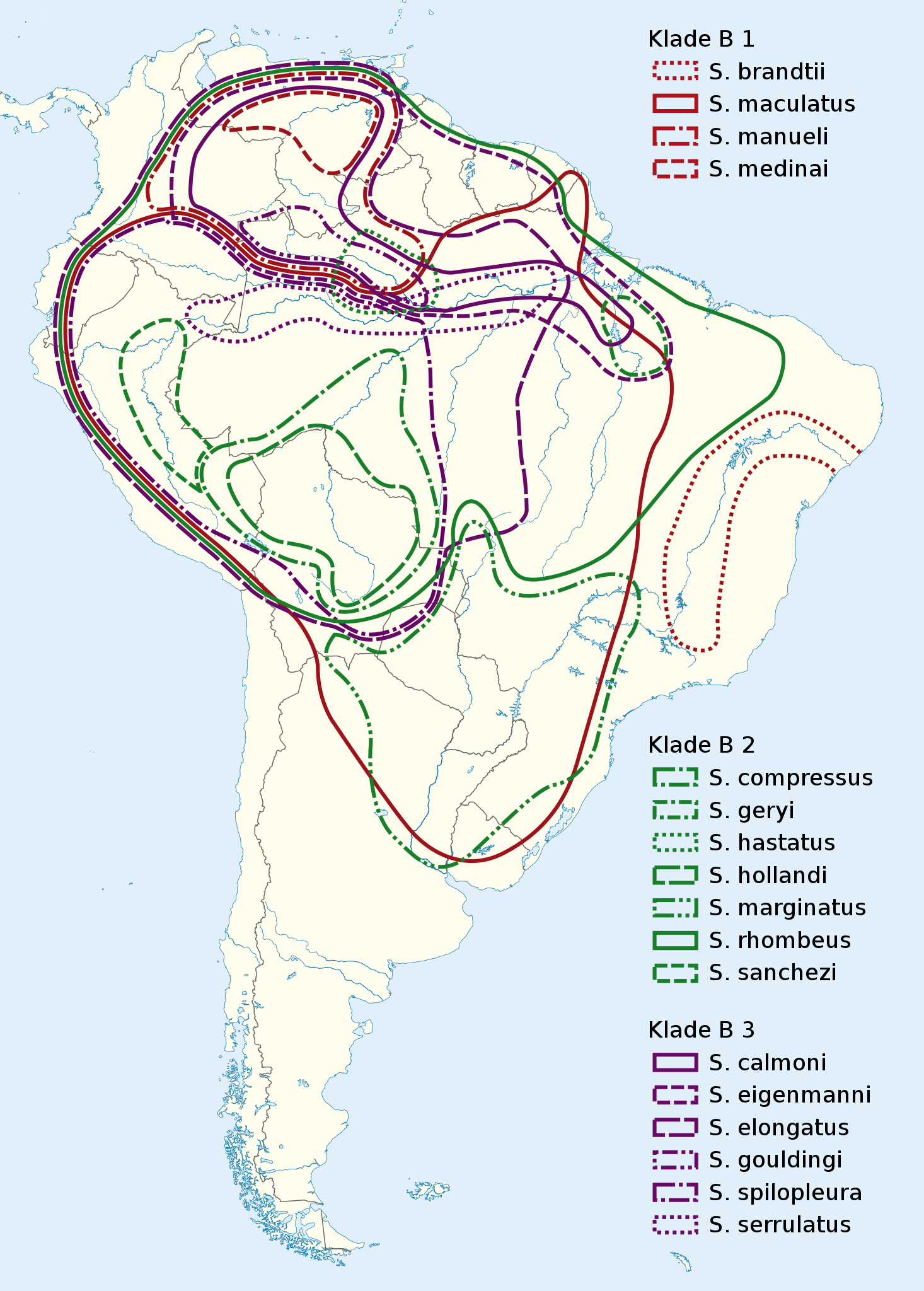
English: Serrasalmus distribution map |
|
| Data | (UTC) | |
| Font |
|
|
| Autor |
|
|
| Permís (Com reutilitzar aquest fitxer) |
Aquest fitxer està publicat sota la llicència de Creative Commons Reconeixement i Compartir Igual 3.0 Alemanya.
 Aquest fitxer està subjecte a la llicència de Creative Commons Reconeixement i Compartir Igual 3.0 No adaptada.
|

Registre original de càrregues
This image is a derivative work of the following images:
- File:South_America_laea_location_map.svg licensed with Cc-by-sa-3.0, GFDL
- 2010-11-27T12:48:20Z Uwe Dedering 1181x1732 (3103940 Bytes) {{Information |Description={{en|1= Location map of SouthAmerica. * Projection: Lambert azimuthal equal-area projection. * Area of interest: :* N: 25.0° N :* S: -60.0° N :* W: -90.0° E :* E: -30.0° E * Projection center: :
Uploaded with derivativeFX

|
This map has been made or improved in the German Kartenwerkstatt (Map Lab). You can propose maps to improve as well.
|
Historial del fitxer
Cliqueu una data/hora per veure el fitxer tal com era aleshores.
| Data/hora | Miniatura | Dimensions | Usuari/a | Comentari | |
|---|---|---|---|---|---|
| actual | 23:43, 4 març 2011 | | 1.022 × 1.428 (1,06 Mo) | NordNordWest | {{Information |Description={{de|Verbreitungskarte Piranhas}} {{en|''Serrasalmus'' distribution map}} |Source=*File:South_America_laea_location_map.svg *N. Hubert, F. Duponchelle, J. Nuñez, C. Garcia-Davila, D. P |
Ús del fitxer
La pàgina següent utilitza aquest fitxer:
Ús global del fitxer
Utilització d'aquest fitxer en altres wikis:
- Utilització a arz.wikipedia.org
- Utilització a be.wikipedia.org
- Utilització a bg.wikipedia.org
- Utilització a de.wikipedia.org
- Utilització a es.wikipedia.org
- Utilització a fr.wikipedia.org
- Utilització a hsb.wikipedia.org
- Utilització a hu.wikipedia.org
- Utilització a it.wikipedia.org
- Utilització a pl.wikipedia.org
- Utilització a pt.wikipedia.org
- Utilització a ru.wikipedia.org
- Utilització a sv.wikipedia.org
- Utilització a th.wikipedia.org
- Utilització a uk.wikipedia.org
- Utilització a www.wikidata.org
- Utilització a zh.wikipedia.org