Fitxer:Aerial photograph of Helmand River at Gereshk in 2011.jpg
Mida d'aquesta previsualització: 800 × 531 píxels. Altres resolucions: 320 × 212 píxels | 640 × 425 píxels | 1.024 × 680 píxels | 1.280 × 850 píxels | 2.784 × 1.848 píxels.
Fitxer original (2.784 × 1.848 píxels, mida del fitxer: 3,95 Mo, tipus MIME: image/jpeg)
| Aquest fitxer i la informació mostrada a continuació provenen del dipòsit multimèdia lliure Wikimedia Commons. |
Resum
| Descripció |
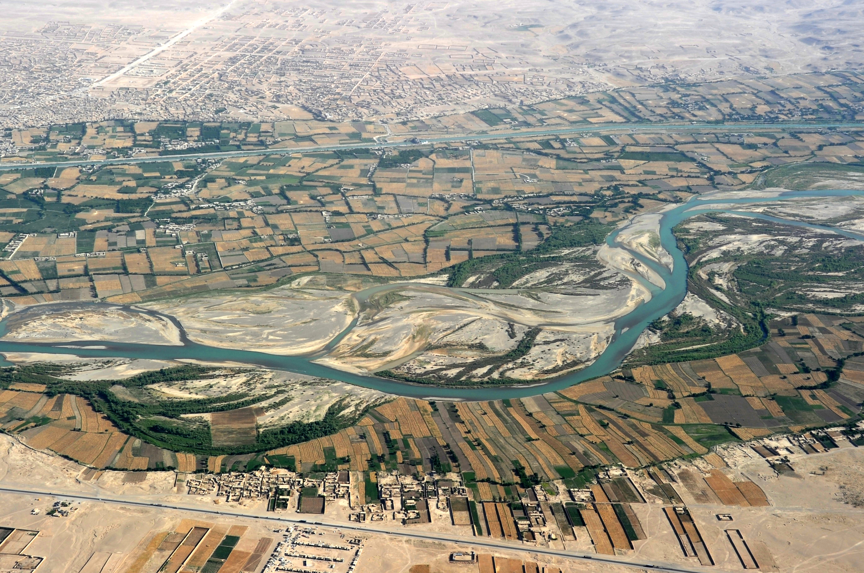
English: Traveling by helicopter enables us to see the beauty of Helmand River with the Boghra Irrigation Canal (Nahr-e Bughra) in the middle distance and the town of Gereshk (Grishk) in the far distance, Helmand Province. |
| Data | |
| Font | https://www.flickr.com/photos/usace-tas/8713418682/in/photostream/ |
| Autor | Karla Marshall |
| Posició de la càmera | | Aquesta i altres imatges properes a: OpenStreetMap |
|---|
Llicència
This image or file is a work of a U.S. Army Corps of Engineers soldier or employee, taken or made as part of that person's official duties. As a work of the U.S. federal government, the image is in the public domain.
|
Historial del fitxer
Cliqueu una data/hora per veure el fitxer tal com era aleshores.
| Data/hora | Miniatura | Dimensions | Usuari/a | Comentari | |
|---|---|---|---|---|---|
| actual | 16:14, 21 maig 2013 | | 2.784 × 1.848 (3,95 Mo) | Officer | {{Information |Description={{en|Traveling by helicopter enables us to see the beauty of Kandahar province from the air. (USACE Photo by Karla Marshall)}} |Source=http://www.flickr.com/photos/usace-tas/8713418682/in/photostream/ |Date=2011-05-30 |Author... |
Ús del fitxer
La pàgina següent utilitza aquest fitxer:
Ús global del fitxer
Utilització d'aquest fitxer en altres wikis:
- Utilització a ar.wikipedia.org
- Utilització a azb.wikipedia.org
- Utilització a bn.wikipedia.org
- Utilització a bs.wikipedia.org
- Utilització a ceb.wikipedia.org
- Utilització a cs.wikipedia.org
- Utilització a cy.wikipedia.org
- Utilització a da.wikipedia.org
- Utilització a el.wikipedia.org
- Utilització a en.wikipedia.org
- Utilització a en.wikivoyage.org
- Utilització a en.wiktionary.org
- Utilització a eo.wikipedia.org
- Utilització a es.wikipedia.org
- Utilització a eu.wikipedia.org
- Utilització a fa.wikipedia.org
- Utilització a fi.wikipedia.org
- Utilització a fr.wikipedia.org
- Utilització a gu.wikipedia.org
- Utilització a he.wikipedia.org
- Utilització a hu.wikipedia.org
- Utilització a hy.wikipedia.org
- Utilització a id.wikipedia.org
- Utilització a incubator.wikimedia.org
- Utilització a it.wikipedia.org
- Utilització a kab.wikipedia.org
Vegeu més usos globals d'aquest fitxer.