Fitxer:Bahía de Alicante.jpg

Fitxer original (900 × 1.279 píxels, mida del fitxer: 149 Ko, tipus MIME: image/jpeg)
| Aquest fitxer i la informació mostrada a continuació provenen del dipòsit multimèdia lliure Wikimedia Commons. |
Resum
| Descripció |
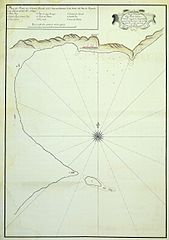
ES: Plano manuscrito de la Bahía de Alicante (España) de 1782. |
| Data |
Creation of the map: 1782 |
| Font | http://www.alicantevivo.org/2007/06/mapas-y-cartas-nuticas-de-la-baha-de.html |
| Autor |
Creation of the map: Don Vicente Caamaño |
| Permís (Com reutilitzar aquest fitxer) |
Public domain (1782) |
Llicència
|
Això és una mera fotografia d'una obra d'art bidimensional en domini públic. L'obra d'art original és en domini públic pel següent motiu:
La posició oficial de la Fundació Wikimedia és que «les reproduccions fidels d'obres d'art bidimensionals de domini públic són en domini públic». Per tant, aquesta reproducció fotogràfica també es considera en domini públic als Estats Units. En altres jurisdiccions la reutilització d'aquest contingut pot estar restringida; vegeu Reuse of PD-Art photographs per a més informació. {{PD-Art}} template without license parameter: please specify why the underlying work is public domain in both the source country and the United States
(Usage: {{PD-Art|1=|deathyear=''year of author's death''|country=''source country''}}, where parameter #1 can be PD-old-auto, PD-old-auto-expired, PD-old-auto-1996, PD-old-100 or similar. See Commons:Multi-license copyright tags for more information.) | ||||
Historial del fitxer
Cliqueu una data/hora per veure el fitxer tal com era aleshores.
| Data/hora | Miniatura | Dimensions | Usuari/a | Comentari | |
|---|---|---|---|---|---|
| actual | 11:47, 3 set 2008 | | 900 × 1.279 (149 Ko) | Kokoo | {{Information |Description= ES: Plano manuscrito de la Bahía de Alicante (España) de 1782. EN: ''Map of the Bay of Alicante (Spain). 1782.'' |Source=http://www.alicantevivo.org/2007/06/mapas-y-cartas-nuticas-de-la-baha-de.html |Date= Creation of the m |
Ús del fitxer
La pàgina següent utilitza aquest fitxer:
Ús global del fitxer
Utilització d'aquest fitxer en altres wikis:
- Utilització a ast.wikipedia.org
- Utilització a es.wikipedia.org