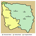
Fitxer:Banat05.png

Mida d'aquesta previsualització: 651 × 600 píxels. Altres resolucions: 261 × 240 píxels | 521 × 480 píxels | 1.014 × 934 píxels.
Fitxer original (1.014 × 934 píxels, mida del fitxer: 64 Ko, tipus MIME: image/png)
Historial del fitxer
Cliqueu una data/hora per veure el fitxer tal com era aleshores.
| Data/hora | Miniatura | Dimensions | Usuari/a | Comentari | |
|---|---|---|---|---|---|
| actual | 19:19, 18 set 2009 |  | 1.014 × 934 (64 Ko) | Abigor | This file has been send to me by email, the author of this file is: PANONIAN just like the first version. |
| 18:00, 24 maig 2006 |  | 694 × 703 (162 Ko) | Dantadd | Map of Banat source: http://en.wikipedia.org/wiki/Image:Banat05.png Category:Maps of Romania |
Ús del fitxer
La pàgina següent utilitza aquest fitxer:
Ús global del fitxer
Utilització d'aquest fitxer en altres wikis:
- Utilització a als.wikipedia.org
- Utilització a an.wikipedia.org
- Utilització a be-tarask.wikipedia.org
- Utilització a be.wikipedia.org
- Utilització a bg.wikipedia.org
- Utilització a cs.wikipedia.org
- Utilització a cv.wikipedia.org
- Utilització a de.wikipedia.org
- Utilització a el.wikipedia.org
- Utilització a en.wikipedia.org
- Utilització a en.wiktionary.org
- Utilització a eo.wikipedia.org
- Utilització a es.wikipedia.org
- Utilització a fi.wikipedia.org
- Utilització a fr.wikipedia.org
- Utilització a gl.wikipedia.org
- Utilització a he.wikipedia.org
- Utilització a hr.wikipedia.org
- Utilització a hu.wikipedia.org
- Utilització a id.wikipedia.org
- Utilització a io.wikipedia.org
- Utilització a it.wikivoyage.org
- Utilització a ja.wikipedia.org
- Utilització a ko.wikipedia.org
- Utilització a la.wikipedia.org
- Utilització a nl.wikipedia.org
- Utilització a nn.wikipedia.org
- Utilització a oc.wikipedia.org
- Utilització a pl.wikipedia.org
- Utilització a pt.wikipedia.org
- Utilització a ro.wikipedia.org
- Utilització a ru.wikipedia.org
- Utilització a scn.wikipedia.org
- Utilització a sh.wikipedia.org
- Utilització a sk.wikipedia.org
- Utilització a sr.wikipedia.org
Vegeu més usos globals d'aquest fitxer.

