Fitxer:China agricultural 1986.jpg

Mida d'aquesta previsualització: 724 × 600 píxels. Altres resolucions: 290 × 240 píxels | 580 × 480 píxels | 927 × 768 píxels | 1.024 × 848 píxels.
Fitxer original (1.024 × 848 píxels, mida del fitxer: 97 Ko, tipus MIME: image/jpeg)
| Aquest fitxer i la informació mostrada a continuació provenen del dipòsit multimèdia lliure Wikimedia Commons. |
| Descripció |
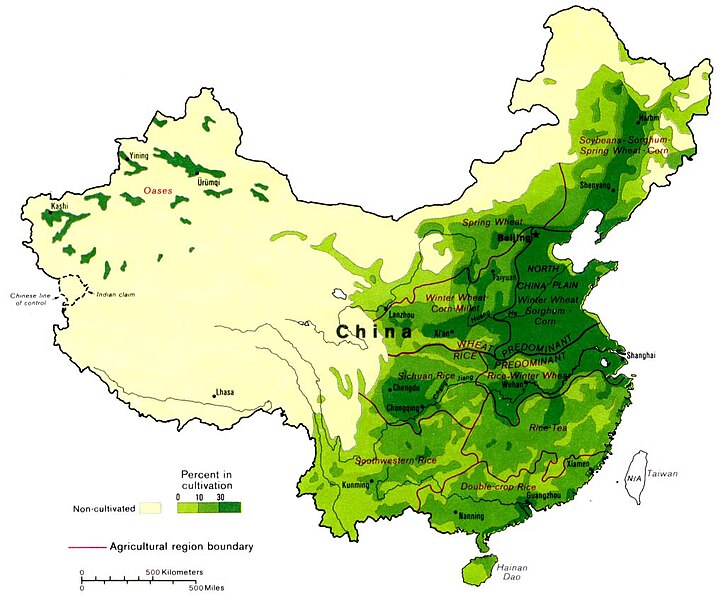
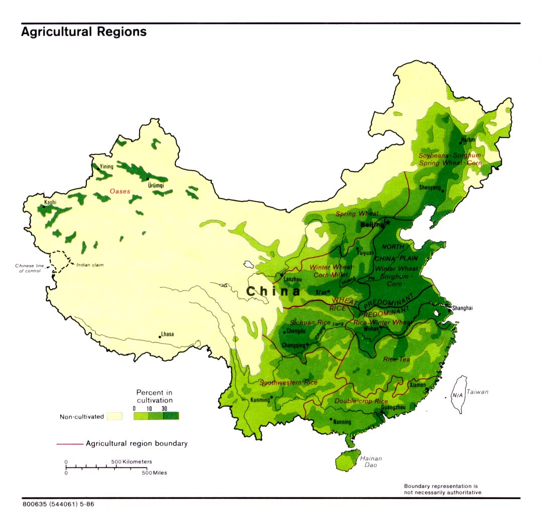
English: Maps of China: Agricultural regions of China – Note: Boundary representation is not necessarily authoritative. |
|||
| Data | ||||
| Font | Map No. 800635 (544061) 5-86 – produced by the U.S. Central Intelligence Agency – see also China Maps Collection | |||
| Autor | Desconegut (U.S. Central Intelligence Agency) | |||
| Permís (Com reutilitzar aquest fitxer) |
|

Historial del fitxer
Cliqueu una data/hora per veure el fitxer tal com era aleshores.
| Data/hora | Miniatura | Dimensions | Usuari/a | Comentari | |
|---|---|---|---|---|---|
| actual | 15:04, 13 abr 2010 | | 1.024 × 848 (97 Ko) | Ras67 | losslessly cropped with Jpegcrop |
| 06:58, 15 gen 2005 |  | 1.084 × 1.039 (127 Ko) | Ran | {{PD-USGov}} |
Ús del fitxer
Les 2 pàgines següents utilitzen aquest fitxer:
Ús global del fitxer
Utilització d'aquest fitxer en altres wikis:
- Utilització a ar.wikipedia.org
- Utilització a ast.wikipedia.org
- Utilització a de.wikipedia.org
- Utilització a en.wikipedia.org
- Utilització a es.wikipedia.org
- Utilització a es.wikibooks.org
- Utilització a fr.wikipedia.org
- Utilització a fr.wiktionary.org
- Utilització a gl.wikipedia.org
- Utilització a id.wikipedia.org
- Utilització a ka.wikipedia.org
- Utilització a ru.wikipedia.org
- Utilització a sh.wikipedia.org
- Utilització a zh.wikipedia.org