Fitxer:CoropunaSouthViewUSGS.jpg
No hi ha cap versió amb una resolució més gran.
CoropunaSouthViewUSGS.jpg (640 × 409 píxels, mida del fitxer: 25 Ko, tipus MIME: image/jpeg)
| Aquest fitxer i la informació mostrada a continuació provenen del dipòsit multimèdia lliure Wikimedia Commons. |
Resum
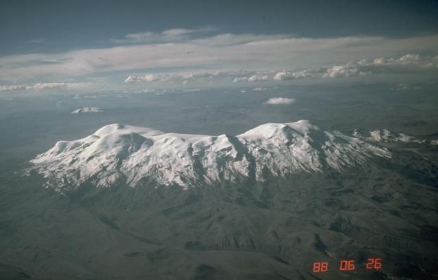
| Descripció | Aerial photo of Nevado Coropuna, Peru's largest and highest volcano, from the south. The true summit (left) is located at the NW end of the vast summit plateau. | |||
| Localització | Southern Peru | |||
| Data | ||||
| Font | https://volcano.si.edu/volcano.cfm?vn=354003&vtab=Photos | |||
| Autor | Norm Banks, U.S. Geological Survey | |||
| Permís (Com reutilitzar aquest fitxer) |
|
Historial del fitxer
Cliqueu una data/hora per veure el fitxer tal com era aleshores.
| Data/hora | Miniatura | Dimensions | Usuari/a | Comentari | |
|---|---|---|---|---|---|
| actual | 06:25, 22 abr 2007 | | 640 × 409 (25 Ko) | Seattle Skier | == Summary == {{Information |Description= Aerial photo of Nevado Coropuna, Peru's largest and highest volcano, from the south. The true summit (left) is located at the NW end of the vast summit plateau. |Source=http://www.volcano. |
Ús del fitxer
La pàgina següent utilitza aquest fitxer:
Ús global del fitxer
Utilització d'aquest fitxer en altres wikis:
- Utilització a ay.wikipedia.org
- Utilització a be.wikipedia.org
- Utilització a en.wikipedia.org
- Utilització a lt.wikipedia.org
- Utilització a qu.wikipedia.org
- Utilització a uk.wikipedia.org