Fitxer:Exeter-20may44.jpg
No hi ha cap versió amb una resolució més gran.
Exeter-20may44.jpg (600 × 555 píxels, mida del fitxer: 79 Ko, tipus MIME: image/jpeg)
| Aquest fitxer i la informació mostrada a continuació provenen del dipòsit multimèdia lliure Wikimedia Commons. |
Resum
| Descripció |
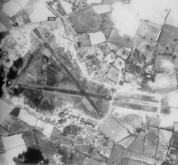
English: Exeter Airfield, England |
||||||
| Data | |||||||
| Font | Freeman, Roger A., Airfields Of The Ninth, Then And Now, 1993 (where the annotations are from) | ||||||
| Autor | Royal Ordinance Survey. | ||||||
| Permís (Com reutilitzar aquest fitxer) |
|

Registre original de càrregues
La pàgina de descripció original era aquí. Els noms d'usuari a continuació es refereixen a en.wikipedia.
- 2007-05-15 23:39 Bwmoll3 600×555×8 (81388 bytes) Exeter Airfield, England, 20 May 1944 Source: Royal Ordinance Survey. Crown Copyright expired 50 years after photograph taken in 1994. Annotations on photo from Freeman, Roger A., Airfields Of The Ninth, Then And Now, 1993
Historial del fitxer
Cliqueu una data/hora per veure el fitxer tal com era aleshores.
| Data/hora | Miniatura | Dimensions | Usuari/a | Comentari | |
|---|---|---|---|---|---|
| actual | 12:29, 21 maig 2008 | | 600 × 555 (79 Ko) | Aps1 | {{Information |Description={{en|Exeter Airfield, England, 20 May 1944 Source: Royal Ordinance Survey. Crown Copyright expired 50 years after photograph taken in 1994. Annotations on photo from Freeman, Roger A., Airfields Of The Ninth, Then And Now, 1993 |
Ús del fitxer
La pàgina següent utilitza aquest fitxer:
Ús global del fitxer
Utilització d'aquest fitxer en altres wikis:
- Utilització a bg.wikipedia.org
- Utilització a en.wikipedia.org
- Utilització a ru.wikipedia.org
- Utilització a si.wikipedia.org
- Utilització a uk.wikipedia.org
- Utilització a vi.wikipedia.org