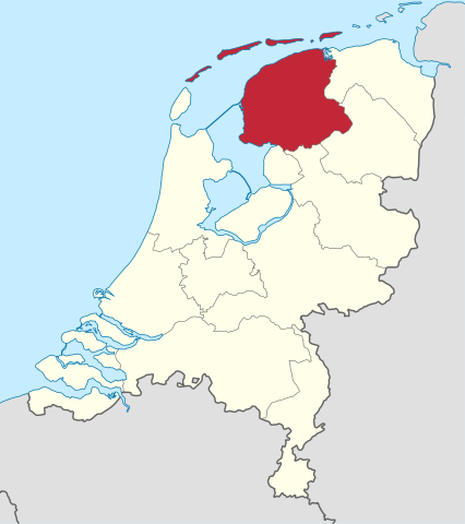
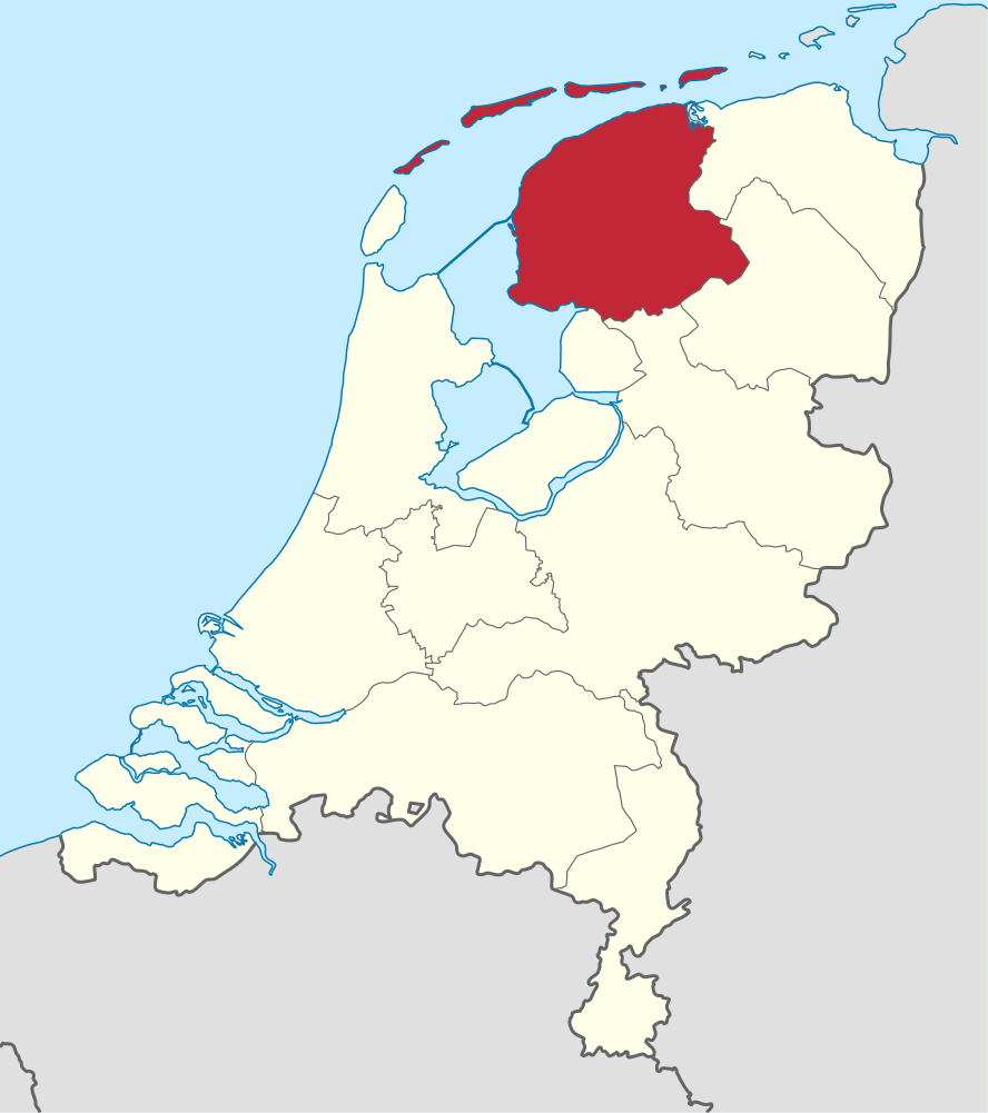
Fitxer:Friesland in the Netherlands.svg

Mida d'aquesta previsualització PNG del fitxer SVG: 532 × 600 píxels. Altres resolucions: 213 × 240 píxels | 426 × 480 píxels | 681 × 768 píxels | 908 × 1.024 píxels | 1.817 × 2.048 píxels | 888 × 1.001 píxels.
Fitxer original (fitxer SVG, nominalment 888 × 1.001 píxels, mida del fitxer: 147 Ko)
| Aquest fitxer i la informació mostrada a continuació provenen del dipòsit multimèdia lliure Wikimedia Commons. |
Resum
.svg)
.svg)
.svg)
.svg)
.svg)
.svg)
.svg)

-en.svg)

.svg)
.svg)
.svg)

_(US48).svg)
_(small_islands_magnified)_(-mini_map_-rivers).svg)
.svg)
_(extra_close)_(US48).svg)
.svg)
_(zoom).svg)

.svg)


_(UNMIK).svg)
.svg)
_(disputed_hatched).svg)
_(claimed_and_disputed_hatched).svg)
.svg)
.svg)
_(%2Ball_claims_hatched).svg)

.svg)
_(shade).svg)
_(shade)_(special_marker).svg)
_(-mini_map).svg)
_(-mini_map).svg)
_(-mini_map).svg)


.svg)

.svg)
Llicència
Jo, el titular dels drets d'autor d'aquest treball, el public sota les següents llicències:

|
S'autoritza la còpia, la distribució i la modificació d'aquest document sota els termes de la llicència de documentació lliure GNU versió 1.2 o qualsevol altra versió posterior que publiqui la Free Software Foundation; sense seccions invariants, ni textos de portada, ni textos de contraportada. S'inclou una còpia d'aquesta llicència en la secció titulada GNU Free Documentation License. |
Aquest fitxer està subjecte a la llicència de Creative Commons Reconeixement i Compartir Igual 3.0 No adaptada.
- Sou lliure de:
- compartir – copiar, distribuir i comunicar públicament l'obra
- adaptar – fer-ne obres derivades
- Amb les condicions següents:
- reconeixement – Heu de donar la informació adequada sobre l'autor, proporcionar un enllaç a la llicència i indicar si s'han realitzat canvis. Podeu fer-ho amb qualsevol mitjà raonable, però de cap manera no suggereixi que l'autor us dóna suport o aprova l'ús que en feu.
- compartir igual – Si modifiqueu, transformeu, o generareu amb el material, haureu de distribuir les vostres contribucions sota una llicència similar o una de compatible com l'original
Podeu seleccionar la llicència que vulgueu.

|
I'd greatly appreciate, that you attribute this media file to Wikimedia Commons, if used outside Wikipedia or Commons. For use in publications such as books, newspapers, blogs, websites, please insert here the following line:
|
Historial del fitxer
Cliqueu una data/hora per veure el fitxer tal com era aleshores.
| Data/hora | Miniatura | Dimensions | Usuari/a | Comentari | |
|---|---|---|---|---|---|
| actual | 13:28, 5 gen 2019 | | 888 × 1.001 (147 Ko) | Thayts | small border corrections |
| 14:27, 2 gen 2019 |  | 888 × 1.001 (147 Ko) | Thayts | update | |
| 09:58, 21 abr 2011 |  | 888 × 1.001 (470 Ko) | TUBS | upd wegen Grenze zu Zealand und belgische Exklave im Süden | |
| 02:14, 4 març 2011 |  | 888 × 1.001 (459 Ko) | TUBS |
Ús del fitxer
La pàgina següent utilitza aquest fitxer:
Ús global del fitxer
Utilització d'aquest fitxer en altres wikis:
- Utilització a af.wikipedia.org
- Friesland
- Leeuwarden
- Heerenveen
- Kategorie:Munisipaliteite in Friesland
- Vlieland
- Terschelling
- Friese
- Sjabloon:Munisipaliteite in Friesland
- Achtkarspelen
- Noardeast-Fryslân
- Schiermonnikoog
- Smallingerland
- Opsterland
- Ooststellingwerf
- Weststellingwerf
- De Fryske Marren
- Súdwest-Fryslân
- Ameland
- Dantumadiel
- Tytsjerksteradiel
- Waadhoeke
- Harlingen
- Utilització a ar.wikipedia.org
- Utilització a arz.wikipedia.org
- Utilització a ast.wikipedia.org
- Utilització a ban.wikipedia.org
- Utilització a bg.wikipedia.org
- Utilització a br.wikipedia.org
- Utilització a ceb.wikipedia.org
- Utilització a ckb.wikipedia.org
- Utilització a cs.wikipedia.org
- Utilització a cv.wikipedia.org
- Utilització a da.wikipedia.org
- Utilització a de.wikivoyage.org
- Utilització a el.wikipedia.org
- Utilització a el.wikivoyage.org
- Utilització a en.wikipedia.org
- Utilització a en.wiktionary.org
- Utilització a eo.wikipedia.org
- Utilització a es.wikipedia.org
Vegeu més usos globals d'aquest fitxer.