Fitxer:Ionian Islands.svg

Mida d'aquesta previsualització PNG del fitxer SVG: 532 × 547 píxels. Altres resolucions: 233 × 240 píxels | 467 × 480 píxels | 747 × 768 píxels | 996 × 1.024 píxels | 1.992 × 2.048 píxels.
Fitxer original (fitxer SVG, nominalment 532 × 547 píxels, mida del fitxer: 281 Ko)
| Aquest fitxer i la informació mostrada a continuació provenen del dipòsit multimèdia lliure Wikimedia Commons. |

|
This map has been uploaded by Electionworld from en.wikipedia.org to enable the |
Resum
| Descripció |
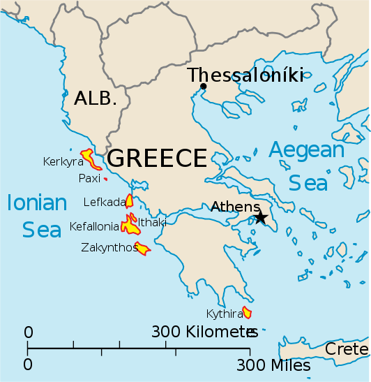
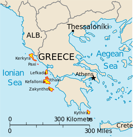
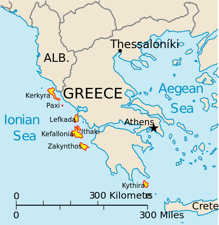
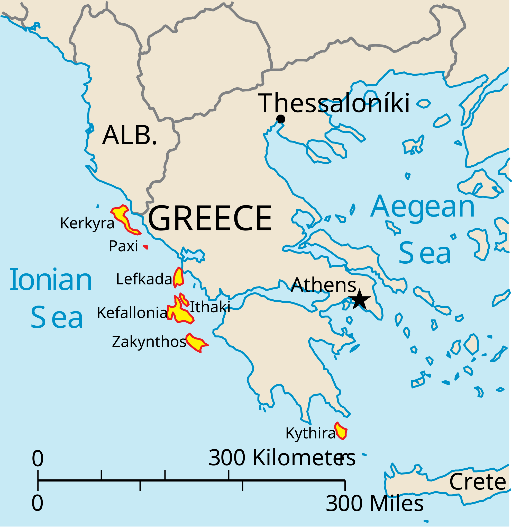
English: Map of the Ionian Islands off Greece. |
| Data | |
| Font | Treball propi, Original vector data taken from the 2006 CIA World Factbook map of Europe. All modifications were made by me, and are free for anyone to use for any purpose. |
| Autor | Electionworld |
| Altres versions |
Version en français : |
Llicència
This image is in the public domain because it contains materials that originally came from the United States Central Intelligence Agency's World Factbook.
|
 |
Historial del fitxer
Cliqueu una data/hora per veure el fitxer tal com era aleshores.
| Data/hora | Miniatura | Dimensions | Usuari/a | Comentari | |
|---|---|---|---|---|---|
| actual | 16:39, 4 abr 2010 | | 532 × 547 (281 Ko) | Kmusser | rm Macedonia label, not important to the map and avoids POV issue |
| 22:17, 20 des 2006 |  | 532 × 547 (258 Ko) | Electionworld | {{ew|en|IMeowbot}} == Summary == Map of the Ionian Islands off Greece. Original vector data taken from the 2006 CIA World Factbook map of Europe. All modifications were made by me, and are free for anyone to use for any purpose. == Licensing == {{PD-US |
Ús del fitxer
No hi ha pàgines que utilitzin aquest fitxer.
Ús global del fitxer
Utilització d'aquest fitxer en altres wikis:
- Utilització a ar.wikipedia.org
- Utilització a ast.wikipedia.org
- Utilització a be.wikipedia.org
- Utilització a bg.wikipedia.org
- Utilització a ceb.wikipedia.org
- Utilització a ce.wikipedia.org
- Utilització a cy.wikipedia.org
- Utilització a da.wikipedia.org
- Utilització a de.wikipedia.org
- Utilització a en.wikipedia.org
- Utilització a et.wikipedia.org
- Utilització a fa.wikipedia.org
- Utilització a fi.wikipedia.org
- Utilització a fr.wikipedia.org
- Utilització a he.wikipedia.org
- Utilització a hr.wikipedia.org
- Utilització a hu.wikipedia.org
- Utilització a hyw.wikipedia.org
- Utilització a id.wikipedia.org
- Utilització a it.wikipedia.org
Vegeu més usos globals d'aquest fitxer.