Fitxer:Island of Ireland location map Monaghan.svg

Mida d'aquesta previsualització PNG del fitxer SVG: 481 × 599 píxels. Altres resolucions: 192 × 240 píxels | 385 × 480 píxels | 616 × 768 píxels | 822 × 1.024 píxels | 1.643 × 2.048 píxels | 1.450 × 1.807 píxels.
Fitxer original (fitxer SVG, nominalment 1.450 × 1.807 píxels, mida del fitxer: 642 Ko)
| Aquest fitxer i la informació mostrada a continuació provenen del dipòsit multimèdia lliure Wikimedia Commons. |
| Descripció |
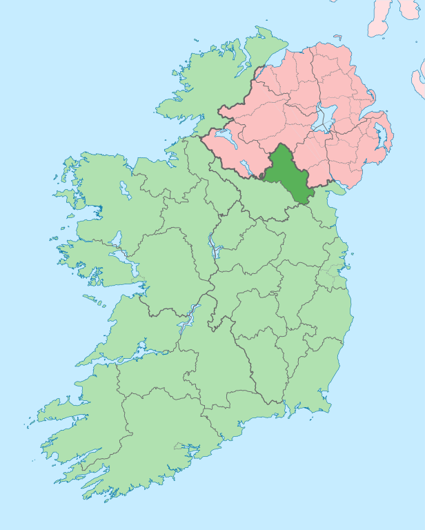
English: The island of Ireland, showing international border between Northern Ireland and Republic of Ireland, traditional provinces, traditional counties, and local authority areas in the Republic of Ireland and Northern Ireland. |
||
| Data | (UTC) | ||
| Font | |||
| Autor | |||
| SVG genesis | Aquesta imatge vectorial ha estat creada amb unknown tool
|
Jo, el titular dels drets d'autor d'aquest treball, el public sota la següent llicència:
Aquest fitxer està subjecte a la llicència de Creative Commons Reconeixement i Compartir Igual 3.0 No adaptada.
- Sou lliure de:
- compartir – copiar, distribuir i comunicar públicament l'obra
- adaptar – fer-ne obres derivades
- Amb les condicions següents:
- reconeixement – Heu de donar la informació adequada sobre l'autor, proporcionar un enllaç a la llicència i indicar si s'han realitzat canvis. Podeu fer-ho amb qualsevol mitjà raonable, però de cap manera no suggereixi que l'autor us dóna suport o aprova l'ús que en feu.
- compartir igual – Si modifiqueu, transformeu, o generareu amb el material, haureu de distribuir les vostres contribucions sota una llicència similar o una de compatible com l'original
Registre original de càrregues
This image is a derivative work of the following images:
- File:Island_of_Ireland_location_map.svg licensed with Cc-by-sa-3.0
- 2010-03-06T20:43:33Z Rannpháirtí anaithnid 1450x1807 (679207 Bytes) Fix incorrectly coloured isands.
- 2010-03-03T22:19:29Z Rannpháirtí anaithnid 1450x1807 (679744 Bytes) {{Information |Description={{de|Positionskarte von [[:de:Irland|Irland]]}} Quadratische Plattkarte, N-S-Streckung 170 %. Geographische Begrenzung der Karte: * N: 55.6° N * S: 51.2° N * W: 11.0° W * O: 5.0° W {{en|Location
Uploaded with derivativeFX
Historial del fitxer
Cliqueu una data/hora per veure el fitxer tal com era aleshores.
| Data/hora | Miniatura | Dimensions | Usuari/a | Comentari | |
|---|---|---|---|---|---|
| actual | 15:41, 29 juny 2020 | | 1.450 × 1.807 (642 Ko) | Chipmunkdavis | Further edits per the Local Government Reform Act 2014, joining both Tipperarys and both Waterfords (and removing Limerick City code). Colouring in islands, cleaning up and grouping code to remove stray objects and show Galway and Lough Ree. |
| 05:53, 6 maig 2016 |  | 1.450 × 1.807 (833 Ko) | Houdinipeter | to reflect the changes of the w:Local Government Reform Act 2014 | |
| 03:02, 19 jul 2010 |  | 1.450 × 1.807 (815 Ko) | Mabuska | {{Information |Description={{en|The island of Ireland, showing international border between Northern Ireland and Republic of Ireland, traditional provinces, traditional counties, and local authority areas in the Republic of Ireland and Northern Ireland.}} |
Ús del fitxer
Les 7 pàgines següents utilitzen aquest fitxer:
Ús global del fitxer
Utilització d'aquest fitxer en altres wikis:
- Utilització a ar.wikipedia.org
- Utilització a ast.wikipedia.org
- Utilització a bg.wikipedia.org
- Utilització a ceb.wikipedia.org
- Utilització a cs.wikipedia.org
- Utilització a de.wikivoyage.org
- Utilització a en.wikipedia.org
- County Monaghan
- Clones, County Monaghan
- List of Ireland-related topics
- Monaghan
- Carrickmacross
- Castleblayney
- Lough Egish
- Emyvale
- Clontibret
- Scotshouse
- Ballybay
- Tydavnet
- Sheskin
- Scotstown
- Corblonog
- Knockatallon
- Corlat
- Killycarnan
- Skeatry
- Derryarrit
- Knockacullion
- Newbliss
- Rockcorry
- Dartrey Forest
- Ballinode
- Farney (barony)
- Tirnaneill
- Castleshane, County Monaghan
- Inniskeen
- Dún na Rí Forest Park
- Template:Monaghan-geo-stub
- List of civil parishes in County Monaghan
- Tyholland
- Finn Bridge
- Killymarron
- Smithborough
- Rossmore Forest Park
- Glaslough
- Template:County Monaghan
- Threemilehouse
- Tullycorbet
- Doohamlet
- Wikipedia:Graphics Lab/Map workshop/Archive/Oct 2014
- Cremorne (barony)
Vegeu més usos globals d'aquest fitxer.