Fitxer:Koninkrijk der Nederlanden.png

Mida d'aquesta previsualització: 624 × 599 píxels. Altres resolucions: 250 × 240 píxels | 500 × 480 píxels | 799 × 768 píxels | 1.171 × 1.125 píxels.
Fitxer original (1.171 × 1.125 píxels, mida del fitxer: 241 Ko, tipus MIME: image/png)
| Aquest fitxer i la informació mostrada a continuació provenen del dipòsit multimèdia lliure Wikimedia Commons. |
Resum
| Descripció |
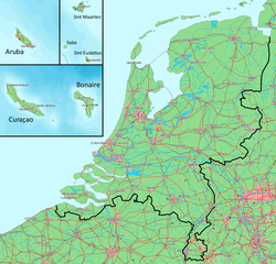
Deutsch: Karte des Königreichs der Niederlande. Das Festland und die Inseln befinden sich auf derselben Ebene.
English: Map of the Kingdom of the Netherlands. The mainland and all the islands are on the same scale.
Nederlands: Kaart van het Koninkrijk der Nederlanden. Het vasteland (Nederland) en de eilanden worden getoond op dezelfde schaal. |
||||
| Data | |||||
| Font | Gebaseerd op/Based on http://www.demis.nl/wms/mapclip.htm (free software based on a free database/vrije software gebaseerd op een vrije database) | ||||
| Autor | Bewerkt door/Edited by Maarten van der Bent | ||||
| Permís (Com reutilitzar aquest fitxer) |
|
Historial del fitxer
Cliqueu una data/hora per veure el fitxer tal com era aleshores.
| Data/hora | Miniatura | Dimensions | Usuari/a | Comentari | |
|---|---|---|---|---|---|
| actual | 01:13, 6 ago 2010 | | 1.171 × 1.125 (241 Ko) | Ras67 | cropped and squeezed |
| 00:31, 31 oct 2008 |  | 1.180 × 1.135 (398 Ko) | Pbech | Fixed some glaring errors/anachronisms concerning railways. Situation is now (as far as I can see) updated to 2008 | |
| 22:01, 24 abr 2007 |  | 1.180 × 1.135 (400 Ko) | Maartenvdbent~commonswiki | bigger names | |
| 20:19, 24 abr 2007 |  | 1.179 × 1.135 (394 Ko) | Maartenvdbent~commonswiki | without hand | |
| 19:08, 24 abr 2007 |  | 1.179 × 1.135 (394 Ko) | Maartenvdbent~commonswiki | {{Information |Description=Map of the Kingdom of the Netherlands |Source=Based on http://www.demis.nl/wms/mapclip.htm (free software based on free database) |Date=2007-04-24 |Author=Edited by Maarten van der Bent |Permissi |
Ús del fitxer
La pàgina següent utilitza aquest fitxer:
Ús global del fitxer
Utilització d'aquest fitxer en altres wikis:
- Utilització a af.wikipedia.org
- Utilització a ar.wikipedia.org
- Utilització a bn.wikipedia.org
- Utilització a chy.wikipedia.org
- Utilització a da.wikipedia.org
- Utilització a de.wikipedia.org
- Utilització a el.wikipedia.org
- Utilització a en.wikipedia.org
- Utilització a eo.wikipedia.org
- Utilització a es.wikipedia.org
- Utilització a eu.wikipedia.org
- Utilització a fa.wikipedia.org
- Utilització a fy.wikipedia.org
- Utilització a hr.wikipedia.org
- Utilització a id.wikipedia.org
- Utilització a it.wikipedia.org
- Utilització a ja.wikipedia.org
- Utilització a ko.wikipedia.org
- Utilització a ml.wikipedia.org
- Utilització a nl.wikipedia.org
- Utilització a no.wikipedia.org
- Utilització a pl.wikipedia.org
- Utilització a pt.wikipedia.org
- Utilització a ro.wikipedia.org
- Utilització a sv.wikipedia.org
- Utilització a tl.wikipedia.org
- Utilització a uk.wikipedia.org
- Utilització a zh-classical.wikipedia.org
- Utilització a zh.wikipedia.org