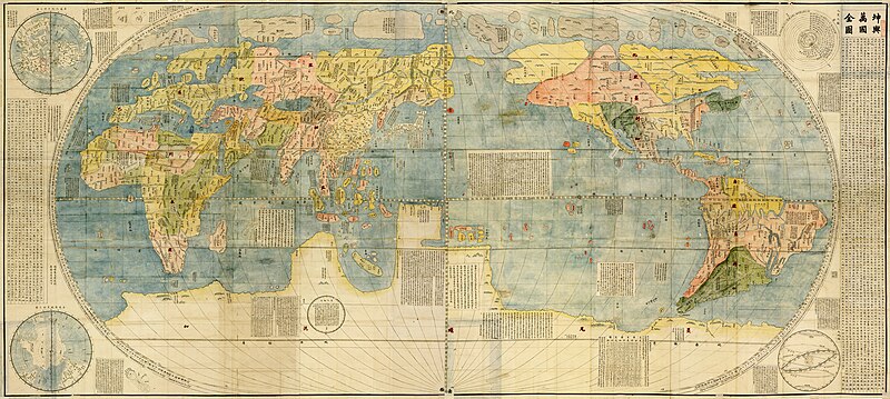
Fitxer:Kunyu Wanguo Quantu (坤輿萬國全圖).jpg

Mida d'aquesta previsualització: 800 × 359 píxels. Altres resolucions: 320 × 144 píxels | 640 × 287 píxels | 1.024 × 460 píxels | 1.280 × 575 píxels | 2.560 × 1.150 píxels | 11.726 × 5.266 píxels.
Fitxer original (11.726 × 5.266 píxels, mida del fitxer: 16,75 Mo, tipus MIME: image/jpeg)
Historial del fitxer
Cliqueu una data/hora per veure el fitxer tal com era aleshores.
| Data/hora | Miniatura | Dimensions | Usuari/a | Comentari | |
|---|---|---|---|---|---|
| actual | 11:19, 15 gen 2010 |  | 11.726 × 5.266 (16,75 Mo) | PhiLiP | Reverted to version as of 16:13, 13 January 2010 |
| 11:19, 15 gen 2010 |  | 11.726 × 5.266 (15,71 Mo) | PhiLiP | Reverted to version as of 14:44, 13 January 2010 | |
| 18:13, 13 gen 2010 |  | 11.726 × 5.266 (16,75 Mo) | PhiLiP | light up | |
| 16:44, 13 gen 2010 |  | 11.726 × 5.266 (15,71 Mo) | PhiLiP | {{Information |Description={{en|''Impossible Black Tulip''.}} {{zh-hans|《坤舆万国全图》。}} {{zh-hant|《坤輿萬國全圖》。}} |Source= File:坤輿萬國全圖(左).jpg, [[:File:坤輿萬國全圖(� |
Ús del fitxer
La pàgina següent utilitza aquest fitxer:
Ús global del fitxer
Utilització d'aquest fitxer en altres wikis:
- Utilització a ar.wikipedia.org
- Utilització a ba.wikipedia.org
- Utilització a ba.wikibooks.org
- Utilització a bn.wikipedia.org
- Utilització a crh.wikipedia.org
- Utilització a cs.wikipedia.org
- Utilització a cv.wikipedia.org
- Utilització a da.wikipedia.org
- Utilització a de.wikipedia.org
- Utilització a en.wikipedia.org
- World map
- Matthijs Quast
- Early world maps
- Matteo Ricci
- User:Daniel Mietchen/Science communication gallery
- Kunyu Wanguo Quantu
- Talk:Kunyu Wanguo Quantu
- Wikipedia:ITN archives/2010/January
- Wikipedia:Picture peer review/Archives/Apr-Jun 2010
- Wikipedia:Picture peer review/Kunyu Wanguo Quantu
- List of countries by population in 1600
- Utilització a es.wikipedia.org
- Usuario:Manuel González Olaechea y Franco/Galería de mapamundi
- Wikipedia:Imágenes destacadas/Diagramas, dibujos y mapas
- Wikipedia:Recurso del día/401 - 500
- Kunyu Wanguo Quantu
- Wikipedia:Candidatos a recursos destacados/坤輿萬國全圖.jpg
- Wikipedia:Candidatos a recursos destacados/Enero-2010
- Plantilla:RDD/448
- Wikiproyecto:Revisores/Revisiones en curso/ArchivoCID
- Wikipedia:Recurso del día/marzo de 2011
- Wikipedia:Recurso del día/octubre de 2012
- Wikipedia:Recurso del día/noviembre de 2014
- Wikipedia:Recurso del día/marzo de 2017
- Wikipedia:Recurso del día/junio de 2019
- Wikipedia:Recurso del día/diciembre de 2021
- Utilització a fa.wikipedia.org
- Utilització a fr.wikipedia.org
- Utilització a ha.wikipedia.org
- Utilització a he.wikipedia.org
Vegeu més usos globals d'aquest fitxer.


