Fitxer:Landslide Buries Valley of the Geysers.jpg

Mida d'aquesta previsualització: 600 × 600 píxels. Altres resolucions: 240 × 240 píxels | 480 × 480 píxels | 768 × 768 píxels | 1.024 × 1.024 píxels | 2.400 × 2.400 píxels.
Fitxer original (2.400 × 2.400 píxels, mida del fitxer: 3,84 Mo, tipus MIME: image/jpeg)
| Aquest fitxer i la informació mostrada a continuació provenen del dipòsit multimèdia lliure Wikimedia Commons. |
Resum
| Descripció |
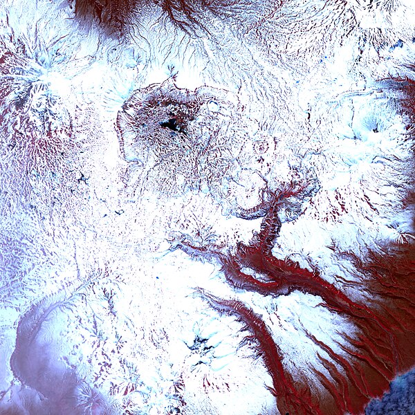
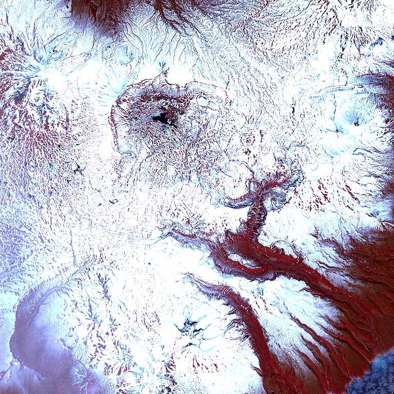
English: This infra-red-enhanced image shows the valley, the landslide, and a new thermal lake. Even in mid-June, just days from the start of summer, the landscape is generally covered in snow, though the geologically heated valley is relatively snow free. The tree-covered hills are red (the colour of vegetation in this false-colour treatment), providing a strong contrast to the aquamarine water and the grey-brown slide. |
| Data | |
| Font | http://earthobservatory.nasa.gov/IOTD/view.php?id=7789 |
| Autor | Jesse Allen |
Image created using The Advanced Spaceborne Thermal Emission and Reflection Radiometer (ASTER) on NASA’s Terra satellite. Data provided courtesy of the NASA/GSFC/MITI/ERSDAC/JAROS, and U.S./Japan ASTER Science Team.
Llicència
| Aquest fitxer és en el domini públic perquè ha estat creat per la NASA. L'avís legal de la NASA diu que «el material de la NASA no està protegit per copyright si no es diu el contrari». (NASA copyright policy page o JPL Image Use Policy). | ||
 |
Atenció:
|
Historial del fitxer
Cliqueu una data/hora per veure el fitxer tal com era aleshores.
| Data/hora | Miniatura | Dimensions | Usuari/a | Comentari | |
|---|---|---|---|---|---|
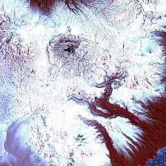
| actual | 20:56, 5 jul 2009 | | 2.400 × 2.400 (3,84 Mo) | Originalwana | {{Information |Description={{en|1=This infra-red-enhanced image shows the valley, the landslide, and a new thermal lake. Even in mid-June, just days from the start of summer, the landscape is generally covered in snow, though the geologically heated valle |
Ús del fitxer
La pàgina següent utilitza aquest fitxer:
Ús global del fitxer
Utilització d'aquest fitxer en altres wikis:
- Utilització a ba.wikipedia.org
- Utilització a el.wikipedia.org
- Utilització a en.wikipedia.org
- Utilització a fr.wikipedia.org
- Utilització a it.wikipedia.org
- Utilització a kn.wikipedia.org
- Utilització a or.wikipedia.org
- Utilització a ru.wikipedia.org
- Utilització a ta.wikipedia.org