Fitxer:Location map Padania.png

Mida d'aquesta previsualització: 721 × 600 píxels. Altres resolucions: 289 × 240 píxels | 577 × 480 píxels | 924 × 768 píxels | 1.232 × 1.024 píxels | 1.442 × 1.199 píxels.
Fitxer original (1.442 × 1.199 píxels, mida del fitxer: 355 Ko, tipus MIME: image/png)
| Aquest fitxer i la informació mostrada a continuació provenen del dipòsit multimèdia lliure Wikimedia Commons. |
Resum
| Descripció |
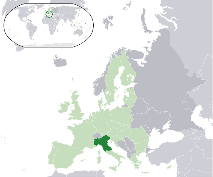
English: Map of the proposed state of Padania (advocated by Northern League)
Italiano: Mappa della Padania, come proposta dalla Lega Nord. |
| Data | |
| Font | Treball propi |
| Autor | Pattyone |
Llicència
| Jo, el titular del copyright d'aquesta obra, l'allibero al domini públic. Això s'aplica a tot el món. En alguns països això pot no ser legalment possible, en tal cas: Jo faig concessió a tothom del dret d'usar aquesta obra per a qualsevol propòsit, sense cap condició llevat d'aquelles requerides per la llei. |
Historial del fitxer
Cliqueu una data/hora per veure el fitxer tal com era aleshores.
| Data/hora | Miniatura | Dimensions | Usuari/a | Comentari | |
|---|---|---|---|---|---|
| actual | 17:17, 16 gen 2016 | | 1.442 × 1.199 (355 Ko) | Tromber | Croatia is a member of the European Union. The country is now marked in light green. |
| 17:16, 16 gen 2016 |  | 1.442 × 1.199 (355 Ko) | Tromber | Croatia is a member of the European Union. The country is now marked in light green. | |
| 17:14, 16 gen 2016 |  | 1.442 × 1.199 (355 Ko) | Tromber | Croatia is a member of the European Union. The country is now marked in light green. | |
| 12:08, 27 ago 2009 |  | 2.056 × 1.710 (193 Ko) | Pattyone | {{Information |Description={{en|1=Map of the proposed state of Padania}} |Source=Own work by uploader |Author=Pattyone |Date=2009-08-27 |Permission= |other_versions= }} Category:Padania |
Ús del fitxer
No hi ha pàgines que utilitzin aquest fitxer.
Ús global del fitxer
Utilització d'aquest fitxer en altres wikis:
- Utilització a ast.wikipedia.org
- Utilització a de.wikipedia.org
- Utilització a en.wikipedia.org
- Utilització a es.wikipedia.org
- Utilització a et.wikipedia.org
- Utilització a fa.wikipedia.org
- Utilització a fr.wikipedia.org
- Utilització a hr.wikipedia.org
- Utilització a hu.wikipedia.org
- Utilització a id.wikipedia.org
- Utilització a is.wikipedia.org
- Utilització a it.wikipedia.org
- Utilització a pt.wikipedia.org
- Utilització a ro.wikipedia.org
- Utilització a tr.wikipedia.org
- Utilització a vec.wikipedia.org
- Utilització a www.wikidata.org
- Utilització a zh.wikipedia.org