Fitxer:Luftbild EDDS edit.jpg
Fitxer original (3.888 × 2.592 píxels, mida del fitxer: 5,43 Mo, tipus MIME: image/jpeg)
| Aquest fitxer i la informació mostrada a continuació provenen del dipòsit multimèdia lliure Wikimedia Commons. |
Resum
| Posició de l'objecte | | Aquesta i altres imatges properes a: OpenStreetMap |
|---|
| Descripció |
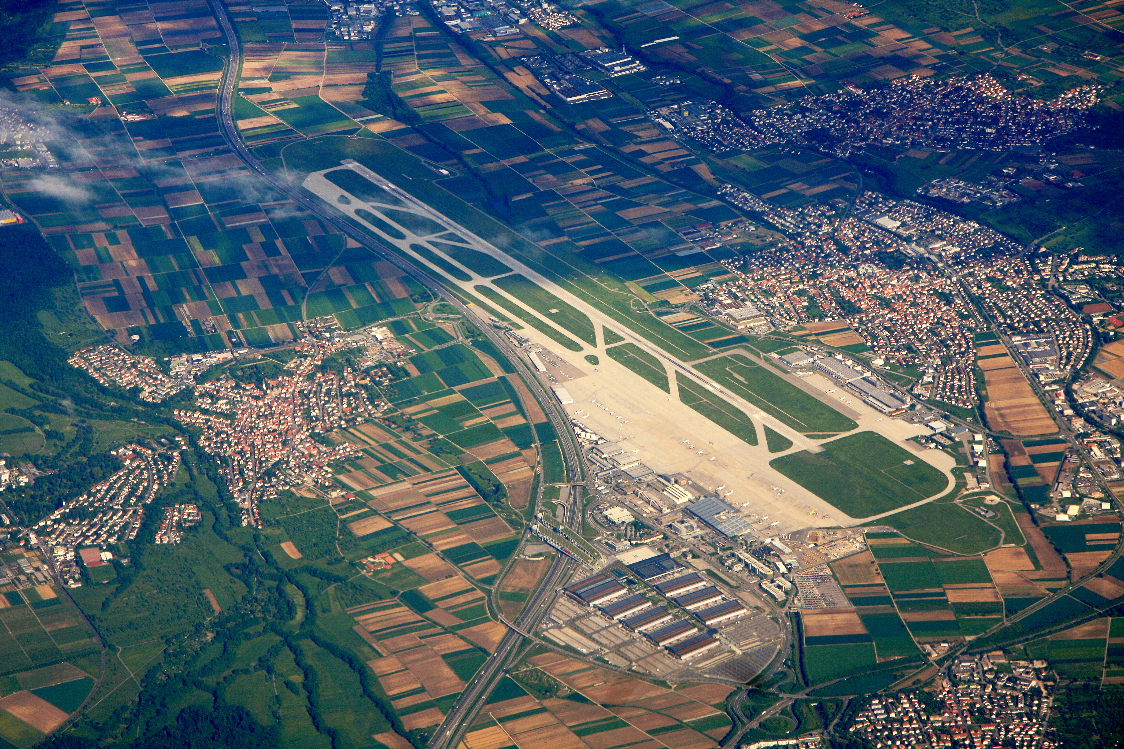
Deutsch: Luftbild des Stuttgarter Flughafens
English: Aerial photo of Stuttgart Airport, Germany |
||
| Data | 18 de maig de 2009, 15:31 (UTC) | ||
| Font | Treball propi | ||
| Autor |
Wo st 01 |
||
| Permís (Com reutilitzar aquest fitxer) |
Aquest fitxer està publicat sota la llicència de Creative Commons Reconeixement i Compartir Igual 3.0 Alemanya.

|
||
| Reconeixement (required by the license) | Wo st 01 / Wikimedia Commons / | ||
| Original: Luftbild EDDS.jpg | Editor: Julian Herzog (talk) 20:21, 25 June 2011 (UTC) |
| Changes: Levels, White balance, unsharp masks, black value gradient, sharpened | |
This picture was reworked by the Fotowerkstatt. You can propose images to improve as well.
Historial del fitxer
Cliqueu una data/hora per veure el fitxer tal com era aleshores.
| Data/hora | Miniatura | Dimensions | Usuari/a | Comentari | |
|---|---|---|---|---|---|
| actual | 22:21, 25 juny 2011 | | 3.888 × 2.592 (5,43 Mo) | Julian Herzog | <div style="background-color:transparent; border:1px grey solid; margin:0 10 0px 25px; padding:0 10px 0 5px;">'''Retouched version''' of File:Luftbild EDDS.jpg, which has the following description: <small>(Changes see below)</small></div> {{User:Wo |
Ús del fitxer
La pàgina següent utilitza aquest fitxer:
Ús global del fitxer
Utilització d'aquest fitxer en altres wikis:
- Utilització a ar.wikipedia.org
- Utilització a arz.wikipedia.org
- Utilització a bn.wikipedia.org
- Utilització a cs.wikipedia.org
- Utilització a da.wikipedia.org
- Utilització a de.wikipedia.org
- Utilització a de.wikivoyage.org
- Baden-Württemberg
- Böblingen
- Esslingen
- Ludwigsburg
- Sindelfingen
- Stuttgart
- Region Stuttgart
- Geislingen an der Steige
- Nürtingen
- Leinfelden-Echterdingen
- Filder
- Waldenbuch
- Giengen an der Brenz
- Göppingen
- Flughafen Stuttgart
- Filderstadt
- Fellbach
- Kornwestheim
- Erlenbach (Landkreis Heilbronn)
- Oberkochen
- Stühlingen
- Holzgerlingen
- Merklingen
- Vöhringen (Württemberg)
- Oberstenfeld
- Schlat
- Westerheim (Württemberg)
- Utilització a el.wikipedia.org
- Utilització a en.wikipedia.org
- Utilització a eo.wikipedia.org
- Utilització a es.wikipedia.org
- Utilització a et.wikipedia.org
- Utilització a eu.wikipedia.org
- Utilització a fa.wikipedia.org
- Utilització a fi.wikipedia.org
- Utilització a fr.wikipedia.org
- Utilització a fr.wikivoyage.org
- Utilització a gl.wikipedia.org
- Utilització a he.wikipedia.org
- Utilització a hu.wikipedia.org
- Utilització a id.wikipedia.org
Vegeu més usos globals d'aquest fitxer.