Fitxer:Mani 2000.png
No hi ha cap versió amb una resolució més gran.
Mani_2000.png (380 × 450 píxels, mida del fitxer: 147 Ko, tipus MIME: image/png)
| Aquest fitxer i la informació mostrada a continuació provenen del dipòsit multimèdia lliure Wikimedia Commons. |
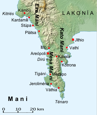
| Descripció | Map of the Mani (Greece, Peloponnes) | ||
| Data | |||
| Font | File:Peloponnese relief map-blank.svg | ||
| Autor | al-Qamar | ||
| Permís (Com reutilitzar aquest fitxer) |
|

Historial del fitxer
Cliqueu una data/hora per veure el fitxer tal com era aleshores.
| Data/hora | Miniatura | Dimensions | Usuari/a | Comentari | |
|---|---|---|---|---|---|
| actual | 22:35, 24 oct 2014 | | 380 × 450 (147 Ko) | Al-qamar | defekte Datei |
| 22:35, 24 oct 2014 |  | 380 × 450 (147 Ko) | Al-qamar | defekte Datei | |
| 22:28, 24 oct 2014 |  | 380 × 450 (165 Ko) | Al-qamar | {{Information |Description= Map of the Mani (Greece, Peloponnes) |Source= File:Peloponnese relief map-blank.svg |Date= 24.Oktober 2014 |Author= al-Qamar |Permission= {{GFDL}} |other_versions= }} Category:Maps of the Peloponnese |
Ús del fitxer
La pàgina següent utilitza aquest fitxer:
Ús global del fitxer
Utilització d'aquest fitxer en altres wikis:
- Utilització a als.wikipedia.org
- Utilització a ar.wikipedia.org
- Utilització a da.wikipedia.org
- Utilització a de.wikipedia.org
- Utilització a el.wikipedia.org
- Utilització a en.wikipedia.org
- Utilització a es.wikipedia.org
- Utilització a hyw.wikipedia.org
- Utilització a ja.wikipedia.org
- Utilització a mk.wikipedia.org
- Utilització a ro.wikipedia.org
- Utilització a ru.wikipedia.org
- Utilització a sr.wikipedia.org
- Utilització a tr.wikipedia.org
- Utilització a uk.wikipedia.org
- Utilització a www.wikidata.org