Fitxer:Map of California highlighting Colusa County.svg

Mida d'aquesta previsualització PNG del fitxer SVG: 521 × 599 píxels. Altres resolucions: 209 × 240 píxels | 417 × 480 píxels | 668 × 768 píxels | 891 × 1.024 píxels | 1.781 × 2.048 píxels | 9.164 × 10.536 píxels.
Fitxer original (fitxer SVG, nominalment 9.164 × 10.536 píxels, mida del fitxer: 229 Ko)
| Aquest fitxer i la informació mostrada a continuació provenen del dipòsit multimèdia lliure Wikimedia Commons. |
Resum
| Descripció |
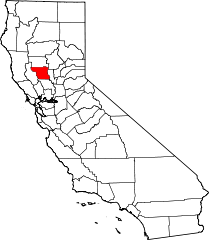
English: This is a locator map showing Colusa County in California. For more information, see Commons:United States county locator maps. |
| Data | |
| Font |
Treball propi: English: The maps use data from nationalatlas.gov, specifically countyp020.tar.gz on the Raw Data Download page. The maps also use state outline data from statesp020.tar.gz. The Florida maps use hydrogm020.tar.gz to display Lake Okeechobee. |
| Autor | David Benbennick |
Llicència
| Jo, el titular del copyright d'aquesta obra, l'allibero al domini públic. Això s'aplica a tot el món. En alguns països això pot no ser legalment possible, en tal cas: Jo faig concessió a tothom del dret d'usar aquesta obra per a qualsevol propòsit, sense cap condició llevat d'aquelles requerides per la llei. |
Historial del fitxer
Cliqueu una data/hora per veure el fitxer tal com era aleshores.
| Data/hora | Miniatura | Dimensions | Usuari/a | Comentari | |
|---|---|---|---|---|---|
| actual | 12:25, 12 feb 2006 | | 9.164 × 10.536 (229 Ko) | David Benbennick | {{subst:User:Dbenbenn/clm|county=Colusa County|state=California}} |
Ús del fitxer
Les 7 pàgines següents utilitzen aquest fitxer:
Ús global del fitxer
Utilització d'aquest fitxer en altres wikis:
- Utilització a ar.wikipedia.org
- Utilització a az.wikipedia.org
- Utilització a ban.wikipedia.org
- Utilització a bpy.wikipedia.org
- Utilització a ceb.wikipedia.org
- Utilització a ce.wikipedia.org
- Utilització a ckb.wikipedia.org
- Utilització a cs.wikipedia.org
- Utilització a cy.wikipedia.org
- Utilització a da.wikipedia.org
- Utilització a de.wikipedia.org
- Utilització a en.wikipedia.org
- List of counties in California
- Colusa County, California
- Arbuckle, California
- Colusa, California
- Williams, California
- Template:Colusa County, California
- Maxwell, California
- Stonyford, California
- Sites, California
- Princeton, California
- Grimes, California
- College City, California
- National Register of Historic Places listings in Colusa County, California
- Colusa Rancheria, California
- Delevan, California
- Fouts Springs, California
- Genevra, California
- Grand Island, California
- Leesville, California
- Lodoga, California
- Sycamore, California
- Waikosel, California
- Kletsel Dehe Wintun Nation of the Cortina Rancheria
- User:Nyttend/County templates/CA/1
- Category:Populated places in Colusa County, California
- Category:Wikipedia requested photographs in Colusa County, California
- User:Darkest tree/sandbox/List of counties in California
- User:CactusJack/California watchlist
- User:AridCeption/sandbox
- Utilització a eo.wikipedia.org
- Utilització a es.wikipedia.org
Vegeu més usos globals d'aquest fitxer.