Fitxer:Map of Vietnam 1829.jpg
Mida d'aquesta previsualització: 399 × 599 píxels. Altres resolucions: 160 × 240 píxels | 320 × 480 píxels | 511 × 768 píxels | 682 × 1.024 píxels | 1.364 × 2.048 píxels | 3.464 × 5.200 píxels.
Fitxer original (3.464 × 5.200 píxels, mida del fitxer: 8,83 Mo, tipus MIME: image/jpeg)
| Aquest fitxer i la informació mostrada a continuació provenen del dipòsit multimèdia lliure Wikimedia Commons. |
Resum
| Descripció |
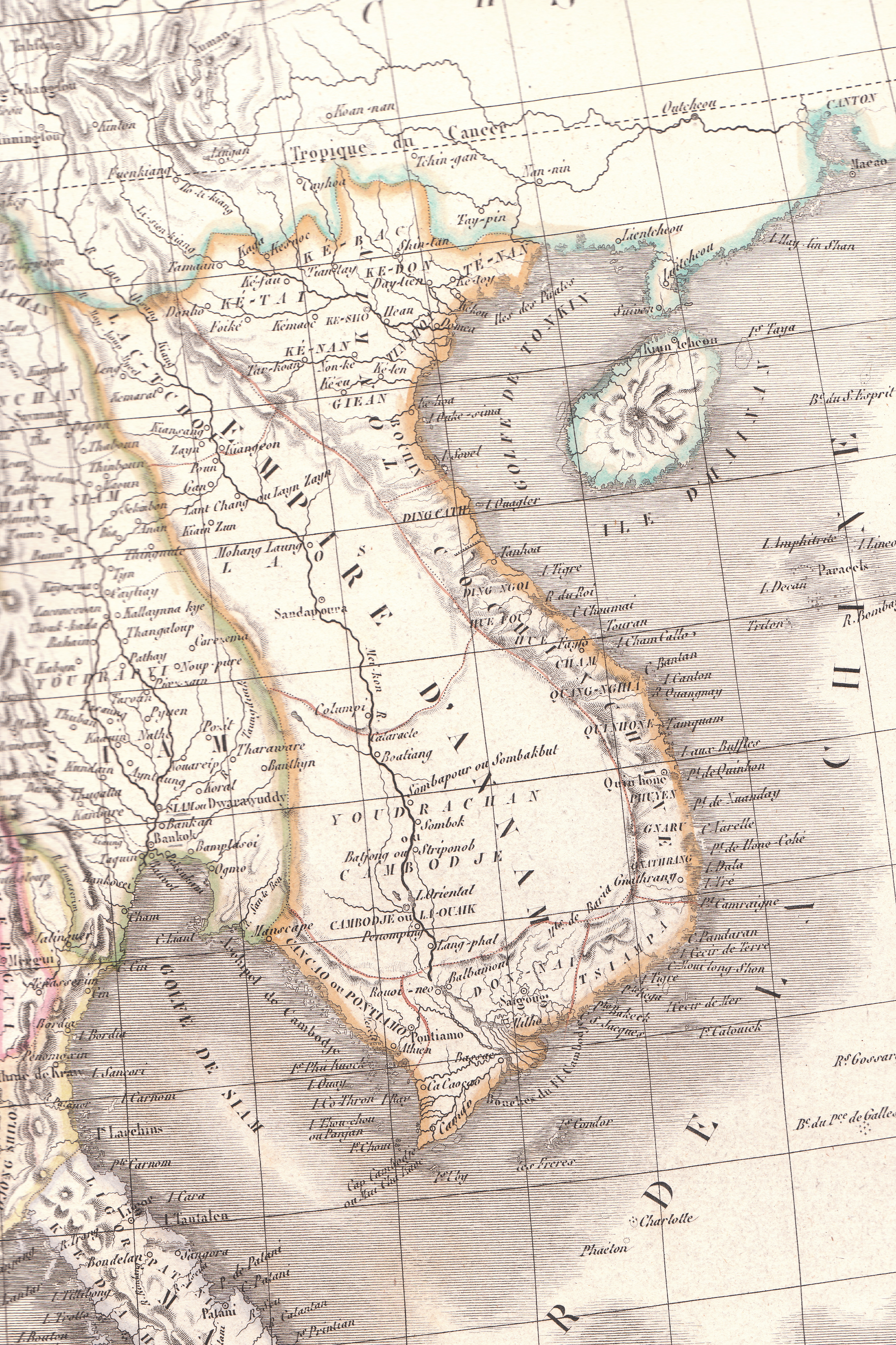
English: Plate 35E "Carte de l’Inde endeca et audela du Gange" from Lapie's Atlas Universel printed in 1829 |
| Font | Atlas Universel |
| Autor | Pierre M. Lapie |
Llicència
|
Aquest material està en domini públic als Estats Units i als altres països on el dret d'autor s'estén per 70 anys (o menys) després de la mort de l'autor. Aquesta obra es troba en el domini públic als Estats Units d'Amèrica per haver estat publicada abans de l'1 de gener de 1929. | |
| Aquest fitxer està identificat com a lliure de restriccions conegudes sota la llei de drets d'autor, inclosos els drets veïns. | |
Historial del fitxer
Cliqueu una data/hora per veure el fitxer tal com era aleshores.
| Data/hora | Miniatura | Dimensions | Usuari/a | Comentari | |
|---|---|---|---|---|---|
| actual | 08:23, 26 abr 2010 | | 3.464 × 5.200 (8,83 Mo) | Duyet-pho | {{Information |Description={{en|1=Plate 35E "Carte de l’Inde endeca et audela du Gange" from Lapie's ''Atlas Universel'' printed in 1829}} |Source=Atlas Universel |Author=Pierre M. Lapie |Date= |Permission={{PD-1923}} |other_versions= }} [[Category:Map |
Ús del fitxer
La pàgina següent utilitza aquest fitxer:
Ús global del fitxer
Utilització d'aquest fitxer en altres wikis:
- Utilització a en.wikipedia.org
- Utilització a eu.wikipedia.org
- Utilització a gl.wikipedia.org
- Utilització a id.wikipedia.org
- Utilització a it.wikipedia.org
- Utilització a pt.wikipedia.org
- Utilització a ru.wikipedia.org
- Utilització a th.wikipedia.org
- Utilització a tr.wikipedia.org
- Utilització a vi.wikipedia.org
- Utilització a www.wikidata.org
- Utilització a zh-min-nan.wikipedia.org
- Utilització a zh-yue.wikipedia.org