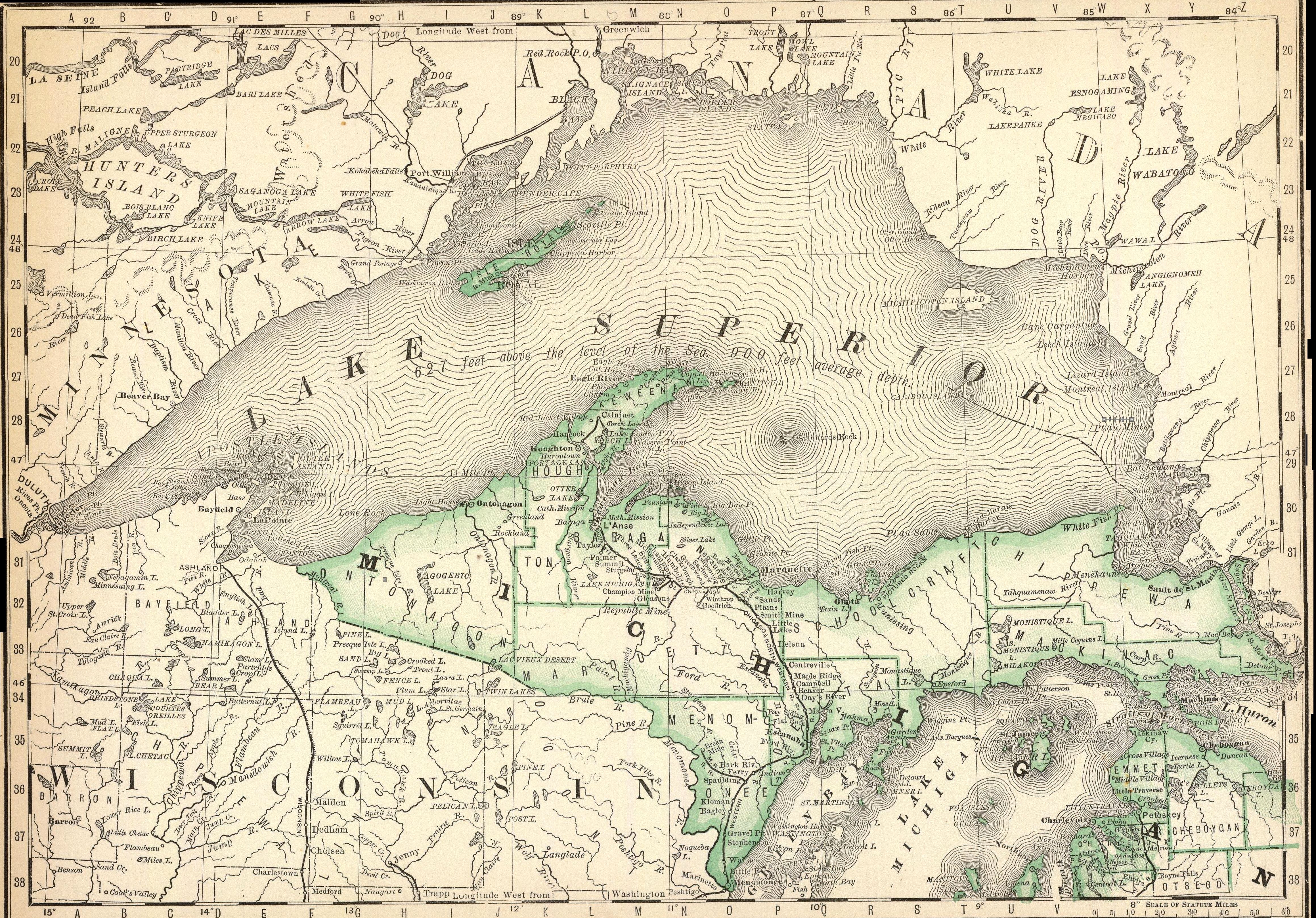
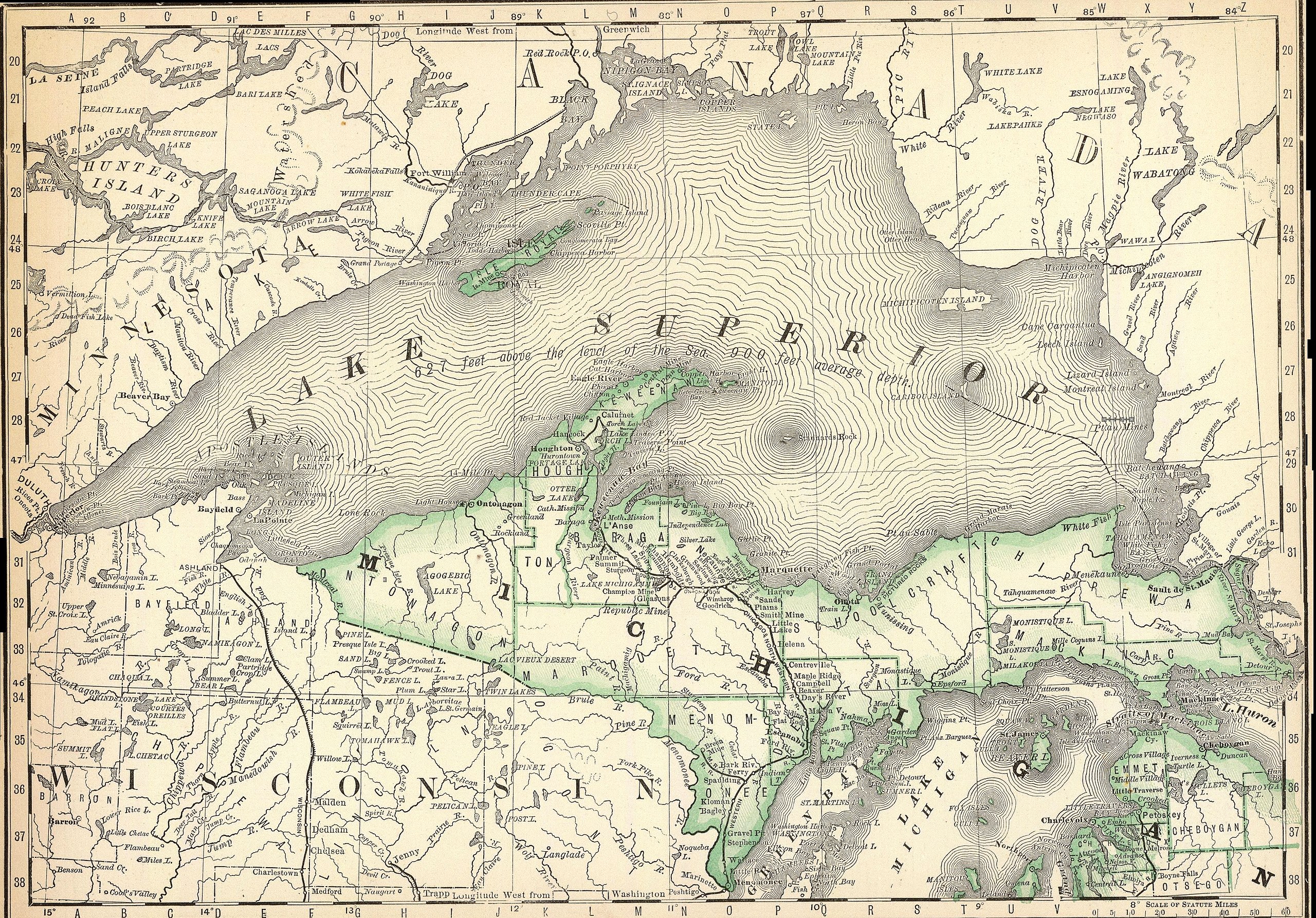
Fitxer:Northern Michigan and Lake Superior.jpg
Mida d'aquesta previsualització: 800 × 558 píxels. Altres resolucions: 320 × 223 píxels | 640 × 447 píxels | 1.024 × 715 píxels | 1.280 × 893 píxels | 2.560 × 1.787 píxels | 4.636 × 3.236 píxels.
Fitxer original (4.636 × 3.236 píxels, mida del fitxer: 4,44 Mo, tipus MIME: image/jpeg)
| Aquest fitxer i la informació mostrada a continuació provenen del dipòsit multimèdia lliure Wikimedia Commons. |
Resum
| Descripció |
English: Rand McNally and Company map of Northern Michigan and Lake Superior, Published 1879 |
|||||||||
| Data | ||||||||||
| Font | https://www.amazon.com/National-Northern-Michigan-Superior-Historic/dp/B077TKRM3X | |||||||||
| Creador |
Rand McNally and Company, Atlas, 1879 |
|||||||||
| Geotemporal data | ||||||||||
| Bounding box |
|
|||||||||
| Georeferencing | ||||||||||
Llicència
This work is in the public domain in the United States because it was published (or registered with the U.S. Copyright Office) before January 1, 1929.
Public domain works must be out of copyright in both the United States and in the source country of the work in order to be hosted on the Commons. If the work is not a U.S. work, the file must have an additional copyright tag indicating the copyright status in the source country.
Note: This tag should not be used for sound recordings. |
Historial del fitxer
Cliqueu una data/hora per veure el fitxer tal com era aleshores.
| Data/hora | Miniatura | Dimensions | Usuari/a | Comentari | |
|---|---|---|---|---|---|
| actual | 01:30, 28 oct 2019 | | 4.636 × 3.236 (4,44 Mo) | Gwillhickers | User created page with UploadWizard |
Ús del fitxer
La pàgina següent utilitza aquest fitxer:
Ús global del fitxer
Utilització d'aquest fitxer en altres wikis:
- Utilització a ar.wikipedia.org
- Utilització a en.wikipedia.org
- Utilització a kn.wikipedia.org
- Utilització a vi.wikipedia.org