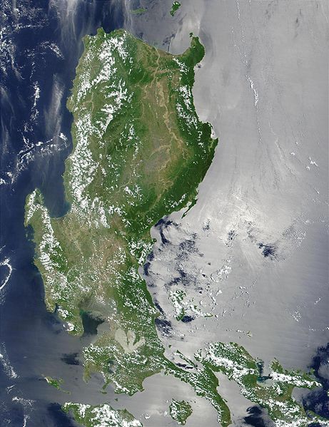
Fitxer:Northern Philippines (Luzon).jpg

Mida d'aquesta previsualització: 461 × 599 píxels. Altres resolucions: 184 × 240 píxels | 369 × 480 píxels | 591 × 768 píxels | 788 × 1.024 píxels | 2.000 × 2.600 píxels.
Fitxer original (2.000 × 2.600 píxels, mida del fitxer: 738 Ko, tipus MIME: image/jpeg)
Historial del fitxer
Cliqueu una data/hora per veure el fitxer tal com era aleshores.
| Data/hora | Miniatura | Dimensions | Usuari/a | Comentari | |
|---|---|---|---|---|---|
| actual | 23:52, 25 oct 2005 |  | 2.000 × 2.600 (738 Ko) | Brian0918 | * Credit Jacques Descloitres, MODIS Land Rapid Response Team, NASA/GSFC This MODIS true-color image of the northern Philippines shows the island of Luzon and the Cagayan River running in the plains between the Sierra Madre mountain rang |
Ús del fitxer
Les 2 pàgines següents utilitzen aquest fitxer:
Ús global del fitxer
Utilització d'aquest fitxer en altres wikis:
- Utilització a af.wikipedia.org
- Utilització a ar.wikipedia.org
- Utilització a arz.wikipedia.org
- Utilització a ast.wikipedia.org
- Utilització a ba.wikipedia.org
- Utilització a be-tarask.wikipedia.org
- Utilització a be.wikipedia.org
- Utilització a bg.wikipedia.org
- Utilització a bjn.wikipedia.org
- Utilització a bo.wikipedia.org
- Utilització a cy.wikipedia.org
- Utilització a de.wikipedia.org
- Utilització a el.wikipedia.org
- Utilització a en.wikipedia.org
- Utilització a eo.wikipedia.org
- Utilització a es.wikipedia.org
- Utilització a et.wikipedia.org
- Utilització a eu.wikipedia.org
- Utilització a fa.wikipedia.org
- Utilització a fi.wiktionary.org
- Utilització a fr.wikipedia.org
- Utilització a fr.wikivoyage.org
- Utilització a ga.wikipedia.org
- Utilització a he.wikipedia.org
- Utilització a hu.wikipedia.org
- Utilització a hy.wikipedia.org
- Utilització a ia.wikipedia.org
- Utilització a id.wikipedia.org
- Utilització a id.wiktionary.org
- Utilització a incubator.wikimedia.org
- Utilització a jv.wikipedia.org
- Utilització a ka.wikipedia.org
- Utilització a ky.wikipedia.org
- Utilització a lv.wikipedia.org
- Utilització a ms.wikipedia.org
- Utilització a nn.wikipedia.org
- Utilització a os.wikipedia.org
- Utilització a pl.wikipedia.org
- Utilització a pl.wiktionary.org
Vegeu més usos globals d'aquest fitxer.


