Fitxer:Northridge near Dayton aerial.jpg

Mida d'aquesta previsualització: 800 × 600 píxels. Altres resolucions: 320 × 240 píxels | 640 × 480 píxels | 1.024 × 768 píxels | 1.280 × 960 píxels | 2.272 × 1.704 píxels.
Fitxer original (2.272 × 1.704 píxels, mida del fitxer: 2,08 Mo, tipus MIME: image/jpeg)
| Aquest fitxer i la informació mostrada a continuació provenen del dipòsit multimèdia lliure Wikimedia Commons. |
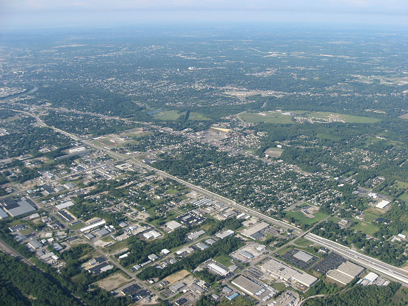
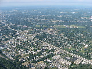
| Descripció | Aerial view of Northridge, a community on the northeast side of the city of Dayton in Montgomery County, Ohio, United States. Interstate 75 is clearly visible in the middle of the picture, with the major intersection toward the left side of the picture being the highway's interchange with Needmore Road. The Great Miami River is visible on the far left edge of the picture. Picture taken from a Diamond Eclipse light airplane at an altitude of 4,480 feet MSL and a bearing of approximately 220º. | ||
| Data | Taken on 12 d'agost de 2008 | ||
| Font | Treball propi | ||
| Autor | Nyttend | ||
| Permís (Com reutilitzar aquest fitxer) |
|
Historial del fitxer
Cliqueu una data/hora per veure el fitxer tal com era aleshores.
| Data/hora | Miniatura | Dimensions | Usuari/a | Comentari | |
|---|---|---|---|---|---|
| actual | 02:58, 19 set 2008 | | 2.272 × 1.704 (2,08 Mo) | Nyttend | {{Information |Description=Aerial view of {{w|Northridge, Montgomery County, Ohio|Northridge}}, a community on the northeast side of the city of {{w|Dayton, Ohio|Dayton}} in {{w|Montgomery County, Ohio|Montgomery County}}, {{w|Ohio}}, {{w|United States}}. |
Ús del fitxer
La pàgina següent utilitza aquest fitxer:
Ús global del fitxer
Utilització d'aquest fitxer en altres wikis:
- Utilització a azb.wikipedia.org
- Utilització a ceb.wikipedia.org
- Utilització a en.wikipedia.org
- Utilització a es.wikipedia.org
- Utilització a eu.wikipedia.org
- Utilització a fa.wikipedia.org
- Utilització a it.wikipedia.org
- Utilització a pt.wikipedia.org
- Utilització a sr.wikipedia.org
- Utilització a ur.wikipedia.org
- Utilització a vi.wikipedia.org
- Utilització a www.wikidata.org
- Utilització a zh-min-nan.wikipedia.org
- Utilització a zh.wikipedia.org