Fitxer:Ohio Portage Kent.png

Mida d'aquesta previsualització: 800 × 468 píxels. Altres resolucions: 320 × 187 píxels | 640 × 374 píxels | 1.025 × 599 píxels.
Fitxer original (1.025 × 599 píxels, mida del fitxer: 141 Ko, tipus MIME: image/png)
| Aquest fitxer i la informació mostrada a continuació provenen del dipòsit multimèdia lliure Wikimedia Commons. |
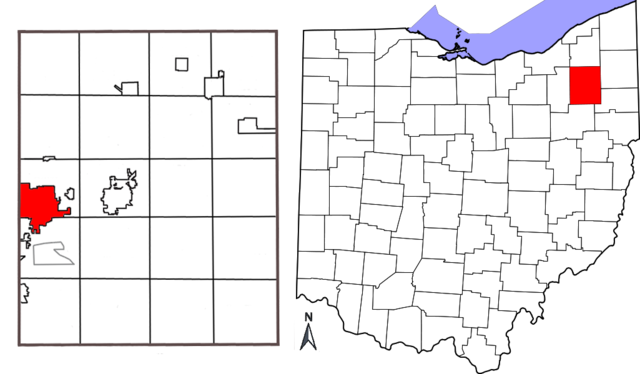
| Descripció | Combination map showing location of Kent, Ohio within Portage County and Portage County's location within the state of Ohio. Original map of Ohio by David Benbennick; map of Portage County with Kent highlighted made by Jon Ridinger. |
| Data | (UTC) |
| Font | |
| Autor |
| Això és una imatge retocada, cosa que vol dir que ha estat alterada digitalment de la seva versió original. Modificacions: added two maps together; removed distance chart from Portage County map; moved compass. L'original es pot veure a: Portage County Kent.png:
|
Aquest fitxer està subjecte a la llicència de Creative Commons Reconeixement i Compartir Igual 3.0 No adaptada.
- Sou lliure de:
- compartir – copiar, distribuir i comunicar públicament l'obra
- adaptar – fer-ne obres derivades
- Amb les condicions següents:
- reconeixement – Heu de donar la informació adequada sobre l'autor, proporcionar un enllaç a la llicència i indicar si s'han realitzat canvis. Podeu fer-ho amb qualsevol mitjà raonable, però de cap manera no suggereixi que l'autor us dóna suport o aprova l'ús que en feu.
- compartir igual – Si modifiqueu, transformeu, o generareu amb el material, haureu de distribuir les vostres contribucions sota una llicència similar o una de compatible com l'original
Registre original de càrregues
This image is a derivative work of the following images:
- File:Map_of_Ohio_highlighting_Portage_County.svg licensed with PD-self
- 2006-02-12T16:10:28Z David Benbennick 3675x3995 (59503 Bytes) {{subst:User:Dbenbenn/clm|county=Portage County|state=Ohio|type=county}}
- File:Portage_County_Kent.png licensed with Cc-by-3.0
- 2010-05-01T03:26:12Z JonRidinger 425x577 (81460 Bytes) Minor correction
- 2010-05-01T03:22:22Z JonRidinger 425x577 (76288 Bytes) Straightened map, cropped, removed extra white areas
- 2008-05-16T02:27:08Z JonRidinger 489x615 (44136 Bytes) {{Information |Description= Map of Portage County, Ohio with the city of Kent highlighted. |Source=self-made |Date= 15 May 2008 |Author= [[User:JonRidinger|JonRidinger]] |Permission= Public domain |other_versions= }} [[Categ
Uploaded with derivativeFX
Historial del fitxer
Cliqueu una data/hora per veure el fitxer tal com era aleshores.
| Data/hora | Miniatura | Dimensions | Usuari/a | Comentari | |
|---|---|---|---|---|---|
| actual | 14:12, 7 maig 2010 | | 1.025 × 599 (141 Ko) | JonRidinger | {{Information |Description=Combination map showing location of Kent, Ohio within Portage County and Portage County's location within the state of Ohio. Original map of Ohio by [[User:Dbenbenn|David B |
Ús del fitxer
La pàgina següent utilitza aquest fitxer:
Ús global del fitxer
Utilització d'aquest fitxer en altres wikis:
- Utilització a ar.wikipedia.org
- Utilització a arz.wikipedia.org
- Utilització a azb.wikipedia.org
- Utilització a bn.wikipedia.org
- Utilització a ceb.wikipedia.org
- Utilització a cy.wikipedia.org
- Utilització a en.wikipedia.org
- Utilització a eu.wikipedia.org
- Utilització a fa.wikipedia.org
- Utilització a fi.wikipedia.org
- Utilització a fr.wikipedia.org
- Utilització a ht.wikipedia.org
- Utilització a id.wikipedia.org
- Utilització a it.wikipedia.org
- Utilització a no.wikipedia.org
- Utilització a sh.wikipedia.org
- Utilització a sr.wikipedia.org
- Utilització a sv.wikipedia.org
- Utilització a tr.wikipedia.org
- Utilització a tt.wikipedia.org
- Utilització a ur.wikipedia.org
- Utilització a vo.wikipedia.org
- Utilització a www.wikidata.org
- Utilització a zh-min-nan.wikipedia.org
- Utilització a zh.wikipedia.org