Fitxer:Phoenix Islands Kiribati.jpg

Mida d'aquesta previsualització: 800 × 578 píxels. Altres resolucions: 320 × 231 píxels | 640 × 462 píxels | 821 × 593 píxels.
Fitxer original (821 × 593 píxels, mida del fitxer: 74 Ko, tipus MIME: image/jpeg)
| Aquest fitxer i la informació mostrada a continuació provenen del dipòsit multimèdia lliure Wikimedia Commons. |
| Descripció |
Deutsch: Karte der Phoenixinseln, Kiribati
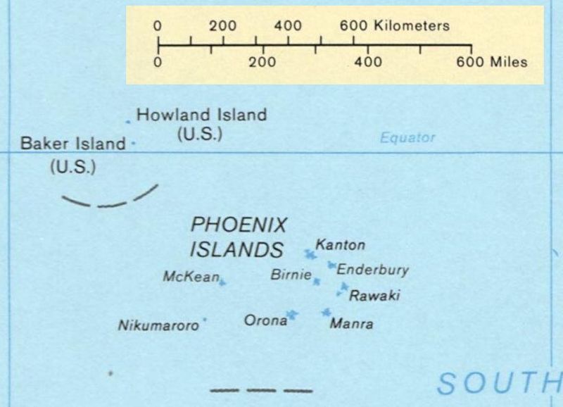
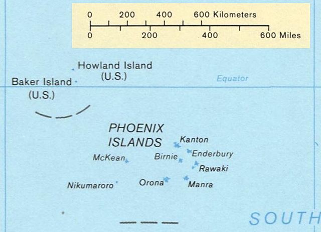
English: Map of the Phoenix Islands, Kiribati
Español: Mapa de las Islas Fénix, Kiribati |
|||
| Font | US government | |||
| Autor | US Library of Congress | |||
| Permís (Com reutilitzar aquest fitxer) |
|
|||
| Altres versions | Image:Kiribati map LOC.jpg, entire map |

Historial del fitxer
Cliqueu una data/hora per veure el fitxer tal com era aleshores.
| Data/hora | Miniatura | Dimensions | Usuari/a | Comentari | |
|---|---|---|---|---|---|
| actual | 02:23, 4 feb 2008 | | 821 × 593 (74 Ko) | Indolences | {{Information |Description={{en|Map of the Phoenix Islands, Kiribati}} {{es|Mapa de las Islas Phoenix, Kiribati}} |Source= US government |Date= |Author= US Library of Congress |Permission={{PD-USgov}} |other_ver |
Ús del fitxer
La pàgina següent utilitza aquest fitxer:
Ús global del fitxer
Utilització d'aquest fitxer en altres wikis:
- Utilització a hr.wikipedia.org