Fitxer:Province of Flemish Brabant (Belgium) location.svg

Mida d'aquesta previsualització PNG del fitxer SVG: 721 × 600 píxels. Altres resolucions: 289 × 240 píxels | 577 × 480 píxels | 923 × 768 píxels | 1.231 × 1.024 píxels | 2.462 × 2.048 píxels | 1.136 × 945 píxels.
Fitxer original (fitxer SVG, nominalment 1.136 × 945 píxels, mida del fitxer: 150 Ko)
| Aquest fitxer i la informació mostrada a continuació provenen del dipòsit multimèdia lliure Wikimedia Commons. |
_location.svg?uselang=ca)
Resum
| Descripció |
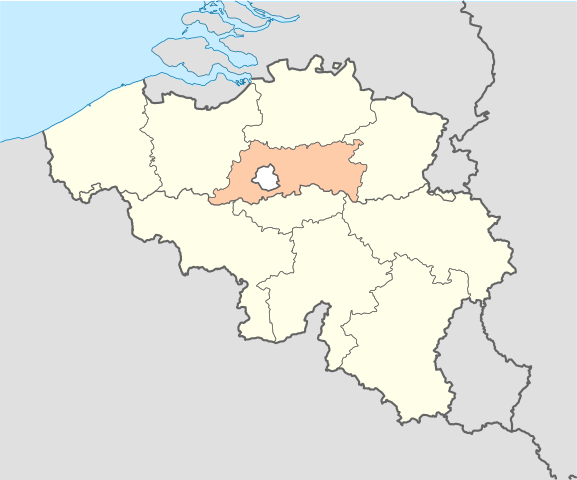
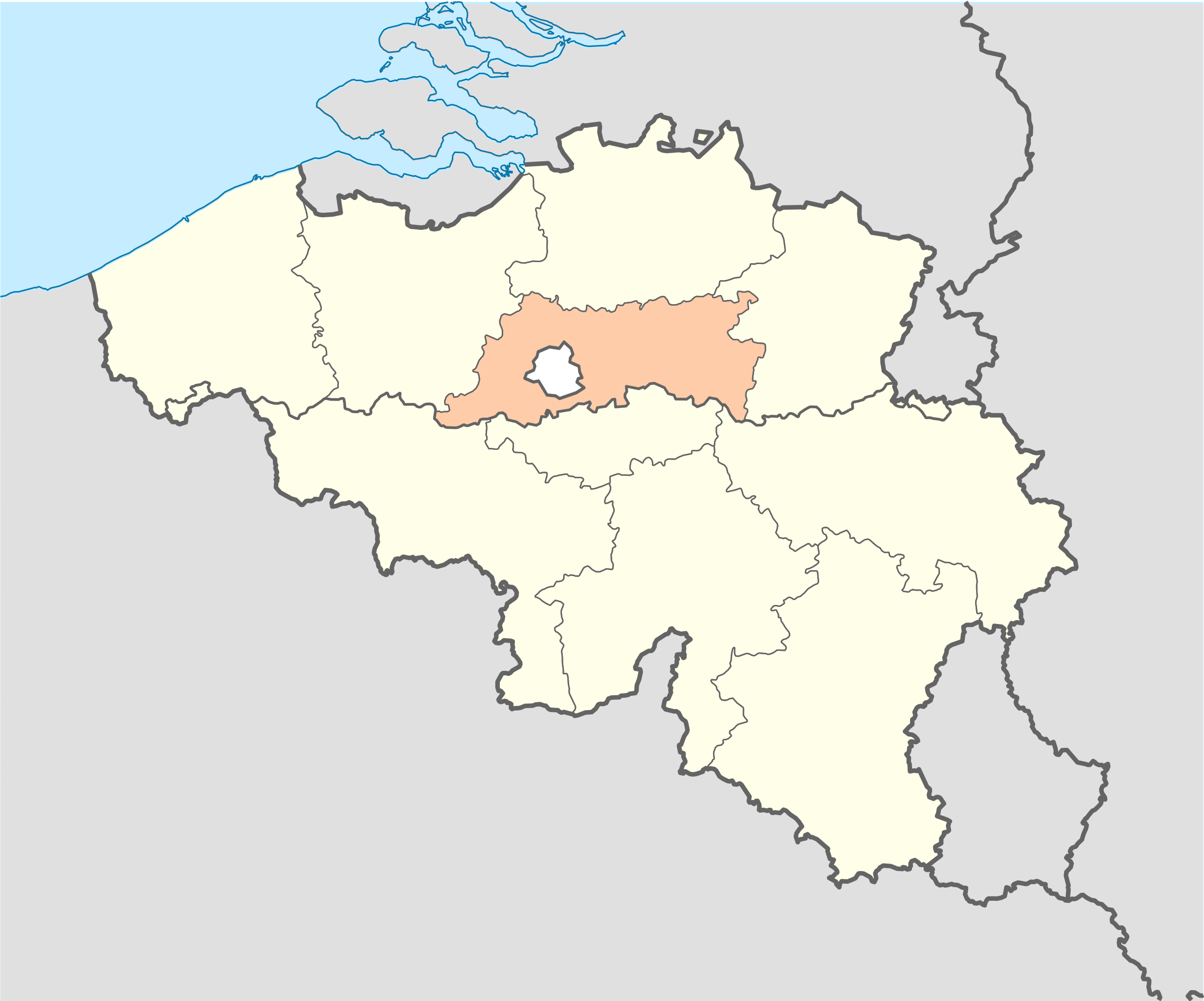
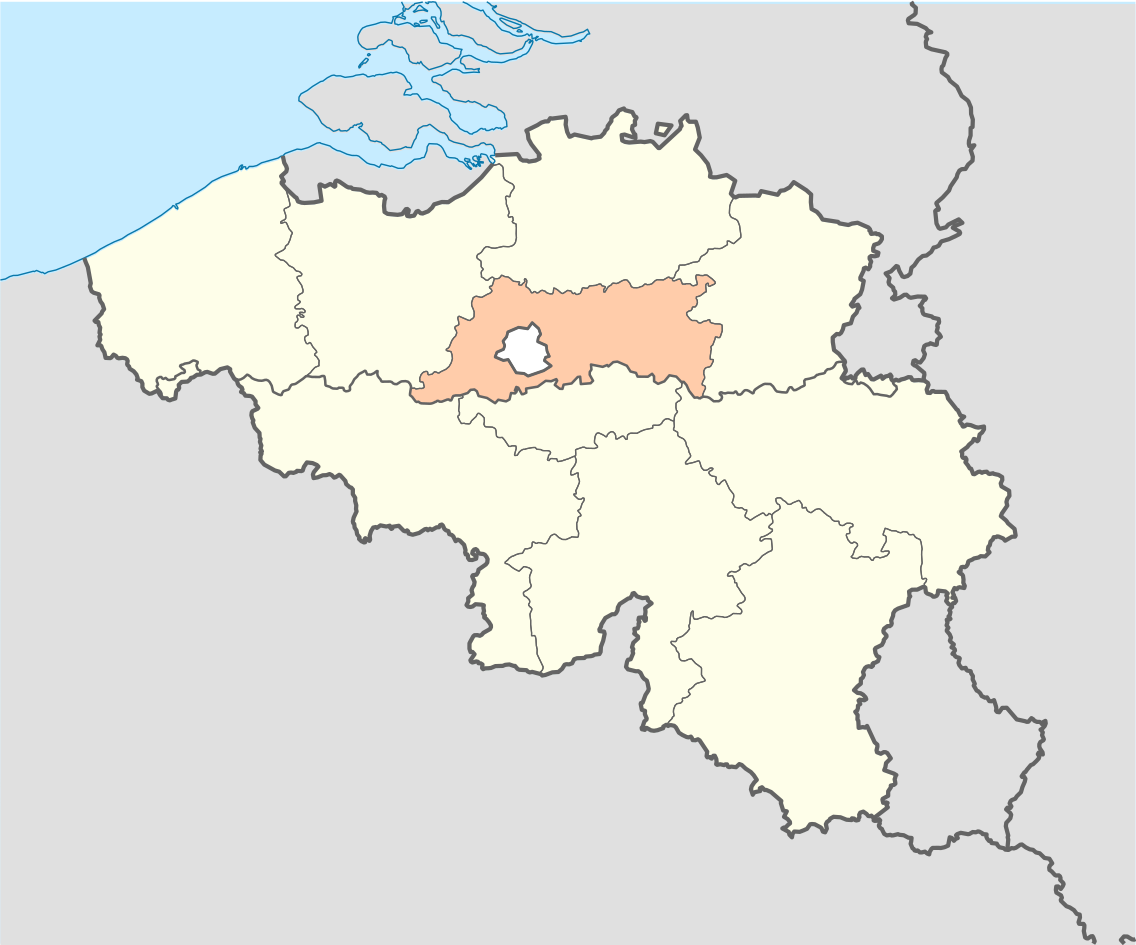
English: Location map of Province of Flemish Brabant, Belgium
Equirectangular projection, N/S stretching 150 %. Geographic limits of the map: * N: 51.8° N * S: 49.2° N * W: 2.2° E * E: 6.9° E Français : Localisation de la province du Brabant flamand, Belgique Projection equirectangulaire, N/S etirement 150 %. Limites géographiques de la cartes: * N: 51.8° N * S: 49.2° N * W: 2.2° E * E: 6.9° E |
| Font | Treball propi |
| Autor | Vascer |
| Altres versions | Belgium_location_map.svg |
Llicència
Jo, el titular dels drets d'autor d'aquest treball, el public sota les següents llicències:

|
S'autoritza la còpia, la distribució i la modificació d'aquest document sota els termes de la llicència de documentació lliure GNU versió 1.2 o qualsevol altra versió posterior que publiqui la Free Software Foundation; sense seccions invariants, ni textos de portada, ni textos de contraportada. S'inclou una còpia d'aquesta llicència en la secció titulada GNU Free Documentation License. |
Aquest fitxer està subjecte a la llicència de Creative Commons Reconeixement i Compartir Igual 3.0 No adaptada.
- Sou lliure de:
- compartir – copiar, distribuir i comunicar públicament l'obra
- adaptar – fer-ne obres derivades
- Amb les condicions següents:
- reconeixement – Heu de donar la informació adequada sobre l'autor, proporcionar un enllaç a la llicència i indicar si s'han realitzat canvis. Podeu fer-ho amb qualsevol mitjà raonable, però de cap manera no suggereixi que l'autor us dóna suport o aprova l'ús que en feu.
- compartir igual – Si modifiqueu, transformeu, o generareu amb el material, haureu de distribuir les vostres contribucions sota una llicència similar o una de compatible com l'original
Podeu seleccionar la llicència que vulgueu.
Historial del fitxer
Cliqueu una data/hora per veure el fitxer tal com era aleshores.
| Data/hora | Miniatura | Dimensions | Usuari/a | Comentari | |
|---|---|---|---|---|---|
| actual | 19:49, 16 oct 2010 | | 1.136 × 945 (150 Ko) | Vascer | {{Information |Description={{en|1=Location map of Province of Flemish Brabant, Belgium<br />Equirectangular projection, N/S stretching 150 %. Geographic limits of the map: * N: 51.8° N * S: 49.2° N * W: 2.2° E * E: 6.9° E}} {{fr|1=Localisation de la p |
Ús del fitxer
La pàgina següent utilitza aquest fitxer:
Ús global del fitxer
Utilització d'aquest fitxer en altres wikis:
- Utilització a af.wikipedia.org
- Utilització a ar.wikipedia.org
- Utilització a arz.wikipedia.org
- Utilització a ast.wikipedia.org
- Utilització a be-tarask.wikipedia.org
- Utilització a be.wikipedia.org
- Utilització a bs.wikipedia.org
- Utilització a cs.wikipedia.org
- Utilització a da.wikipedia.org
- Utilització a de.wiktionary.org
- Utilització a el.wikipedia.org
- Utilització a eo.wikipedia.org
- Utilització a et.wikipedia.org
- Utilització a fa.wikipedia.org
- Utilització a fr.wikipedia.org
- Utilització a gl.wikipedia.org
- Utilització a hy.wikipedia.org
- Utilització a ja.wikipedia.org
- Utilització a ko.wikipedia.org
- Utilització a la.wikipedia.org
- Utilització a lb.wikipedia.org
- Utilització a oc.wikipedia.org
- Utilització a pcd.wikipedia.org
- Utilització a pt.wikipedia.org
- Utilització a ru.wikipedia.org
- Utilització a simple.wikipedia.org
- Utilització a sk.wikipedia.org
- Utilització a sr.wikipedia.org
- Utilització a uk.wikipedia.org
- Utilització a uz.wikipedia.org
- Utilització a vo.wikipedia.org
- Utilització a www.wikidata.org
_location.svg)