Fitxer:RoadThroughMeiringspoort.jpg
Mida d'aquesta previsualització: 800 × 555 píxels. Altres resolucions: 320 × 222 píxels | 640 × 444 píxels | 1.024 × 711 píxels | 1.280 × 888 píxels | 2.560 × 1.777 píxels | 4.980 × 3.456 píxels.
Fitxer original (4.980 × 3.456 píxels, mida del fitxer: 11,6 Mo, tipus MIME: image/jpeg)
| Aquest fitxer i la informació mostrada a continuació provenen del dipòsit multimèdia lliure Wikimedia Commons. |
Resum
| Descripció |
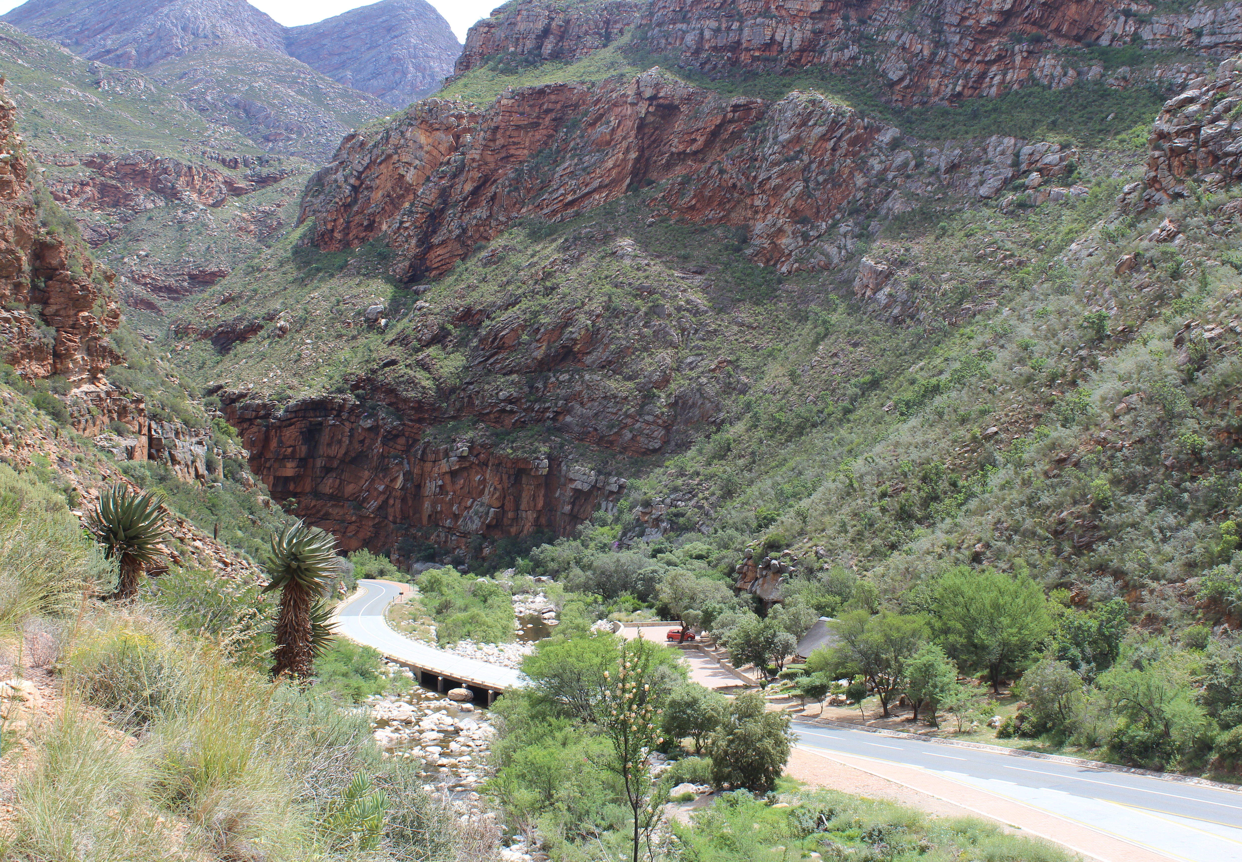
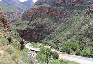
English: View of the South African N12 road as it passes through Meiringspoort, a 20 km (12 mi) gorge with cliffs of up to 700 m (2300&bnbsp;ft) in the Swartberg, a mountain range that separates the Great Karoo from the Little Karoo. The folds in the Swartberg are clearly visible in both the gorge and in this picture. The Groot River (in spite of its name, little more than a stream) passes through the gorge - one of the many crossings of the N12 and the river are visible in the lower part of the picture. The town of Oudtshoorn is about 35 km (22 mi) from the southern portal of the gorge.
Afrikaans: Uitsig op die Suid-Afrikaanse N12-pad in die omgewing Meiringspoort. Meiringspoort is 'n 20 km lank met kranse van 700 m. Hy sny deur die Swartberg tussen die Groot-Karoo en die Klein-Karoo. Die voue in die Swartberg is duidelik sigbaar in die kloof. Een van die kruisings van die N12 oor die Grootrivier wat deur die poort loop is sigbaar in die onderste deel van die prentjie. Die dorp Oudtshoorn is sowat 35 km vanaf die suidelike portaal van die kloof. |
| Data | |
| Font | Treball propi |
| Autor | Martinvl |
| Posició de la càmera | | Aquesta i altres imatges properes a: OpenStreetMap |
|---|
|
Aquest lloc està inscrit en el Patrimoni de la Humanitat de la UNESCO amb la referència 1007.
|
-
 Meiringspoort tourist information

Llicència
Jo, el titular dels drets d'autor d'aquest treball, el public sota la següent llicència:
This file is licensed under the Creative Commons Attribution-Share Alike 4.0 International license.
- Sou lliure de:
- compartir – copiar, distribuir i comunicar públicament l'obra
- adaptar – fer-ne obres derivades
- Amb les condicions següents:
- reconeixement – Heu de donar la informació adequada sobre l'autor, proporcionar un enllaç a la llicència i indicar si s'han realitzat canvis. Podeu fer-ho amb qualsevol mitjà raonable, però de cap manera no suggereixi que l'autor us dóna suport o aprova l'ús que en feu.
- compartir igual – Si modifiqueu, transformeu, o generareu amb el material, haureu de distribuir les vostres contribucions sota una llicència similar o una de compatible com l'original
Historial del fitxer
Cliqueu una data/hora per veure el fitxer tal com era aleshores.
| Data/hora | Miniatura | Dimensions | Usuari/a | Comentari | |
|---|---|---|---|---|---|
| actual | 16:19, 12 des 2015 | | 4.980 × 3.456 (11,6 Mo) | Martinvl | User created page with UploadWizard |
Ús del fitxer
La pàgina següent utilitza aquest fitxer:
Ús global del fitxer
Utilització d'aquest fitxer en altres wikis:
- Utilització a af.wikipedia.org
- Utilització a ceb.wikipedia.org
- Utilització a de.wikipedia.org
- Utilització a en.wikipedia.org
- Utilització a fy.wikipedia.org
- Utilització a nl.wikipedia.org
- Utilització a no.wikipedia.org
- Utilització a pl.wikipedia.org
- Utilització a sw.wikipedia.org
- Utilització a www.wikidata.org