Fitxer:St Lucie Inlet aerial view.jpg
Mida d'aquesta previsualització: 800 × 504 píxels. Altres resolucions: 320 × 202 píxels | 640 × 403 píxels | 1.024 × 645 píxels | 1.500 × 945 píxels.
Fitxer original (1.500 × 945 píxels, mida del fitxer: 120 Ko, tipus MIME: image/jpeg)
| Aquest fitxer i la informació mostrada a continuació provenen del dipòsit multimèdia lliure Wikimedia Commons. |
| Descripció |
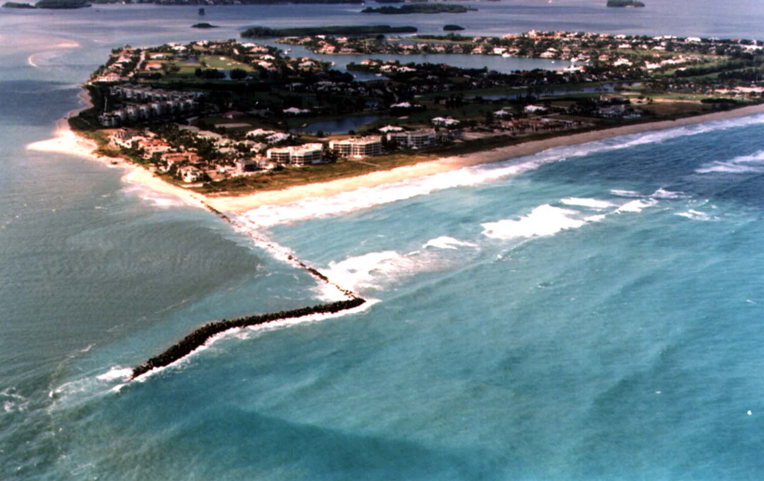
English: Aerial view of Sailfish Point and the St. Lucie Inlet in Martin County, Florida, USA. The inlet is an entrance from the Atlantic Ocean to the Indian River Lagoon and the St. Lucie River. View is to the northwest from over the Atlantic Ocean.
Coordinates: 27°9′58″N 80°9′24″W / 27.16611°N 80.15667°W |
|||
| Localització | Comtat de Martin | |||
| Data | not specified or unknown | |||
| Font |
U.S. Army Corps of Engineers Digital Visual Library Image page Image description page Digital Visual Library home page |
|||
| Autor | Tony Santana, U.S. Army Corps of Engineers | |||
| Permís (Com reutilitzar aquest fitxer) |
|
Historial del fitxer
Cliqueu una data/hora per veure el fitxer tal com era aleshores.
| Data/hora | Miniatura | Dimensions | Usuari/a | Comentari | |
|---|---|---|---|---|---|
| actual | 05:20, 27 abr 2007 | | 1.500 × 945 (120 Ko) | DanMS | {{Information | Description = {{en|Aerial view of St. Lucie Inlet in Martin County, Florida, USA. The inlet is an entrance from the Atlantic Ocean to the Indian River Lagoon and the city of Port St. Lucie. View is to the northwest from over the Atlanti |
Ús del fitxer
La pàgina següent utilitza aquest fitxer:
Ús global del fitxer
Utilització d'aquest fitxer en altres wikis:
- Utilització a ar.wikipedia.org
- Utilització a ceb.wikipedia.org
- Utilització a ce.wikipedia.org
- Utilització a en.wikipedia.org
- Utilització a es.wikipedia.org
- Utilització a eu.wikipedia.org
- Utilització a fa.wikipedia.org
- Utilització a fr.wikipedia.org
- Utilització a it.wikipedia.org
- Utilització a ja.wikipedia.org
- Utilització a lld.wikipedia.org
- Utilització a pl.wikipedia.org
- Utilització a pt.wikipedia.org
- Utilització a ru.wikipedia.org
- Utilització a sr.wikipedia.org
- Utilització a tr.wikipedia.org
- Utilització a tt.wikipedia.org
- Utilització a uk.wikipedia.org
- Utilització a uz.wikipedia.org
- Utilització a www.wikidata.org
- Utilització a zh-min-nan.wikipedia.org