Fitxer:Sweden location map.svg

Mida d'aquesta previsualització PNG del fitxer SVG: 311 × 599 píxels. Altres resolucions: 124 × 240 píxels | 249 × 480 píxels | 399 × 768 píxels | 532 × 1.024 píxels | 1.064 × 2.048 píxels | 954 × 1.836 píxels.
Fitxer original (fitxer SVG, nominalment 954 × 1.836 píxels, mida del fitxer: 2,03 Mo)
| Aquest fitxer i la informació mostrada a continuació provenen del dipòsit multimèdia lliure Wikimedia Commons. |
Resum
| Descripció |
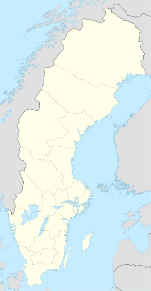
Deutsch: Positionskarte von Schweden
Quadratische Plattkarte, N-S-Streckung 214,7895 %. Geographische Begrenzung der Karte:
English: Location map of Sweden
Equirectangular projection, N/S stretching 214,7895 %. Geographic limits of the map:
|
||
| Data | |||
| Font | own work, using United States National Imagery and Mapping Agency data | ||
| Autor | NordNordWest | ||
| Altres versions |
Derivative works of this file:
|
||
| SVG genesis | Aquesta imatge vectorial ha estat creada amb Inkscape.
|


Llicència
Jo, el titular dels drets d'autor d'aquest treball, el public sota les següents llicències:

|
S'autoritza la còpia, la distribució i la modificació d'aquest document sota els termes de la llicència de documentació lliure GNU versió 1.2 o qualsevol altra versió posterior que publiqui la Free Software Foundation; sense seccions invariants, ni textos de portada, ni textos de contraportada. S'inclou una còpia d'aquesta llicència en la secció titulada GNU Free Documentation License. |
Aquest fitxer està subjecte a la llicència de Creative Commons Reconeixement i Compartir Igual 3.0 No adaptada.
- Sou lliure de:
- compartir – copiar, distribuir i comunicar públicament l'obra
- adaptar – fer-ne obres derivades
- Amb les condicions següents:
- reconeixement – Heu de donar la informació adequada sobre l'autor, proporcionar un enllaç a la llicència i indicar si s'han realitzat canvis. Podeu fer-ho amb qualsevol mitjà raonable, però de cap manera no suggereixi que l'autor us dóna suport o aprova l'ús que en feu.
- compartir igual – Si modifiqueu, transformeu, o generareu amb el material, haureu de distribuir les vostres contribucions sota una llicència similar o una de compatible com l'original
Podeu seleccionar la llicència que vulgueu.
Historial del fitxer
Cliqueu una data/hora per veure el fitxer tal com era aleshores.
| Data/hora | Miniatura | Dimensions | Usuari/a | Comentari | |
|---|---|---|---|---|---|
| actual | 01:26, 21 març 2023 | | 954 × 1.836 (2,03 Mo) | HCa | Reverted to version as of 18:28, 15 July 2008 (UTC) |
| 08:45, 1 nov 2015 |  | 842 × 1.837 (1,01 Mo) | Larske | Correction of border between Västra Götalands län and Jönköpings län. Habo municipality and Mullsjö municipality belong to Jönköpings län. | |
| 19:11, 4 ago 2011 |  | 842 × 1.837 (981 Ko) | NordNordWest | upd | |
| 11:24, 27 gen 2009 |  | 954 × 1.837 (2,74 Mo) | Erik Frohne | Added missing border Scania-Blekinge Category:Location maps of Sweden | |
| 10:22, 29 ago 2008 |  | 954 × 1.837 (2,74 Mo) | NordNordWest | ||
| 10:18, 29 ago 2008 |  | 954 × 1.837 (1,46 Mo) | NordNordWest | ||
| 13:32, 30 jul 2008 |  | 954 × 1.836 (1,46 Mo) | NordNordWest | optimized | |
| 20:28, 15 jul 2008 |  | 954 × 1.836 (2,03 Mo) | NordNordWest | {{Information |Description= {{de|Positionskarte von Schweden}} Quadratische Plattkarte, N-S-Streckung 190 %. Geographische Begrenzung der Karte: * N: 69.5° N * S: 55.1° N * W: 10.4° O * O: 24.6° O {{en|Location map of [[:en:Sweden|Swe |
Ús del fitxer
Les 4 pàgines següents utilitzen aquest fitxer:
Ús global del fitxer
Utilització d'aquest fitxer en altres wikis:
- Utilització a af.wikipedia.org
- Utilització a als.wikipedia.org
- Utilització a am.wikipedia.org
- Utilització a an.wikipedia.org
- Utilització a ar.wikipedia.org
- Utilització a arz.wikipedia.org
- Utilització a ast.wikipedia.org
Vegeu més usos globals d'aquest fitxer.