Fitxer:Tongass NF - map of wilderness areas.jpg
Mida d'aquesta previsualització: 776 × 600 píxels. Altres resolucions: 311 × 240 píxels | 621 × 480 píxels | 994 × 768 píxels | 1.280 × 989 píxels | 2.200 × 1.700 píxels.
Fitxer original (2.200 × 1.700 píxels, mida del fitxer: 954 Ko, tipus MIME: image/jpeg)
| Aquest fitxer i la informació mostrada a continuació provenen del dipòsit multimèdia lliure Wikimedia Commons. |
Resum
| Descripció |
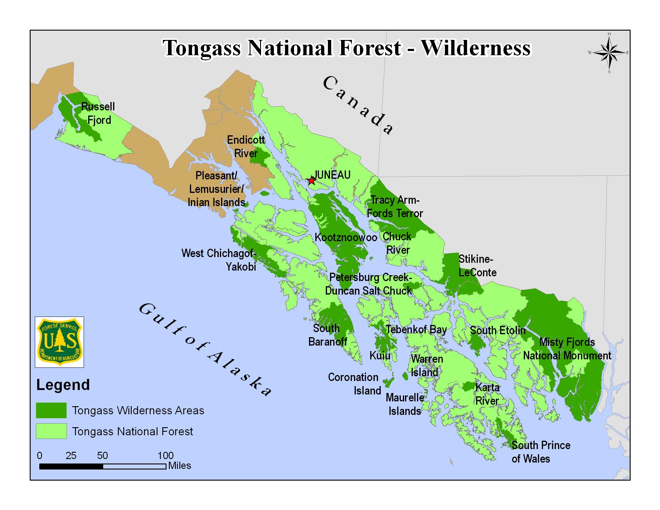
English: Map of the Tongass National Forest in southeast Alaska, USA, showing designated Wilderness Areas |
|||
| Data | Data desconeguda | |||
| Font | https://www.fs.usda.gov/detail/tongass/specialplaces/?cid=stelprdb5393510 | |||
| Autor | U.S. Forest Service | |||
| Permís (Com reutilitzar aquest fitxer) |
|
Historial del fitxer
Cliqueu una data/hora per veure el fitxer tal com era aleshores.
| Data/hora | Miniatura | Dimensions | Usuari/a | Comentari | |
|---|---|---|---|---|---|
| actual | 21:41, 21 set 2018 | | 2.200 × 1.700 (954 Ko) | Jsayre64 | {{Information |description ={{en|1=Map of the Tongass National Forest in southeast Alaska, USA, showing designated wilderness areas}} |date =Unknown |source =https://www.fs.usda.gov/detail/tongass/specialplaces/?cid=stelprdb5393510 |author =U.S. Forest Service |permission ={{PD-USGov-USDA-FS}} }} Category:Maps of Tongass National Forest Category:Wilderness Areas of Alaska |
Ús del fitxer
La pàgina següent utilitza aquest fitxer:
Ús global del fitxer
Utilització d'aquest fitxer en altres wikis:
- Utilització a de.wikipedia.org
- Utilització a en.wikipedia.org
- Utilització a fy.wikipedia.org
- Utilització a zh.wikipedia.org