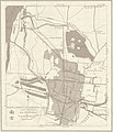
Fitxer:Txu-oclc-10552568-ni50-16-back (cropped).jpg

Mida d'aquesta previsualització: 516 × 599 píxels. Altres resolucions: 207 × 240 píxels | 413 × 480 píxels | 661 × 768 píxels | 881 × 1.024 píxels | 2.462 × 2.860 píxels.
Fitxer original (2.462 × 2.860 píxels, mida del fitxer: 1,34 Mo, tipus MIME: image/jpeg)
Historial del fitxer
Cliqueu una data/hora per veure el fitxer tal com era aleshores.
| Data/hora | Miniatura | Dimensions | Usuari/a | Comentari | |
|---|---|---|---|---|---|
| actual | 10:33, 7 ago 2020 |  | 2.462 × 2.860 (1,34 Mo) | Koavf | File:Txu-oclc-10552568-ni50-16-back.jpg cropped 51 % horizontally, 36 % vertically using CropTool with precise mode. |
Ús del fitxer
La pàgina següent utilitza aquest fitxer:
Ús global del fitxer
Utilització d'aquest fitxer en altres wikis:
- Utilització a en.wikipedia.org
- Utilització a en.wiktionary.org


