Fitxer:US map - states-ca.png
Mida d'aquesta previsualització: 800 × 542 píxels. Altres resolucions: 320 × 217 píxels | 640 × 434 píxels | 1.024 × 694 píxels | 1.480 × 1.003 píxels.
Fitxer original (1.480 × 1.003 píxels, mida del fitxer: 292 Ko, tipus MIME: image/png)
| Aquest fitxer i la informació mostrada a continuació provenen del dipòsit multimèdia lliure Wikimedia Commons. |
Resum
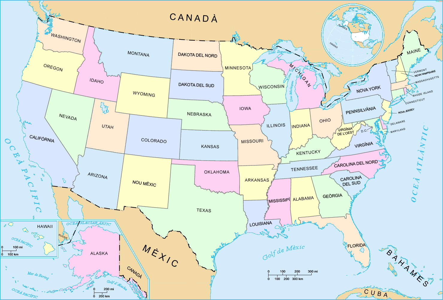
Catalan-version map of the States of the United States.
For the English version, see : Image:US_map_-_states.png.
- Realitzat per: US Department of Interior
- Font: National Atlas of the United States : http://nationalatlas.gov
- Traducció: per ca:Usuari:Pepetps
Llicència
This map was obtained from an edition of the National Atlas of the United States. Like almost all works of the U.S. federal government, works from the National Atlas are in the public domain in the United States.
Online access: NationalAtlas.gov | 1970 print edition: Library of Congress, Perry-Castañeda Library
|
Historial del fitxer
Cliqueu una data/hora per veure el fitxer tal com era aleshores.
| Data/hora | Miniatura | Dimensions | Usuari/a | Comentari | |
|---|---|---|---|---|---|
| actual | 00:34, 4 juny 2020 | | 1.480 × 1.003 (292 Ko) | Martí8888 | He afegit la primera "i" de Louisiana, lletra que es va deixar l'autor en traduir els noms del mapa. |
| 21:41, 2 març 2006 |  | 1.480 × 1.003 (287 Ko) | Pepetps | Catalan-version map of the States of the United States. For the English version, see : Image:US_map_-_states.png. * '''Realitzat per:''' US Department of Interior * '''Font:''' National Atlas of the United States : http://nationalatlas.gov * | |
| 21:41, 2 març 2006 |  | 1.480 × 1.003 (287 Ko) | Pepetps | Catalan-version map of the States of the United States. For the English version, see : Image:US_map_-_states.png. * '''Realitzat per:''' US Department of Interior * '''Font:''' National Atlas of the United States : http://nationalatlas.gov * |
Ús del fitxer
Les 3 pàgines següents utilitzen aquest fitxer: