Fitxer:Western Indian Wars.jpg
Mida d'aquesta previsualització: 785 × 600 píxels. Altres resolucions: 314 × 240 píxels | 629 × 480 píxels | 1.006 × 768 píxels | 1.280 × 978 píxels | 2.006 × 1.532 píxels.
Fitxer original (2.006 × 1.532 píxels, mida del fitxer: 425 Ko, tipus MIME: image/jpeg)
| Aquest fitxer i la informació mostrada a continuació provenen del dipòsit multimèdia lliure Wikimedia Commons. |
| Descripció |
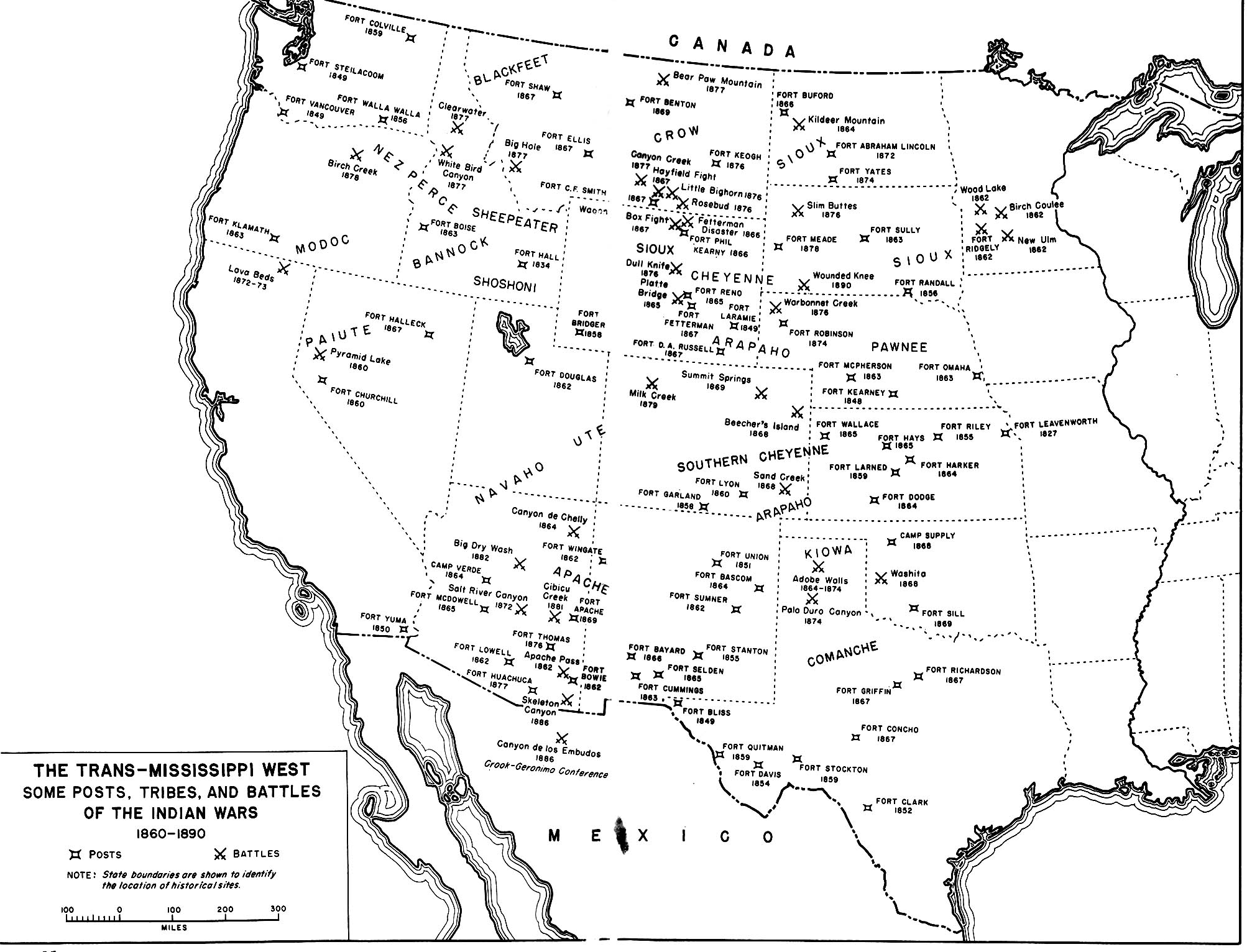
English: A map of the En:Indian Wars in the Western United States showing the general location of tribes and the location of some army posts and battles. Map 35 in Chapter 14 Winning the West: The Army in the Indian Wars, 1865-1890 AMERICAN MILITARY HISTORY ARMY HISTORICAL SERIES OFFICE OF THE CHIEF OF MILITARY HISTORY UNITED STATES ARMY |
|||
| Font | http://www.history.army.mil/books/amh/Map14-35.jpg | |||
| Autor | Work of the United States government | |||
| Permís (Com reutilitzar aquest fitxer) |
|

Historial del fitxer
Cliqueu una data/hora per veure el fitxer tal com era aleshores.
| Data/hora | Miniatura | Dimensions | Usuari/a | Comentari | |
|---|---|---|---|---|---|
| actual | 03:35, 26 jul 2009 | | 2.006 × 1.532 (425 Ko) | Fred Bauder | {{Information |Description={{en|1=A map of the En:Indian Wars in the Western United States showing the general location of tribes and the location of some army posts and battles. Map 35 in Chapter 14 Winning the West: The Army in the Indian Wars, 1865 |
Ús del fitxer
La pàgina següent utilitza aquest fitxer:
Ús global del fitxer
Utilització d'aquest fitxer en altres wikis:
- Utilització a ar.wikipedia.org
- Utilització a en.wikipedia.org
- Utilització a en.wikiquote.org
- Utilització a fr.wikipedia.org
- Utilització a sv.wikipedia.org
- Utilització a tr.wikipedia.org
- Utilització a uk.wikipedia.org