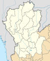
Fitxer:Thailand Northern (17 provinces) location map.svg

Mida d'aquesta previsualització PNG del fitxer SVG: 500 × 600 píxels. Altres resolucions: 200 × 240 píxels | 400 × 480 píxels | 640 × 768 píxels | 853 × 1.024 píxels | 1.707 × 2.048 píxels | 600 × 720 píxels.
Fitxer original (fitxer SVG, nominalment 600 × 720 píxels, mida del fitxer: 178 Ko)
Historial del fitxer
Cliqueu una data/hora per veure el fitxer tal com era aleshores.
| Data/hora | Miniatura | Dimensions | Usuari/a | Comentari | |
|---|---|---|---|---|---|
| actual | 22:26, 13 set 2019 |  | 600 × 720 (178 Ko) | ZeroSixTwo | User created page with UploadWizard |
Ús del fitxer
No hi ha pàgines que utilitzin aquest fitxer.
Ús global del fitxer
Utilització d'aquest fitxer en altres wikis:
- Utilització a id.wikipedia.org
- Utilització a th.wikipedia.org
- ไทยลีก 4 ฤดูกาล 2561 – โซนภาคเหนือ
- ไทยแลนด์ อเมเจอร์ลีก ฤดูกาล 2561 – โซนภาคเหนือ
- ไทยลีก 4 ฤดูกาล 2562 – โซนภาคเหนือ
- ไทยแลนด์ อเมเจอร์ลีก ฤดูกาล 2562 – โซนภาคเหนือ
- มอดูล:Location map/data/Thailand Northern (17 provinces)
- ไทยลีก 4 ฤดูกาล 2563 – โซนภาคเหนือ
- ไทยลีก 3 ฤดูกาล 2564–65 – โซนภาคเหนือ
- ไทยแลนด์ อเมเจอร์ลีก ฤดูกาล 2565 – โซนภาคเหนือ
- ไทยลีก 3 ฤดูกาล 2565–66 – โซนภาคเหนือ
- ไทยแลนด์ เซมิโปรลีก ฤดูกาล 2566 – โซนภาคเหนือ
- ไทยแลนด์ อเมเจอร์ลีก ฤดูกาล 2566 – โซนภาคเหนือ
- ไทยลีก 3 ฤดูกาล 2566–67 – โซนภาคเหนือ
- ไทยแลนด์ เซมิโปรลีก ฤดูกาล 2567 – โซนภาคเหนือ
- มอดูล:Location map/data/Thailand Northern (17 provinces)/doc
- ไทยลีก 3 ฤดูกาล 2567–68 – โซนภาคเหนือ
