Fitxer:Antarctica map.jpg
Fitxer original (4.549 × 3.973 píxels, mida del fitxer: 6,18 Mo, tipus MIME: image/jpeg)
| Aquest fitxer i la informació mostrada a continuació provenen del dipòsit multimèdia lliure Wikimedia Commons. |
| Atenció | El fitxer original té una quantitat elevada de píxels; si l’obriu a resolució plena, és possible que no es carregui correctament o provoqui que el vostre navegador es bloqui. Feu servir el ZoomViewer per a evitar aquests problemes. |
|---|
| Editorial |
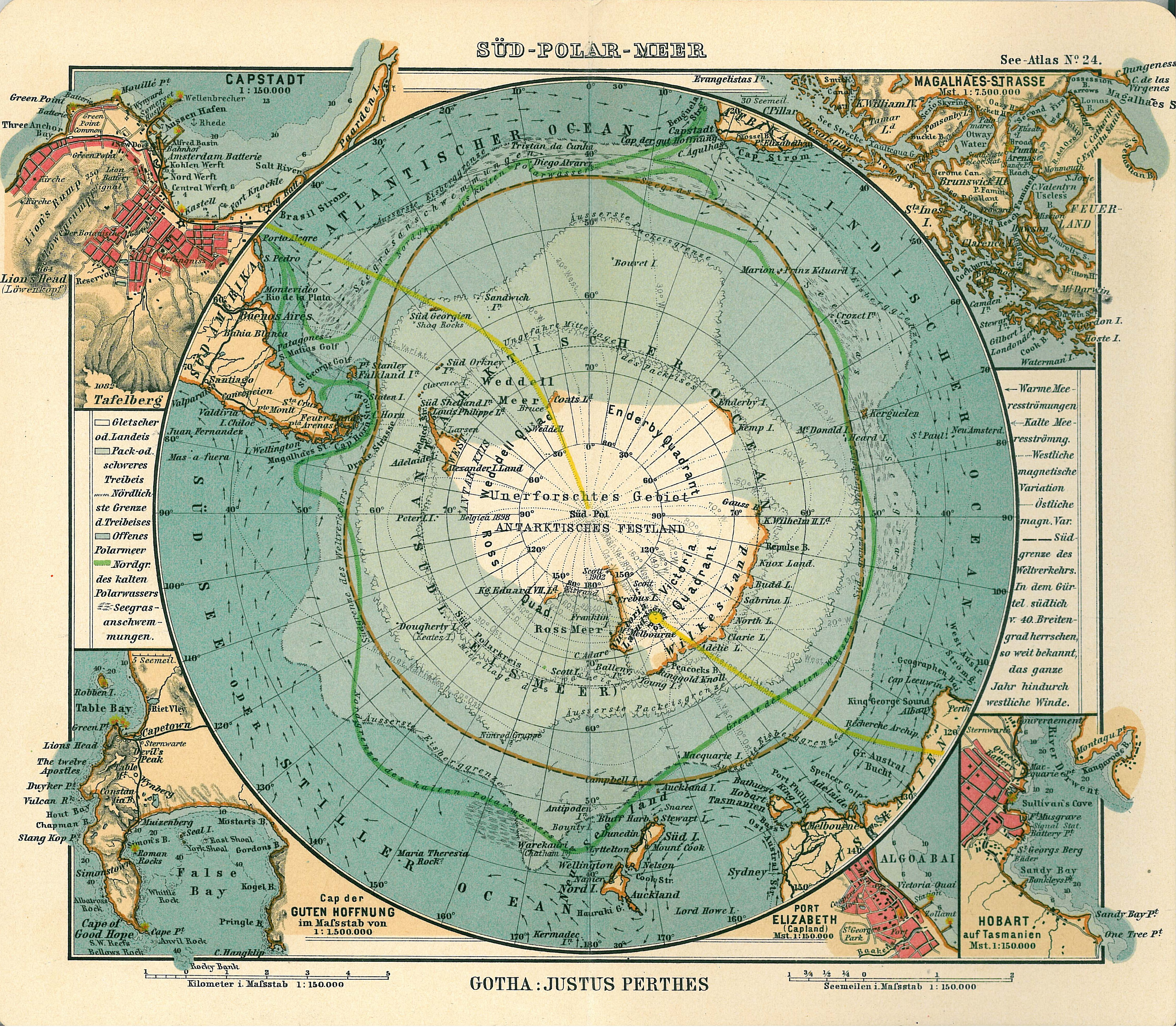
Justus Perthes |
||||
| Descripció |
Deutsch: Blatt 24, Süd-Polar-Meer
English: Page 24, Antarctica, Inset maps of Cape town, Cape of good hope, Magalhaes strait, Hobart, Port Elizabeth |
||||
| Data de publicació | 1906 | ||||
| Lloc de publicació | Gotha | ||||
| Font | See Atlas | ||||
| Permís (Com reutilitzar aquest fitxer) |
|
||||
.jpg)
Historial del fitxer
Cliqueu una data/hora per veure el fitxer tal com era aleshores.
| Data/hora | Miniatura | Dimensions | Usuari/a | Comentari | |
|---|---|---|---|---|---|
| actual | 19:08, 15 gen 2007 | | 4.549 × 3.973 (6,18 Mo) | Martas011 | Category:Old maps of Antarctica Category:Maps of oceans Category:Maps of the Southern Ocean Good map of Antarctica, Justhus Perthes See Atlas 1906 Inset maps of Cape town, Cape of good hope, Magalhaes strait, Hobart, Port Elizabeth |
Ús del fitxer
La pàgina següent utilitza aquest fitxer:
Ús global del fitxer
Utilització d'aquest fitxer en altres wikis:
- Utilització a avk.wikipedia.org
- Utilització a de.wikipedia.org
- Utilització a en.wikipedia.org
- Utilització a eo.wikipedia.org
- Utilització a id.wikipedia.org
- Utilització a it.wikipedia.org
- Utilització a ja.wikipedia.org
- Utilització a nl.wikipedia.org
- Utilització a pl.wikipedia.org
- Utilització a pt.wikipedia.org
- Utilització a ru.wikipedia.org
- Utilització a zh.wikipedia.org