Fitxer:Arabi20FebLeBeau1.jpg
Mida d'aquesta previsualització: 800 × 462 píxels. Altres resolucions: 320 × 185 píxels | 640 × 369 píxels | 1.024 × 591 píxels | 1.280 × 738 píxels | 2.432 × 1.403 píxels.
Fitxer original (2.432 × 1.403 píxels, mida del fitxer: 984 Ko, tipus MIME: image/jpeg)
| Aquest fitxer i la informació mostrada a continuació provenen del dipòsit multimèdia lliure Wikimedia Commons. |
Resum
| Descripció |
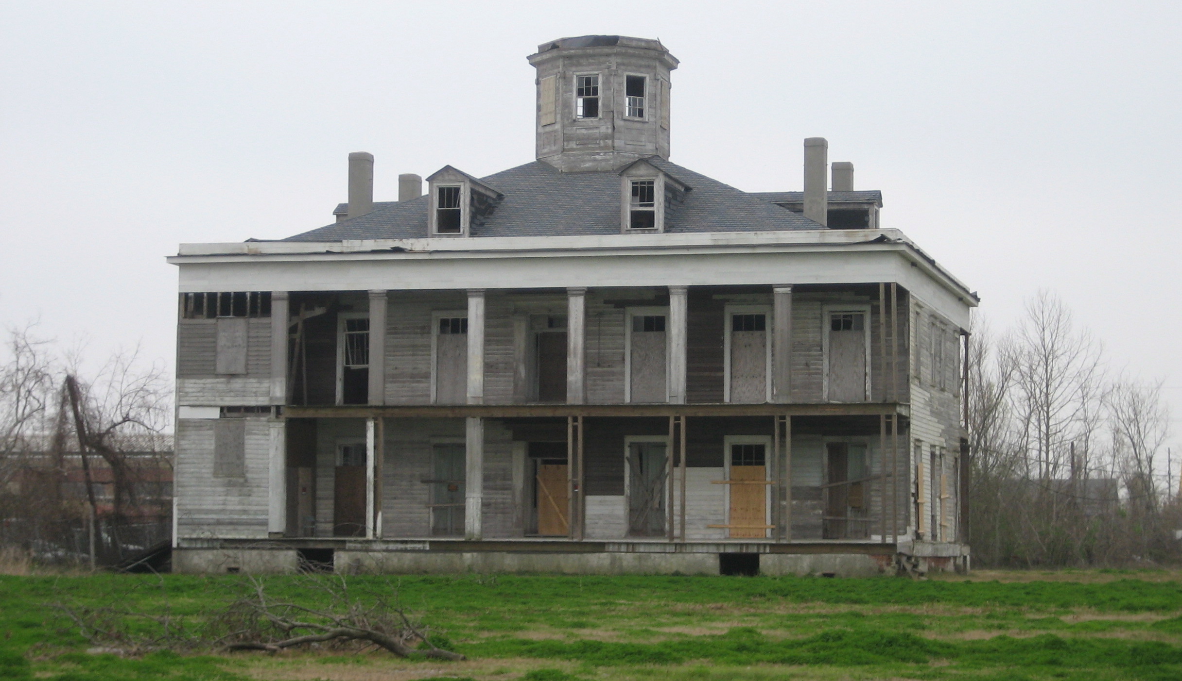
English: LeBeau Plantation, Arabi, Louisiana. The 1854 plantation house, Photographed by Infrogmation of New Orleans in 2006. It was a hotel and gambling establishment in the mid 20th century, destroyed by arson in 2013. The property was owned by Joseph Meraux and in his will was left to Arlene Soper Meraux after a court battle to prove a common law marriage. After her death, months prior to Hurricane Katrina, she left this plantation and several other properties to a commission made of several St. Bernard Parish politicians. Before the storm and later arson, a committee had planned on making large and pricey renovations to Le Beau hoping to bring more tourism into the area.
|
||
| Data | |||
| Font | Photo by Infrogmation of New Orleans | ||
| Autor | Infrogmation of New Orleans | ||
| Permís (Com reutilitzar aquest fitxer) |
May be reused with photographer attribution in accordance with any of the licenses listed by the author. Reuse without attribution is a violation of copyright. |
Llicència
Jo, el titular dels drets d'autor d'aquest treball, el public sota les següents llicències:

|
S'autoritza la còpia, la distribució i la modificació d'aquest document sota els termes de la llicència de documentació lliure GNU versió 1.2 o qualsevol altra versió posterior que publiqui la Free Software Foundation; sense seccions invariants, ni textos de portada, ni textos de contraportada. S'inclou una còpia d'aquesta llicència en la secció titulada GNU Free Documentation License. |
Aquest fitxer està disponible sota la llicència Creative Commons Reconeixement 2.5 Genèrica.
- Sou lliure de:
- compartir – copiar, distribuir i comunicar públicament l'obra
- adaptar – fer-ne obres derivades
- Amb les condicions següents:
- reconeixement – Heu de donar la informació adequada sobre l'autor, proporcionar un enllaç a la llicència i indicar si s'han realitzat canvis. Podeu fer-ho amb qualsevol mitjà raonable, però de cap manera no suggereixi que l'autor us dóna suport o aprova l'ús que en feu.
Podeu seleccionar la llicència que vulgueu.
| Posició de l'objecte | | Aquesta i altres imatges properes a: OpenStreetMap |
|---|
Historial del fitxer
Cliqueu una data/hora per veure el fitxer tal com era aleshores.
| Data/hora | Miniatura | Dimensions | Usuari/a | Comentari | |
|---|---|---|---|---|---|
| actual | 04:04, 24 març 2006 | | 2.432 × 1.403 (984 Ko) | Infrogmation | Le Beau plantation house, Arabi Louisiana. The 1854 planation house was a hotel and gambling establishment in the mid 20th century, and has long been vacant. Photo by ~~~ Category:Houses in Louisiana Category:Plantation houses [[Category:Saint B |
Ús del fitxer
La pàgina següent utilitza aquest fitxer:
Ús global del fitxer
Utilització d'aquest fitxer en altres wikis:
- Utilització a ar.wikipedia.org
- Utilització a ceb.wikipedia.org
- Utilització a ce.wikipedia.org
- Utilització a en.wikipedia.org
- Utilització a en.wikivoyage.org
- Utilització a es.wikipedia.org
- Utilització a fr.wikipedia.org
- Utilització a it.wikipedia.org
- Utilització a lld.wikipedia.org
- Utilització a pl.wikipedia.org
- Utilització a pt.wikipedia.org
- Utilització a sr.wikipedia.org
- Utilització a tt.wikipedia.org
- Utilització a uk.wikipedia.org
- Utilització a www.wikidata.org