Fitxer:Atchafalaya Basin.jpg

Mida d'aquesta previsualització: 800 × 534 píxels. Altres resolucions: 320 × 214 píxels | 640 × 427 píxels | 1.024 × 683 píxels | 1.500 × 1.001 píxels.
Fitxer original (1.500 × 1.001 píxels, mida del fitxer: 648 Ko, tipus MIME: image/jpeg)
| Aquest fitxer i la informació mostrada a continuació provenen del dipòsit multimèdia lliure Wikimedia Commons. |
| Descripció |
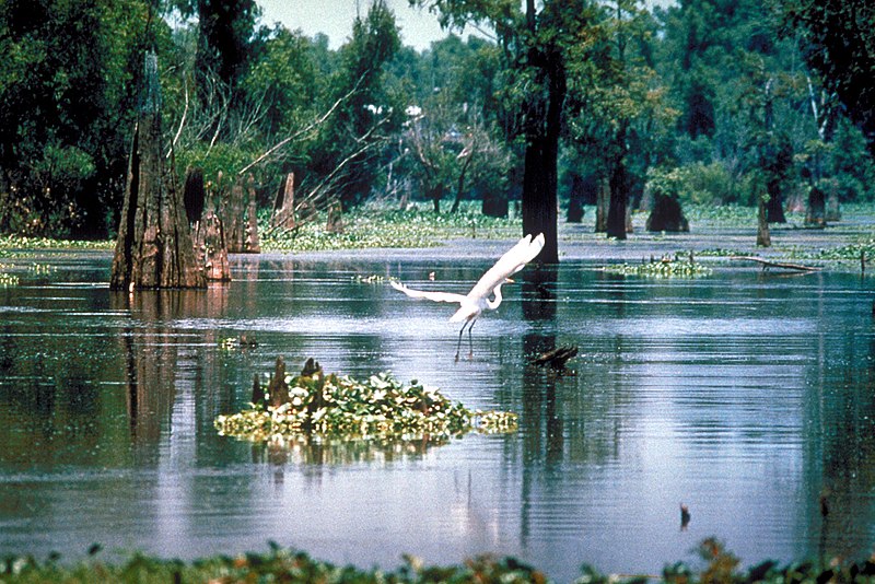
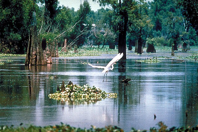
English: A scene in the Atchafalaya Basin in Louisiana, USA, in the Sherburne Complex Wildlife Management Area, a Nature Conservancy reserve. |
|||
| Data | not specified or unknown | |||
| Font |
U.S. Army Corps of Engineers Digital Visual Library Image page Image description page Digital Visual Library home page |
|||
| Autor | U.S. Army Corps of Engineers, photographer not specified or unknown | |||
| Permís (Com reutilitzar aquest fitxer) |
|
|||
| Localització | Atchafalaya Basin, Louisiana, USA |
| Posició de la càmera | | Aquesta i altres imatges properes a: OpenStreetMap |
|---|
Historial del fitxer
Cliqueu una data/hora per veure el fitxer tal com era aleshores.
| Data/hora | Miniatura | Dimensions | Usuari/a | Comentari | |
|---|---|---|---|---|---|
| actual | 07:14, 1 abr 2007 | | 1.500 × 1.001 (648 Ko) | DanMS | {{Information | Description = {{en|A scene in the Atchafalaya Basin in Louisiana, USA.}} | Source = U.S. Army Corps of Engineers Digital Visual Library<br />[http://images.usace.army.mil/images/Hires/0655-12.jpg Image page]<br />[http://images. |
Ús del fitxer
Les 2 pàgines següents utilitzen aquest fitxer:
Ús global del fitxer
Utilització d'aquest fitxer en altres wikis:
- Utilització a bo.wikipedia.org
- Utilització a ceb.wikipedia.org
- Utilització a de.wikipedia.org
- Utilització a eml.wikipedia.org
- Utilització a en.wikipedia.org
- Louisiana
- Oasis
- Ecoregion
- Peter Scott
- Muskeg
- Mangrove
- Estuary
- Lagoon
- Swamp
- Peat
- Wetland
- Wildfowl & Wetlands Trust
- WWT Caerlaverock
- Fen
- WWT Arundel
- Castle Espie
- WWT London Wetland Centre
- WWT Llanelli Wetlands Centre
- WWT Martin Mere
- WWT Slimbridge
- WWT Washington
- Limnology
- Bog
- Lake Agassiz
- Ouse Washes
- Aquatic plant
- Will-o'-the-wisp
- River delta
- Marsh
- Drainage basin
- Ramsar Convention
- Flooded grasslands and savannas
- Tigris–Euphrates river system
- Salt marsh
- Aquatic animal
- Waterkeeper Alliance
- Sapric
- Sudd
- Oxbow lake
- Lake Bangweulu
- Okavango Delta
- Lake Mweru Wantipa
- Mudflat
- Moorland
- Sava
- Ivindo River
Vegeu més usos globals d'aquest fitxer.