Fitxer:Bishopric of Strasbourg 1547.png

Bishopric_of_Strasbourg_1547.png (536 × 522 píxels, mida del fitxer: 599 Ko, tipus MIME: image/png)
| Aquest fitxer i la informació mostrada a continuació provenen del dipòsit multimèdia lliure Wikimedia Commons. |
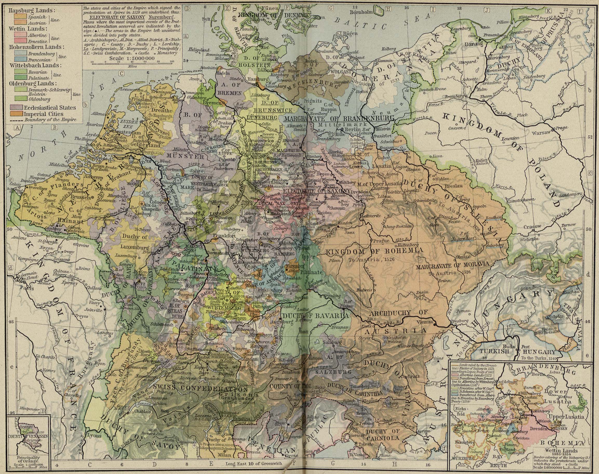
| Descripció | Modern map showing the Bishopric of Strasbourg and part of the Rhineland circa 1547 | ||||||
| Data | (UTC) | ||||||
| Font | Cropped from Central Europe about 1547, from The Historical Atlas by William R. Shepherd, 1923 | ||||||
| Autor | OwenBlacker | ||||||
| Permís (Com reutilitzar aquest fitxer) |
|
||||||
Historial del fitxer
Cliqueu una data/hora per veure el fitxer tal com era aleshores.
| Data/hora | Miniatura | Dimensions | Usuari/a | Comentari | |
|---|---|---|---|---|---|
| actual | 14:22, 16 set 2007 | | 536 × 522 (599 Ko) | OwenBlacker | {{Information |Description=Map of the w:Bishopric of Strasbourg, circa 1547 |Source=Cropped from [http://www.lib.utexas.edu/maps/historical/shepherd/central_europe_1547.jpg Central Europe about 1547], from ''The Historical Atlas'' by William R. Sheph |
Ús del fitxer
La pàgina següent utilitza aquest fitxer:
Ús global del fitxer
Utilització d'aquest fitxer en altres wikis:
- Utilització a cs.wikipedia.org
- Utilització a de.wikipedia.org
- Utilització a en.wikipedia.org
- Utilització a es.wikipedia.org
- Utilització a fr.wikipedia.org
- Utilització a he.wikipedia.org
- Utilització a it.wikipedia.org
- Utilització a ru.wikipedia.org
- Utilització a sh.wikipedia.org
- Utilització a vi.wikipedia.org
- Utilització a www.wikidata.org