Fitxer:BonaiKart (1).jpg
No hi ha cap versió amb una resolució més gran.
BonaiKart_(1).jpg (446 × 371 píxels, mida del fitxer: 189 Ko, tipus MIME: image/jpeg)
| Aquest fitxer i la informació mostrada a continuació provenen del dipòsit multimèdia lliure Wikimedia Commons. |
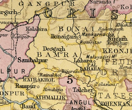
| Descripció | Mapa de Bonai | |||
| Data | ||||
| Font | Imperial Gazetteer on India via http://de.wikipedia.org/wiki/Datei:BonaiKart.jpg | |||
| Autor | Govern britànic de l'Índia / Government of British India | |||
| Permís (Com reutilitzar aquest fitxer) |
|

.jpg?uselang=ca)
Historial del fitxer
Cliqueu una data/hora per veure el fitxer tal com era aleshores.
| Data/hora | Miniatura | Dimensions | Usuari/a | Comentari | |
|---|---|---|---|---|---|
| actual | 16:38, 7 feb 2011 | | 446 × 371 (189 Ko) | MALLUS | {{Information |Description= Mapa de Bonai |Source= http://de.wikipedia.org/wiki/Datei:BonaiKart.jpg |Date= 1931 |Author=Govern britànic de l'Índia |Permission= {{GFDL}} |other_versions= NO }} Category:History of India by state |
Ús del fitxer
Les 3 pàgines següents utilitzen aquest fitxer:
Ús global del fitxer
Utilització d'aquest fitxer en altres wikis:
- Utilització a bn.wikipedia.org
- Utilització a de.wikipedia.org
- Utilització a en.wikipedia.org
- Utilització a it.wikipedia.org
- Utilització a or.wikipedia.org
- Utilització a sv.wikipedia.org
- Utilització a ur.wikipedia.org
.jpg)