Fitxer:CQA Four Mile Bridge.jpg
Mida d'aquesta previsualització: 753 × 600 píxels. Altres resolucions: 301 × 240 píxels | 603 × 480 píxels | 964 × 768 píxels | 1.280 × 1.020 píxels | 2.560 × 2.039 píxels | 4.624 × 3.683 píxels.
Fitxer original (4.624 × 3.683 píxels, mida del fitxer: 1,88 Mo, tipus MIME: image/jpeg)
| Aquest fitxer i la informació mostrada a continuació provenen del dipòsit multimèdia lliure Wikimedia Commons. |
|
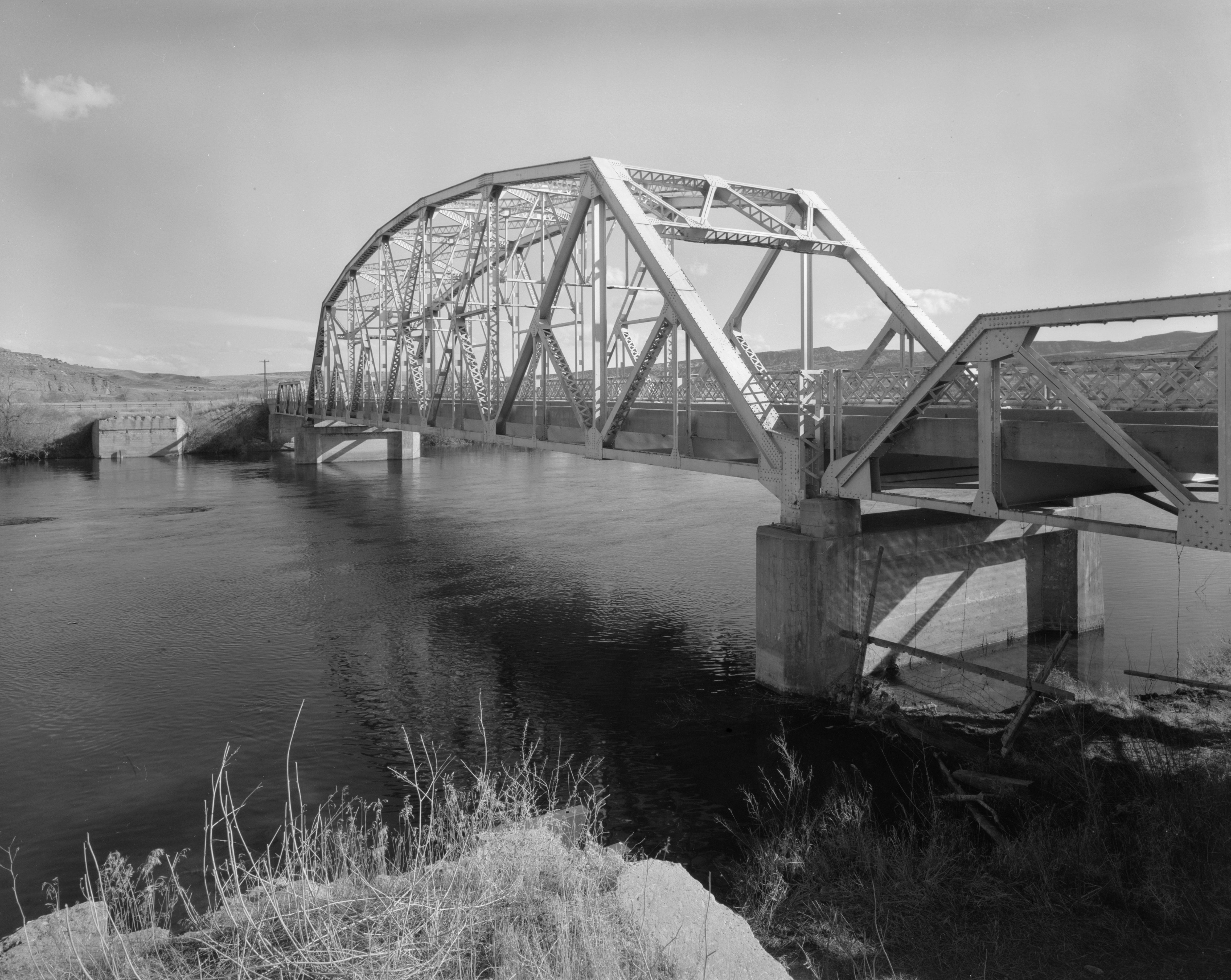
This is an image of a place or building that is listed on the National Register of Historic Places in the United States of America. Its reference number is 85000423. |
| Posició de la càmera | | Aquesta i altres imatges properes a: OpenStreetMap |
|---|
| Descripció |
English: Eastern side of the CQA Four Mile Bridge, which carries WYO 173 over the Bighorn River near Thermopolis in Hot Springs County, Wyoming, United States. Built in 1927, this Pennsylvania through truss bridge is listed on the National Register of Historic Places. |
||||
| Data | |||||
| Font |
Library of Congress, Prints and Photograph Division HAER: WYO,9-THERM.V,2-1
|
||||
| Autor | Clayton B. Fraser | ||||
| Permís (Com reutilitzar aquest fitxer) |
|

Historial del fitxer
Cliqueu una data/hora per veure el fitxer tal com era aleshores.
| Data/hora | Miniatura | Dimensions | Usuari/a | Comentari | |
|---|---|---|---|---|---|
| actual | 18:14, 27 abr 2009 | | 4.624 × 3.683 (1,88 Mo) | Martin H. | high res; cropped |
| 17:18, 25 abr 2009 |  | 1.024 × 820 (170 Ko) | Nyttend | {{Location|43|36|13|N|108|11|48|W}} {{Information |Description={{en|Eastern side of the {{w|CQA Four Mile Bridge}}, which carries {{w|Wyoming Highway 173|WYO 173}} over the {{w|Bighorn River}} near {{w|Thermopolis, Wyoming|Thermopolis}} in {{w|Hot Springs |
Ús del fitxer
La pàgina següent utilitza aquest fitxer:
Ús global del fitxer
Utilització d'aquest fitxer en altres wikis:
- Utilització a arz.wikipedia.org
- Utilització a ceb.wikipedia.org
- Utilització a da.wikipedia.org
- Utilització a de.wikipedia.org
- Utilització a en.wikipedia.org
- Utilització a no.wikipedia.org
- Utilització a sv.wikipedia.org
- Utilització a www.wikidata.org
- Utilització a xmf.wikipedia.org