Fitxer:Campbell Island New Zealand geographic map en.svg

Mida d'aquesta previsualització PNG del fitxer SVG: 603 × 600 píxels. Altres resolucions: 241 × 240 píxels | 482 × 480 píxels | 772 × 768 píxels | 1.029 × 1.024 píxels | 2.058 × 2.048 píxels | 1.005 × 1.000 píxels.
Fitxer original (fitxer SVG, nominalment 1.005 × 1.000 píxels, mida del fitxer: 755 Ko)
| Aquest fitxer i la informació mostrada a continuació provenen del dipòsit multimèdia lliure Wikimedia Commons. |
Resum
| Descripció |
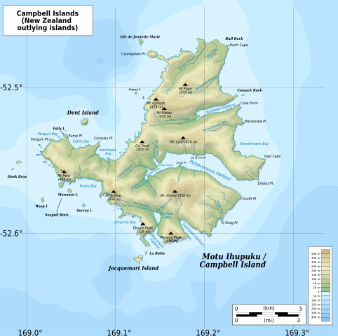
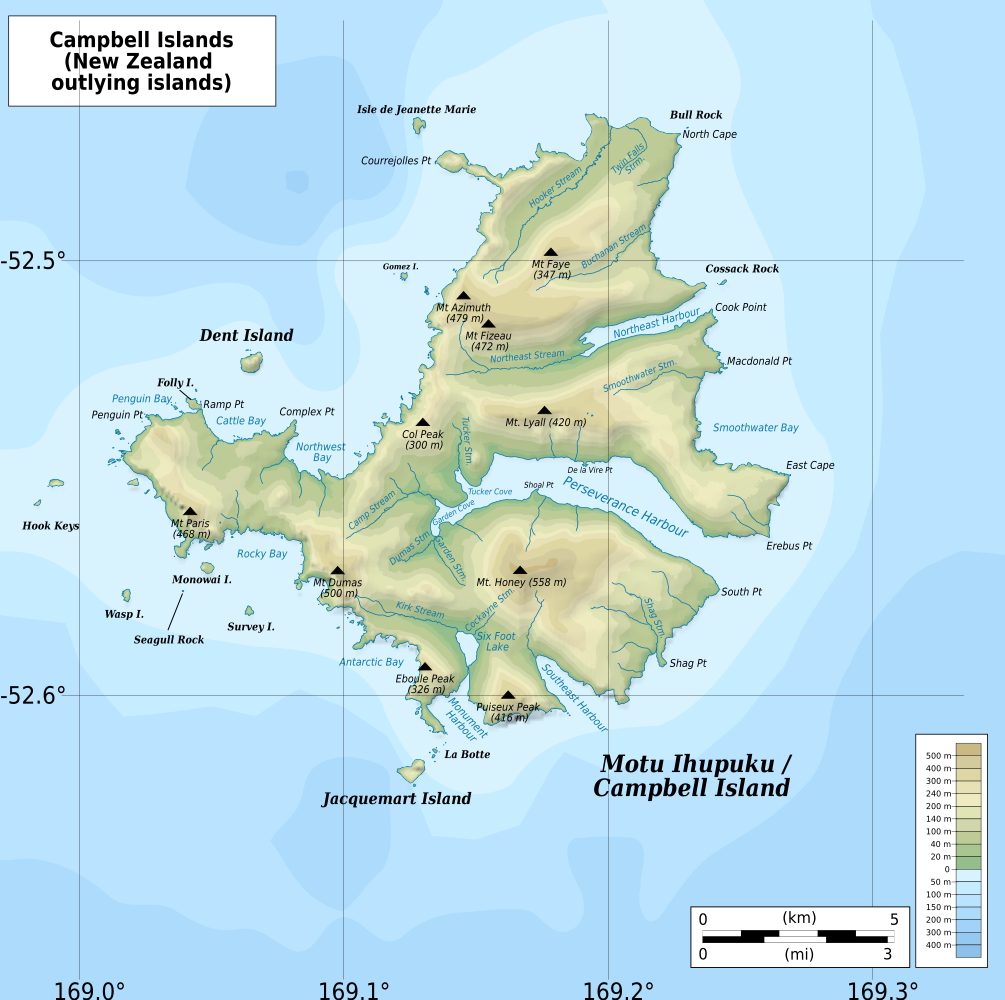
English: Geographic map of Campbell Islands, New Zealand
Geographic limits of the map:
|
| Data | |
| Font |
Treball propi
|
| Autor | ikonact |
Llicència
| This work contains information from OpenStreetMap, which is made available under the Open Database License (ODbL).
The ODbL does not require any particular license for maps produced from ODbL data. Prior to 1 August 2020, map tiles produced by the OpenStreetMap Foundation were licensed under the CC-BY-SA-2.0 license. Maps produced by other people may be subject to other licences. |
Jo, el titular dels drets d'autor d'aquest treball, el public sota la següent llicència:
This file is licensed under the Creative Commons Attribution-Share Alike 4.0 International license.
- Sou lliure de:
- compartir – copiar, distribuir i comunicar públicament l'obra
- adaptar – fer-ne obres derivades
- Amb les condicions següents:
- reconeixement – Heu de donar la informació adequada sobre l'autor, proporcionar un enllaç a la llicència i indicar si s'han realitzat canvis. Podeu fer-ho amb qualsevol mitjà raonable, però de cap manera no suggereixi que l'autor us dóna suport o aprova l'ús que en feu.
- compartir igual – Si modifiqueu, transformeu, o generareu amb el material, haureu de distribuir les vostres contribucions sota una llicència similar o una de compatible com l'original
Historial del fitxer
Cliqueu una data/hora per veure el fitxer tal com era aleshores.
| Data/hora | Miniatura | Dimensions | Usuari/a | Comentari | |
|---|---|---|---|---|---|
| actual | 00:30, 13 feb 2022 | | 1.005 × 1.000 (755 Ko) | Ikonact | == {{int:filedesc}} == {{Information |description={{en|1=Geographic map of {{W|Campbell Islands}}, {{W|New Zealand}} Geographic limits of the map: * N: 52.44° S * S: 52.67° S * W: 168.97° E * E: 169.35° E}} |date=2022-02-12 |source={{own}} *Bathymetry: ETOPO1 Public domain *Relief: [https://data.linz.govt.nz/layer/50927-nz-campbell-island-motu-ihupuku-contours-topo-150k/ NZ Campbell Island/Motu Ihupuku Contours: Land Information New Zealand] © Creative Commons Attribution 4.0 International *C... |
Ús del fitxer
La pàgina següent utilitza aquest fitxer:
Ús global del fitxer
Utilització d'aquest fitxer en altres wikis:
- Utilització a ar.wikipedia.org
- Utilització a en.wikipedia.org
- Utilització a fr.wikipedia.org
- Utilització a gl.wikipedia.org
- Utilització a hr.wikipedia.org
- Utilització a www.wikidata.org