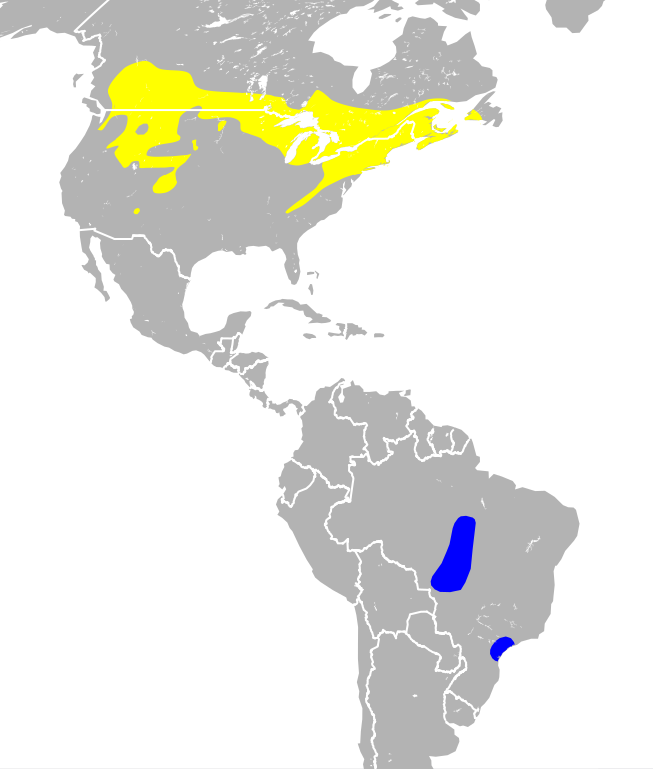
Fitxer:Catharus fuscescens map.svg

Mida d'aquesta previsualització PNG del fitxer SVG: 301 × 354 píxels. Altres resolucions: 204 × 240 píxels | 408 × 480 píxels | 653 × 768 píxels | 871 × 1.024 píxels | 1.741 × 2.048 píxels.
Fitxer original (fitxer SVG, nominalment 301 × 354 píxels, mida del fitxer: 2,12 Mo)
| Aquest fitxer i la informació mostrada a continuació provenen del dipòsit multimèdia lliure Wikimedia Commons. |
Resum
| Descripció | |
| Data | |
| Font |
|
| Autor | Stongey |
Llicència
Jo, el titular dels drets d'autor d'aquest treball, el public sota la següent llicència:
Aquest fitxer està subjecte a la llicència de Creative Commons Reconeixement i Compartir Igual 3.0 No adaptada.
- Sou lliure de:
- compartir – copiar, distribuir i comunicar públicament l'obra
- adaptar – fer-ne obres derivades
- Amb les condicions següents:
- reconeixement – Heu de donar la informació adequada sobre l'autor, proporcionar un enllaç a la llicència i indicar si s'han realitzat canvis. Podeu fer-ho amb qualsevol mitjà raonable, però de cap manera no suggereixi que l'autor us dóna suport o aprova l'ús que en feu.
- compartir igual – Si modifiqueu, transformeu, o generareu amb el material, haureu de distribuir les vostres contribucions sota una llicència similar o una de compatible com l'original

|
Les categories d'aquesta imatge han de ser corroborades. Feu-ho ara!
|
Historial del fitxer
Cliqueu una data/hora per veure el fitxer tal com era aleshores.
| Data/hora | Miniatura | Dimensions | Usuari/a | Comentari | |
|---|---|---|---|---|---|
| actual | 19:36, 12 nov 2013 | | 301 × 354 (2,12 Mo) | Stongey | used a simpler country outline file to reduce file size. Hadn't realize just how big the original file was. Will continue to experiment with reducing file size export out of QGIS. |
| 05:55, 12 nov 2013 |  | 301 × 354 (4,1 Mo) | Stongey | User created page with UploadWizard |
Ús del fitxer
La pàgina següent utilitza aquest fitxer:
Ús global del fitxer
Utilització d'aquest fitxer en altres wikis:
- Utilització a arz.wikipedia.org
- Utilització a ast.wikipedia.org
- Utilització a br.wikipedia.org
- Utilització a ceb.wikipedia.org
- Utilització a cy.wikipedia.org
- Utilització a en.wikipedia.org
- Utilització a eo.wikipedia.org
- Utilització a es.wikipedia.org
- Utilització a eu.wikipedia.org
- Utilització a fr.wikipedia.org
- Utilització a hu.wikipedia.org
- Utilització a nn.wikipedia.org
- Utilització a nv.wikipedia.org
- Utilització a pl.wikipedia.org
- Utilització a species.wikimedia.org
- Utilització a sv.wikipedia.org
- Utilització a uk.wikipedia.org
- Utilització a vi.wikipedia.org
- Utilització a www.wikidata.org