Fitxer:CentervilleBeachCrossCliff.jpg

Mida d'aquesta previsualització: 800 × 600 píxels. Altres resolucions: 320 × 240 píxels | 640 × 480 píxels | 1.024 × 768 píxels | 1.280 × 960 píxels | 2.560 × 1.920 píxels | 3.072 × 2.304 píxels.
Fitxer original (3.072 × 2.304 píxels, mida del fitxer: 3,15 Mo, tipus MIME: image/jpeg)
| Aquest fitxer i la informació mostrada a continuació provenen del dipòsit multimèdia lliure Wikimedia Commons. |
Resum
| Descripció |
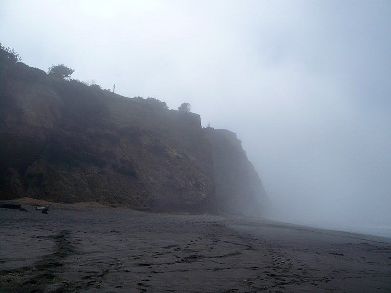
English: Centerville Beach Cross marks the location of the loss of the SS Northerner. In 1921, the Ferndale Parlor of the Native Sons of the Golden West placed a cross and marker on the hill overlooking Centerville Beach. The first marker was destroyed in the 1992 Cape Mendocino earthquakes. A new marker was placed and rededicated on February 11, 1995. The only approach is up an ATV trail on a nearly vertical cliff. California Historical Landmark Reference #173 |
||
| Data | |||
| Font | Treball propi | ||
| Autor | Ellin Beltz | ||
| Permís (Com reutilitzar aquest fitxer) |
|

|
Aquesta imatge ha estat carregada en el marc de Wiki Loves Monuments 2012.
|
 |
| Posició de la càmera | | Aquesta i altres imatges properes a: OpenStreetMap |
|---|
Historial del fitxer
Cliqueu una data/hora per veure el fitxer tal com era aleshores.
| Data/hora | Miniatura | Dimensions | Usuari/a | Comentari | |
|---|---|---|---|---|---|
| actual | 23:18, 24 set 2012 | | 3.072 × 2.304 (3,15 Mo) | Ellin Beltz | {{Information |Description ={{en|1=Centerville Beach Cross marks the location of the loss of the Northerner. In 1921, the Ferndale Parlor of the Native Sons of the Golden West placed a cross and marker on the hill overlooking Centerville Beach. The ... |
Ús del fitxer
La pàgina següent utilitza aquest fitxer:
Ús global del fitxer
Utilització d'aquest fitxer en altres wikis:
- Utilització a en.wikipedia.org
- Utilització a www.wikidata.org