Fitxer:Central House in Napoleon.jpg
Mida d'aquesta previsualització: 800 × 600 píxels. Altres resolucions: 320 × 240 píxels | 640 × 480 píxels | 1.024 × 768 píxels | 1.280 × 960 píxels | 2.560 × 1.920 píxels | 2.816 × 2.112 píxels.
Fitxer original (2.816 × 2.112 píxels, mida del fitxer: 1,82 Mo, tipus MIME: image/jpeg)
| Aquest fitxer i la informació mostrada a continuació provenen del dipòsit multimèdia lliure Wikimedia Commons. |
|
This is an image of a place or building that is listed on the National Register of Historic Places in the United States of America. Its reference number is 82000071. |
| Posició de la càmera | | Aquesta i altres imatges properes a: OpenStreetMap |
|---|
| Descripció |
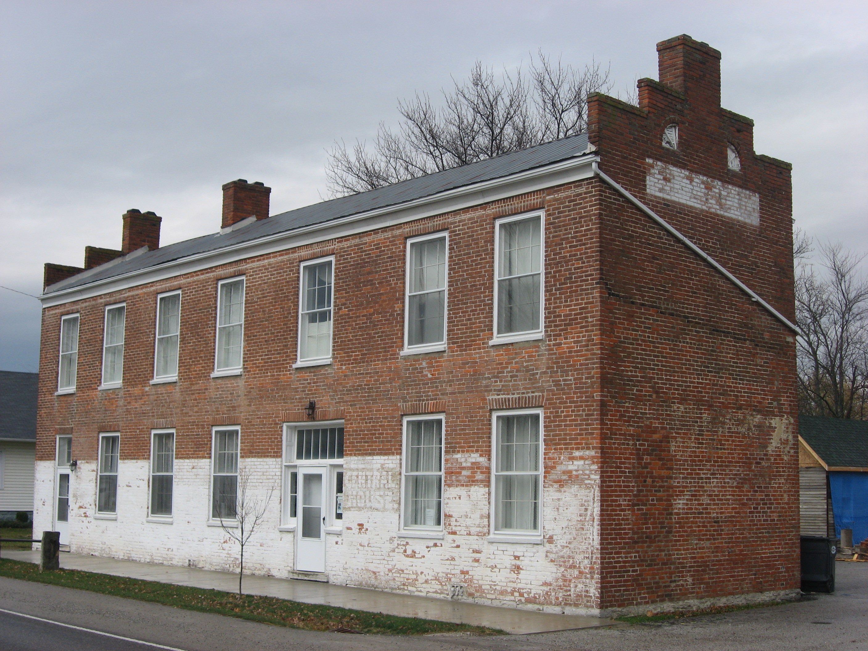
English: Front and eastern end of the Central House, located along the northern side of State Road 229 on the public square in Napoleon, Indiana, United States. Built in 1856, it is listed on the National Register of Historic Places. |
||
| Data | Taken on 3 de novembre de 2012 | ||
| Font | Treball propi | ||
| Autor | Nyttend | ||
| Permís (Com reutilitzar aquest fitxer) |
|
Historial del fitxer
Cliqueu una data/hora per veure el fitxer tal com era aleshores.
| Data/hora | Miniatura | Dimensions | Usuari/a | Comentari | |
|---|---|---|---|---|---|
| actual | 03:34, 13 nov 2012 | | 2.816 × 2.112 (1,82 Mo) | Nyttend | {{NRHP|82000071}} {{Location|39|12|18.2|N|85|19|42|W}} {{Information |Description={{en|Front and eastern end of the {{w|Central House (Napoleon, Indiana)|Central House}}, located along the northern side of {{w|Indiana State Road 229|State Road 229}} on... |
Ús del fitxer
La pàgina següent utilitza aquest fitxer:
Ús global del fitxer
Utilització d'aquest fitxer en altres wikis:
- Utilització a ar.wikipedia.org
- Utilització a arz.wikipedia.org
- Utilització a ceb.wikipedia.org
- Utilització a ce.wikipedia.org
- Utilització a en.wikipedia.org
- Utilització a es.wikipedia.org
- Utilització a eu.wikipedia.org
- Utilització a fr.wikipedia.org
- Utilització a ht.wikipedia.org
- Utilització a hu.wikipedia.org
- Utilització a lld.wikipedia.org
- Utilització a no.wikipedia.org
- Utilització a pl.wikipedia.org
- Utilització a pt.wikipedia.org
- Utilització a sh.wikipedia.org
- Utilització a sr.wikipedia.org
- Utilització a sv.wikipedia.org
- Utilització a tt.wikipedia.org
- Utilització a uz.wikipedia.org
- Utilització a www.wikidata.org
- Utilització a zh-min-nan.wikipedia.org